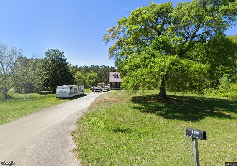
19 Mccowan Rd Rockmart, GA 30153
Estimated Value: $203,000 - $319,000
3
Beds
3
Baths
1,570
Sq Ft
$150/Sq Ft
Est. Value
About This Home
This home is located at 19 Mccowan Rd, Rockmart, GA 30153 and is currently estimated at $235,680, approximately $150 per square foot. 19 Mccowan Rd is a home located in Polk County with nearby schools including Rockmart Middle School.
Ownership History
Date
Name
Owned For
Owner Type
Purchase Details
Closed on
May 1, 2002
Sold by
Burnley Larry F and Burnley Margaret A
Bought by
Heath Raymond D and Heath Agnes A
Current Estimated Value
Purchase Details
Closed on
Dec 26, 1996
Sold by
Everett Daryl C
Bought by
Lasalle National Bank
Purchase Details
Closed on
Dec 19, 1996
Sold by
Burnley Larry F
Bought by
Burnley Larry F and Burnley Margaret A
Purchase Details
Closed on
Jul 12, 1995
Sold by
Everette Valerie Jerzak
Bought by
Everette Deryl C
Purchase Details
Closed on
Apr 27, 1995
Sold by
Everette Valerie Jerzak Exec
Bought by
Everette Deryl C
Purchase Details
Closed on
Mar 20, 1995
Sold by
Everette Deryl C
Bought by
Everette Deryl C and Everette Sonya B
Purchase Details
Closed on
Feb 10, 1995
Sold by
Everette Valerie Jerzak
Bought by
Everette Deryl C
Create a Home Valuation Report for This Property
The Home Valuation Report is an in-depth analysis detailing your home's value as well as a comparison with similar homes in the area
Home Values in the Area
Average Home Value in this Area
Purchase History
| Date | Buyer | Sale Price | Title Company |
|---|---|---|---|
| Heath Raymond D | -- | -- | |
| Lasalle National Bank | -- | -- | |
| Burnley Larry F | -- | -- | |
| Burnley Larry F | $39,000 | -- | |
| Everette Deryl C | -- | -- | |
| Everette Deryl C | -- | -- | |
| Everette Deryl C | -- | -- | |
| Everette Deryl C | -- | -- |
Source: Public Records
Tax History Compared to Growth
Tax History
| Year | Tax Paid | Tax Assessment Tax Assessment Total Assessment is a certain percentage of the fair market value that is determined by local assessors to be the total taxable value of land and additions on the property. | Land | Improvement |
|---|---|---|---|---|
| 2024 | $1,336 | $63,938 | $4,019 | $59,919 |
| 2023 | $1,128 | $47,533 | $4,019 | $43,514 |
| 2022 | $934 | $39,349 | $2,680 | $36,669 |
| 2021 | $946 | $39,349 | $2,680 | $36,669 |
| 2020 | $948 | $39,349 | $2,680 | $36,669 |
| 2019 | $825 | $30,718 | $2,680 | $28,038 |
| 2018 | $823 | $29,864 | $2,680 | $27,184 |
| 2017 | $813 | $29,864 | $2,680 | $27,184 |
| 2016 | $714 | $26,228 | $1,980 | $24,248 |
| 2015 | $728 | $26,655 | $1,980 | $24,675 |
| 2014 | $733 | $26,655 | $1,980 | $24,675 |
Source: Public Records
Map
Nearby Homes
- 1039 Old Cedartown Rd
- 1714 Cedartown Hwy
- 1211 Bellview Rd
- 18 Hillside Dr
- 107 Main Line Rd
- 332 Stringer Rd
- 740 Calloway Dr
- 1825 Calloway Path
- 0 Morgan Valley Rd Unit 25693839
- 0 Morgan Valley Rd Unit 10563202
- 0 Morgan Valley Rd Unit 7614571
- 11 Lee St
- 93 Clay Rd
- 184 Morgan Ln
- 92 Autumn Path
- 702 Calloway Dr
- 865 Morgan Valley Rd
- 0 Pine Mountain St Unit 10620510
- 0 Pine Mountain St Unit 10620492
- 155 Government Farm Rd
- N/A Cedartown Hwy
- 0 Mccowan Rd
- 0 Mccowan Rd Unit 7339673
- 0 Mccowan Rd Unit 20171644
- 0 Mccowan Rd Unit 7243973
- 0 Mccowan Rd Unit 20133566
- 48 Mccowan Rd
- 2134 Cedartown Hwy
- 360 Rowell Rd
- 75 Mccowan Rd
- 2146 Cedartown Hwy
- 2126 Cedartown Hwy
- 0 Cedartown Hwy Unit 7208217
- 0 Cedartown Hwy Unit 7156896
- 0 Cedartown Hwy Unit 7305607
- 0 Cedartown Hwy Unit 5197970
- 0 Cedartown Hwy Unit 5240374
- 0 Cedartown Hwy Unit 5319533
- 0 Cedartown Hwy Unit 6979890
- 0 Cedartown Hwy Unit 20006144