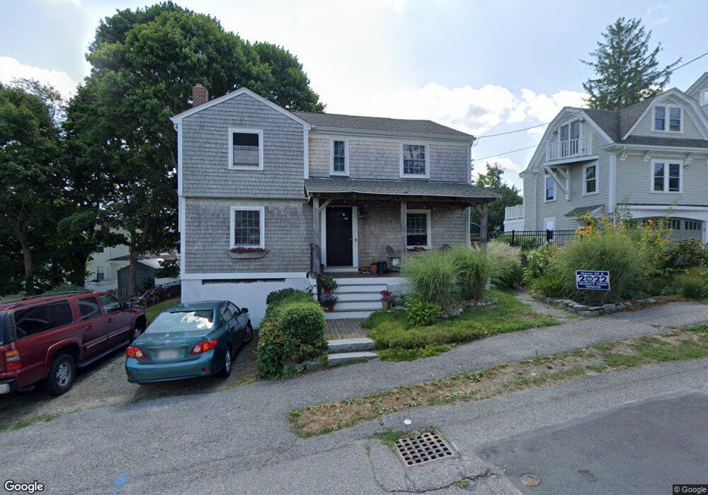
19 Middlesex St Quincy, MA 02171
Squantum NeighborhoodEstimated Value: $711,000 - $829,000
3
Beds
2
Baths
1,604
Sq Ft
$490/Sq Ft
Est. Value
About This Home
This home is located at 19 Middlesex St, Quincy, MA 02171 and is currently estimated at $786,531, approximately $490 per square foot. 19 Middlesex St is a home located in Norfolk County with nearby schools including Squantum Elementary School, Atlantic Middle School, and North Quincy High School.
Ownership History
Date
Name
Owned For
Owner Type
Purchase Details
Closed on
Mar 3, 2000
Sold by
Clasby Janet
Bought by
Vacca Elizabeth K
Current Estimated Value
Home Financials for this Owner
Home Financials are based on the most recent Mortgage that was taken out on this home.
Original Mortgage
$188,000
Interest Rate
8.21%
Mortgage Type
Purchase Money Mortgage
Create a Home Valuation Report for This Property
The Home Valuation Report is an in-depth analysis detailing your home's value as well as a comparison with similar homes in the area
Home Values in the Area
Average Home Value in this Area
Purchase History
| Date | Buyer | Sale Price | Title Company |
|---|---|---|---|
| Vacca Elizabeth K | $235,000 | -- |
Source: Public Records
Mortgage History
| Date | Status | Borrower | Loan Amount |
|---|---|---|---|
| Open | Vacca Elizabeth K | $185,000 | |
| Closed | Vacca Elizabeth K | $185,800 | |
| Closed | Vacca Elizabeth K | $188,000 |
Source: Public Records
Tax History
| Year | Tax Paid | Tax Assessment Tax Assessment Total Assessment is a certain percentage of the fair market value that is determined by local assessors to be the total taxable value of land and additions on the property. | Land | Improvement |
|---|---|---|---|---|
| 2025 | $8,418 | $730,100 | $385,900 | $344,200 |
| 2024 | $7,942 | $704,700 | $367,500 | $337,200 |
| 2023 | $7,386 | $663,600 | $350,000 | $313,600 |
| 2022 | $7,001 | $584,400 | $291,600 | $292,800 |
| 2021 | $6,964 | $573,600 | $291,600 | $282,000 |
| 2020 | $6,481 | $521,400 | $265,200 | $256,200 |
| 2019 | $6,390 | $509,200 | $265,200 | $244,000 |
| 2018 | $6,378 | $478,100 | $252,500 | $225,600 |
| 2017 | $6,126 | $432,300 | $219,600 | $212,700 |
| 2016 | $5,669 | $394,800 | $199,600 | $195,200 |
| 2015 | $5,526 | $378,500 | $199,600 | $178,900 |
| 2014 | $5,413 | $364,300 | $199,600 | $164,700 |
Source: Public Records
Map
Nearby Homes
- 156 Parke Ave
- 130 Parke Ave (Lot 2)
- 11 Bellevue Rd
- 1 Parke Ave
- 865 E Squantum St
- 19 Harbourside Rd Unit 19
- 21 Harbourside Rd Unit 26
- 1001 Marina Dr Unit 213
- 100 Marina Dr Unit 306
- 2001 Marina Dr Unit 506W
- 2001 Marina Dr Unit 211
- 10 Seaport Dr Unit 2213
- 297 Billings St
- 212 Quincy Shore Dr
- 201 Billings St
- 175 Quincy Shore Dr Unit B24
- 175 Quincy Shore Dr Unit B23
- 165 Quincy Shore Dr Unit C63
- 138 Quincy Shore Dr Unit 170
- 171 Walnut St Unit 4
- 23 Middlesex St
- 15 Middlesex St
- 20 Gladstone St
- 24 Gladstone St
- 26 Gladstone St
- 16 Gladstone St
- 20 Middlesex St
- 30 Gladstone St
- 31 Middlesex St
- 12 Middlesex St
- 12 Gladstone St
- 28 Middlesex St
- 124 Bellevue Rd
- 34 Gladstone St
- 32 Middlesex St
- 128 Bellevue Rd
- 17 Wedgewood St
- 19 Gladstone St
- 25 Wedgewood St
- 25 Wedgewood St Unit 1