Estimated Value: $685,913 - $809,000
Studio
--
Bath
2,116
Sq Ft
$354/Sq Ft
Est. Value
About This Home
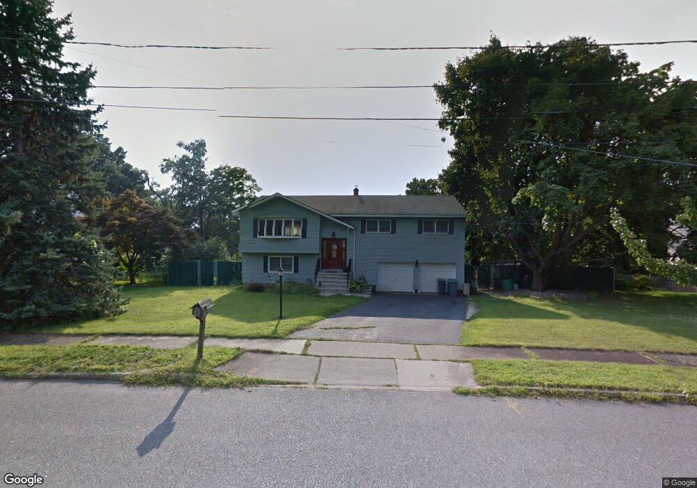
This home is located at 19 Morgan Ct, Wayne, NJ 07470 and is currently estimated at $748,728, approximately $353 per square foot. 19 Morgan Ct is a home located in Passaic County with nearby schools including Ryerson Elementary School, George Washington Middle School, and Wayne Valley High School.
Ownership History
Date
Name
Owned For
Owner Type
Purchase Details
Closed on
Oct 26, 1995
Sold by
Keane William and Keane Nancy
Bought by
Freer Keivn and Freer Sharon
Current Estimated Value
Home Financials for this Owner
Home Financials are based on the most recent Mortgage that was taken out on this home.
Original Mortgage
$175,000
Outstanding Balance
$2,394
Interest Rate
7.37%
Estimated Equity
$746,334
Purchase Details
Closed on
May 16, 1994
Sold by
Iuliani David
Bought by
Keane William and Keane Nancy
Home Financials for this Owner
Home Financials are based on the most recent Mortgage that was taken out on this home.
Original Mortgage
$150,000
Interest Rate
8.29%
Create a Home Valuation Report for This Property
The Home Valuation Report is an in-depth analysis detailing your home's value as well as a comparison with similar homes in the area
Home Values in the Area
Average Home Value in this Area
Purchase History
| Date | Buyer | Sale Price | Title Company |
|---|---|---|---|
| Freer Keivn | $230,000 | -- | |
| Keane William | $200,000 | -- |
Source: Public Records
Mortgage History
| Date | Status | Borrower | Loan Amount |
|---|---|---|---|
| Open | Freer Keivn | $175,000 | |
| Previous Owner | Keane William | $150,000 |
Source: Public Records
Tax History
| Year | Tax Paid | Tax Assessment Tax Assessment Total Assessment is a certain percentage of the fair market value that is determined by local assessors to be the total taxable value of land and additions on the property. | Land | Improvement |
|---|---|---|---|---|
| 2025 | $12,956 | $217,900 | $104,100 | $113,800 |
| 2024 | $12,460 | $217,900 | $104,100 | $113,800 |
Source: Public Records
Map
Nearby Homes
- 193 Newark Pompton Turnpike
- 310 Boulevard Dr
- 27 Archung Rd
- 109 Monmouth Ave
- 221 Boulevard Dr
- 16 Gressinger Rd
- 119 Herrick Rd
- 107 Randolph St
- 31 Brookside Rd
- 2 Brookside Rd
- 140 de Hart St
- 53 Laurel Dr
- 450 Boonton Turnpike
- 26 Pequannock Ave
- 86 Lake Dr W
- 74 Nakomis Path
- 0 Oakwood Ave Unit 3989632
- 14 Oneida Trail
- 208 Fayette Ave
- 12 Oakwood Ave
- 214 Newark Pompton Turnpike
- 15 Morgan Ct
- 23 Morgan Ct
- 210 Newark Pompton Turnpike
- 11 Morgan Ct
- 222 Newark Pompton Turnpike
- 18 Morgan Ct
- 14 Morgan Ct
- 198 Newark Pompton Turnpike
- 27 Morgan Ct
- 22 Morgan Ct
- 7 Morgan Ct
- 234 Newark Pompton Turnpike
- 10 Morgan Ct
- 192 Newark Pompton Turnpike
- 201 Newark Pompton Turnpike
- 11 Squire Ln
- 15 Squire Ln
- 13 Mcclelland Ave
- 19 Squire Ln
Your Personal Tour Guide
Ask me questions while you tour the home.