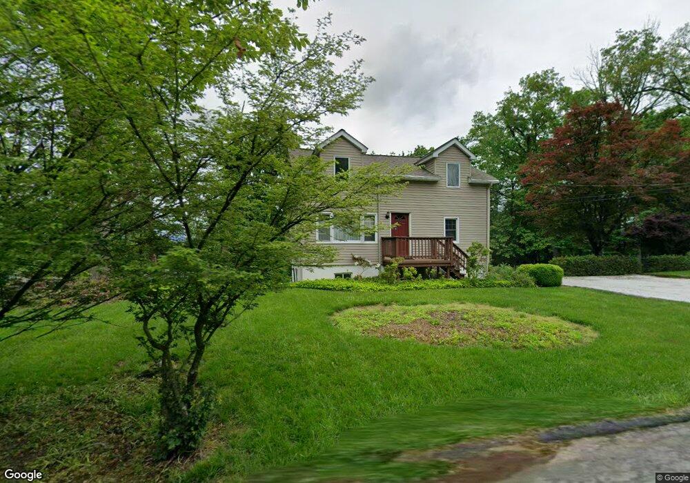
19 Mountainside Dr Newton, NJ 07860
Andover Township NeighborhoodEstimated Value: $342,079 - $410,000
--
Bed
--
Bath
1,296
Sq Ft
$299/Sq Ft
Est. Value
About This Home
This home is located at 19 Mountainside Dr, Newton, NJ 07860 and is currently estimated at $387,770, approximately $299 per square foot. 19 Mountainside Dr is a home located in Sussex County with nearby schools including Florence M. Burd School, Long Pond School, and Reverand George A. Brown School.
Ownership History
Date
Name
Owned For
Owner Type
Purchase Details
Closed on
Feb 2, 2004
Sold by
Oneill Donald J and Oneill Margaret
Bought by
Mcglone John M and Mcglone Susan
Current Estimated Value
Purchase Details
Closed on
Mar 28, 1985
Bought by
Petrie Louis B and Petrie Camille A
Create a Home Valuation Report for This Property
The Home Valuation Report is an in-depth analysis detailing your home's value as well as a comparison with similar homes in the area
Home Values in the Area
Average Home Value in this Area
Purchase History
| Date | Buyer | Sale Price | Title Company |
|---|---|---|---|
| Mcglone John M | $63,000 | -- | |
| Petrie Louis B | $69,000 | -- |
Source: Public Records
Tax History Compared to Growth
Tax History
| Year | Tax Paid | Tax Assessment Tax Assessment Total Assessment is a certain percentage of the fair market value that is determined by local assessors to be the total taxable value of land and additions on the property. | Land | Improvement |
|---|---|---|---|---|
| 2025 | $7,807 | $185,300 | $87,900 | $97,400 |
| 2024 | $7,525 | $185,300 | $87,900 | $97,400 |
| 2023 | $7,525 | $185,300 | $87,900 | $97,400 |
| 2022 | $7,212 | $185,300 | $87,900 | $97,400 |
| 2021 | $7,108 | $185,300 | $87,900 | $97,400 |
| 2020 | $6,925 | $185,300 | $87,900 | $97,400 |
| 2019 | $6,763 | $185,300 | $87,900 | $97,400 |
| 2018 | $6,658 | $185,300 | $87,900 | $97,400 |
| 2017 | $6,515 | $185,300 | $87,900 | $97,400 |
| 2016 | $6,306 | $185,300 | $87,900 | $97,400 |
| 2015 | $5,778 | $162,200 | $71,300 | $90,900 |
| 2014 | $5,653 | $162,200 | $71,300 | $90,900 |
Source: Public Records
Map
Nearby Homes
- 108 Hillside Dr
- 133 Hillside Dr
- 160 Newton Sparta Rd
- 12 Goodale Rd
- 16 Kilroy Rd
- 19 Lourdes Ct
- 63 Mulford Rd
- 14 Luchetti Way
- 70 Goodale Rd
- 68 & 70 Goodale Rd (5 9 Acres)
- 000 Florence Ln
- 11 Cheyenne Rd Unit 11
- 393 Mohegan Cir
- 322 Andover Sparta Rd
- 131 McPeek Rd Unit 131
- 994 Limecrest Rd
- 107 Overlook Rd
- 41 Kilroy Rd
- 293 Cheyenne Rd Unit 293
- 14 Kimberly Ct
- 21 Mountainside Dr
- 22 Lakeview Dr
- 15 Mountainside Dr
- 20 Lake View Dr
- 20 Mountainside Dr
- 18 Lake View Dr
- 16 Lake View Dr
- 14 Mountainside Dr
- 16 Mountainside Dr
- 13 Mountainside Dr
- 24 Mountainside Dr
- 25 Mountainside Dr
- 114 Hillside Dr
- 11 Mountainside Dr
- 110 Hillside Dr
- 116 Hillside Dr
- 28 Mountainside Dr
- 106 Hillside Dr
- 9 Mountainside Dr
- 10 Mountainside Dr