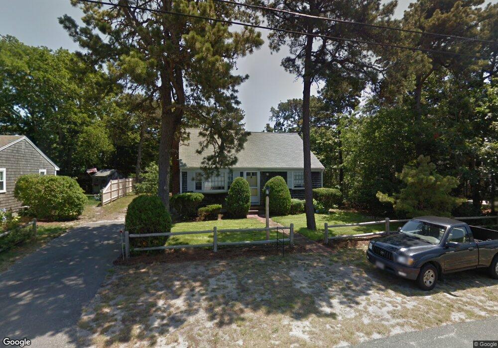
19 Nipigon Way E Dennis Port, MA 02639
Dennis Port NeighborhoodEstimated Value: $604,000 - $792,000
3
Beds
2
Baths
1,392
Sq Ft
$489/Sq Ft
Est. Value
About This Home
This home is located at 19 Nipigon Way E, Dennis Port, MA 02639 and is currently estimated at $680,071, approximately $488 per square foot. 19 Nipigon Way E is a home located in Barnstable County with nearby schools including Dennis-Yarmouth Regional High School and St. Pius X. School.
Ownership History
Date
Name
Owned For
Owner Type
Purchase Details
Closed on
Dec 26, 2007
Sold by
Bobrowich M and Bobrowich Mary L
Bought by
Bobrowich Mary L
Current Estimated Value
Purchase Details
Closed on
Dec 31, 1999
Sold by
Kirkendall Margaret A and Mckernan Georgene K
Bought by
Bobrowich Mary L and Bobrowich Paul A
Create a Home Valuation Report for This Property
The Home Valuation Report is an in-depth analysis detailing your home's value as well as a comparison with similar homes in the area
Home Values in the Area
Average Home Value in this Area
Purchase History
| Date | Buyer | Sale Price | Title Company |
|---|---|---|---|
| Bobrowich Mary L | -- | -- | |
| Bobrowich Mary L | $100,008 | -- |
Source: Public Records
Tax History Compared to Growth
Tax History
| Year | Tax Paid | Tax Assessment Tax Assessment Total Assessment is a certain percentage of the fair market value that is determined by local assessors to be the total taxable value of land and additions on the property. | Land | Improvement |
|---|---|---|---|---|
| 2025 | $2,505 | $578,500 | $207,400 | $371,100 |
| 2024 | $2,398 | $546,200 | $199,500 | $346,700 |
| 2023 | $2,319 | $496,600 | $181,300 | $315,300 |
| 2022 | $2,227 | $397,700 | $163,400 | $234,300 |
| 2021 | $2,224 | $368,800 | $183,000 | $185,800 |
| 2020 | $2,015 | $330,300 | $160,100 | $170,200 |
| 2019 | $1,919 | $311,000 | $157,000 | $154,000 |
| 2018 | $1,882 | $296,800 | $149,500 | $147,300 |
| 2017 | $1,723 | $280,200 | $138,800 | $141,400 |
| 2016 | $1,807 | $276,700 | $149,500 | $127,200 |
| 2015 | $1,771 | $276,700 | $149,500 | $127,200 |
| 2014 | $1,596 | $251,300 | $128,100 | $123,200 |
Source: Public Records
Map
Nearby Homes
- 80 Michaels Ave
- 27 Mayflower Ln
- 37 Ocean Dr Unit 2
- 10 Grindell Ave
- 112 Old Wharf Rd Unit E4
- 112 Old Wharf Rd Unit E1
- 18 Holiday Ln
- 154 Old Wharf Rd Unit 26
- 154 Old Wharf Rd Unit 14
- 61 Trotters Ln
- 15 Woodside Park Rd
- 4 Coffey Ln
- 71 Main St
- 6 Baker Way
- 217 Old Wharf Rd Unit 64
- 125 Main St Unit 3
- 241 Old Wharf Rd Unit 82
- 241 Old Wharf Rd Unit 127
- 262 Old Wharf Rd Unit 67
- 262 Old Wharf Rd Unit 5
- 21 Nipigon Way E
- 22 Nipigon Way E
- 43 Lawrence Rd
- 118 Michaels Ave
- 45 Lawrence Rd
- 39 Lawrence Rd
- 12 Nipigon Way E
- 13 Nipigon Way E
- 49 Lawrence Rd
- 37 Lawrence Rd
- 9 Nipigon Way E
- 119 Michaels Ave
- 119 Michael's
- 51 Lawrence Rd
- 54 Northern Ave
- 114 Michaels Ave
- 2 Nipigon Way E
- 58 Northern Ave
- 3 Nipigon Way E
- 29 Nipigon Way E