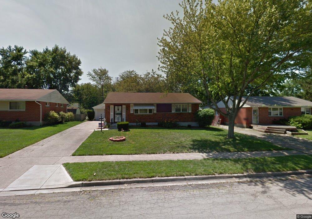
19 Nona Dr Dayton, OH 45426
Estimated Value: $117,000 - $160,000
3
Beds
2
Baths
1,100
Sq Ft
$125/Sq Ft
Est. Value
About This Home
This home is located at 19 Nona Dr, Dayton, OH 45426 and is currently estimated at $137,217, approximately $124 per square foot. 19 Nona Dr is a home located in Montgomery County with nearby schools including Trotwood-Madison Middle School, Trotwood-Madison High School, and Trotwood Preparatory & Fitness Academy.
Ownership History
Date
Name
Owned For
Owner Type
Purchase Details
Closed on
Jul 31, 2014
Sold by
Bates Angelique M
Bought by
Bolds Reshauna
Current Estimated Value
Home Financials for this Owner
Home Financials are based on the most recent Mortgage that was taken out on this home.
Original Mortgage
$1,322
Outstanding Balance
$1,008
Interest Rate
4.11%
Mortgage Type
Stand Alone Second
Estimated Equity
$136,209
Purchase Details
Closed on
Jun 18, 1999
Sold by
Sheldon Beaulah J
Bought by
Bates Angelique M
Home Financials for this Owner
Home Financials are based on the most recent Mortgage that was taken out on this home.
Original Mortgage
$62,605
Interest Rate
7.15%
Purchase Details
Closed on
Mar 27, 1997
Sold by
Sheldon Beaulah J
Bought by
Sheldon Beaulah J
Create a Home Valuation Report for This Property
The Home Valuation Report is an in-depth analysis detailing your home's value as well as a comparison with similar homes in the area
Home Values in the Area
Average Home Value in this Area
Purchase History
| Date | Buyer | Sale Price | Title Company |
|---|---|---|---|
| Bolds Reshauna | $52,900 | None Available | |
| Bates Angelique M | $65,900 | -- | |
| Sheldon Beaulah J | -- | -- |
Source: Public Records
Mortgage History
| Date | Status | Borrower | Loan Amount |
|---|---|---|---|
| Open | Bolds Reshauna | $1,322 | |
| Open | Bolds Reshauna | $51,941 | |
| Previous Owner | Bates Angelique M | $62,605 |
Source: Public Records
Tax History Compared to Growth
Tax History
| Year | Tax Paid | Tax Assessment Tax Assessment Total Assessment is a certain percentage of the fair market value that is determined by local assessors to be the total taxable value of land and additions on the property. | Land | Improvement |
|---|---|---|---|---|
| 2024 | $1,573 | $23,510 | $4,480 | $19,030 |
| 2023 | $1,573 | $23,510 | $4,480 | $19,030 |
| 2022 | $1,580 | $18,390 | $3,500 | $14,890 |
| 2021 | $1,583 | $18,390 | $3,500 | $14,890 |
| 2020 | $1,580 | $18,390 | $3,500 | $14,890 |
| 2019 | $1,330 | $13,810 | $2,450 | $11,360 |
| 2018 | $1,332 | $13,810 | $2,450 | $11,360 |
| 2017 | $1,324 | $13,810 | $2,450 | $11,360 |
| 2016 | $1,368 | $14,280 | $3,500 | $10,780 |
| 2015 | $1,312 | $14,280 | $3,500 | $10,780 |
| 2014 | $1,312 | $14,280 | $3,500 | $10,780 |
| 2012 | -- | $19,960 | $5,430 | $14,530 |
Source: Public Records
Map
Nearby Homes
- 33 Mario Dr
- 204 E Main St
- 4 Pleasant Ave
- 17 Grand Ave
- 17 N Sunrise Ave
- 103 E Worley Ave
- 1 E Worley Ave
- 0 Main
- 209 W Main St
- 208 E Sunrise Ave
- 301 Beardsley Rd
- 385 Blairwood Dr
- 208 E Eppington Dr
- 717 Mapleside Dr
- 512 N Sherry Dr
- 7540 Tuscola Dr
- 4051 Belmore Trace
- 800 Chandler Dr
- 6899 Little Richmond Rd
- 0 Little Richmond Rd