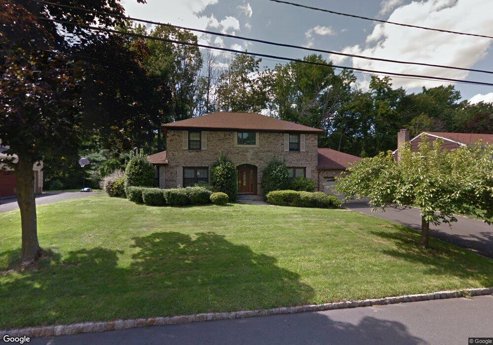
19 Oak Ave West Orange, NJ 07052
Estimated Value: $973,000 - $1,126,000
--
Bed
--
Bath
2,658
Sq Ft
$387/Sq Ft
Est. Value
About This Home
This home is located at 19 Oak Ave, West Orange, NJ 07052 and is currently estimated at $1,028,729, approximately $387 per square foot. 19 Oak Ave is a home located in Essex County with nearby schools including West Orange High School, Golda Och Academy, and Golda Och Academy Lower School.
Ownership History
Date
Name
Owned For
Owner Type
Purchase Details
Closed on
Aug 25, 2009
Sold by
Rosenzweig Joel and Rosenzweig Renee
Bought by
Smith Steven C and Isaacs Smith Patricia J
Current Estimated Value
Home Financials for this Owner
Home Financials are based on the most recent Mortgage that was taken out on this home.
Original Mortgage
$394,400
Outstanding Balance
$258,198
Interest Rate
5.21%
Mortgage Type
New Conventional
Estimated Equity
$770,531
Purchase Details
Closed on
Jun 28, 1989
Sold by
Malone Brendan and Malone Maureen
Bought by
Rosenzweig Joel and Rosenzweig Renee
Create a Home Valuation Report for This Property
The Home Valuation Report is an in-depth analysis detailing your home's value as well as a comparison with similar homes in the area
Home Values in the Area
Average Home Value in this Area
Purchase History
| Date | Buyer | Sale Price | Title Company |
|---|---|---|---|
| Smith Steven C | $493,000 | None Available | |
| Rosenzweig Joel | $326,000 | -- |
Source: Public Records
Mortgage History
| Date | Status | Borrower | Loan Amount |
|---|---|---|---|
| Open | Smith Steven C | $394,400 |
Source: Public Records
Tax History Compared to Growth
Tax History
| Year | Tax Paid | Tax Assessment Tax Assessment Total Assessment is a certain percentage of the fair market value that is determined by local assessors to be the total taxable value of land and additions on the property. | Land | Improvement |
|---|---|---|---|---|
| 2025 | $22,181 | $848,900 | $341,500 | $507,400 |
| 2024 | $22,181 | $482,400 | $147,300 | $335,100 |
| 2022 | $21,404 | $482,400 | $147,300 | $335,100 |
| 2021 | $21,004 | $482,400 | $147,300 | $335,100 |
| 2020 | $20,666 | $482,400 | $147,300 | $335,100 |
| 2019 | $20,073 | $482,400 | $147,300 | $335,100 |
| 2018 | $19,479 | $482,400 | $147,300 | $335,100 |
| 2017 | $19,228 | $482,400 | $147,300 | $335,100 |
| 2016 | $18,765 | $482,400 | $147,300 | $335,100 |
| 2015 | $18,413 | $482,400 | $147,300 | $335,100 |
| 2014 | $18,051 | $482,400 | $147,300 | $335,100 |
Source: Public Records
Map
Nearby Homes
- 24 Oak Ave
- 33 Maple Ave
- 54 Maple Ave
- 382 Saint Cloud Ave
- 44 Jessica Way
- 31 Sheridan Ave
- 23 Sheridan Ave
- 21 Sheridan Ave
- 1490 Pleasant Valley Way
- 51 Birchwood Ave
- 8 Lenox Terrace
- 290 N Wyoming Ave
- 97 Fairview Ave
- 356 Northfield Ave
- 57 Winding Way
- 55-57 Ridgeway Ave
- 55 Ridgeway Ave
- 288 Gregory Ave
- 1-3 Birchwood Ave
- 13 Arverne Rd