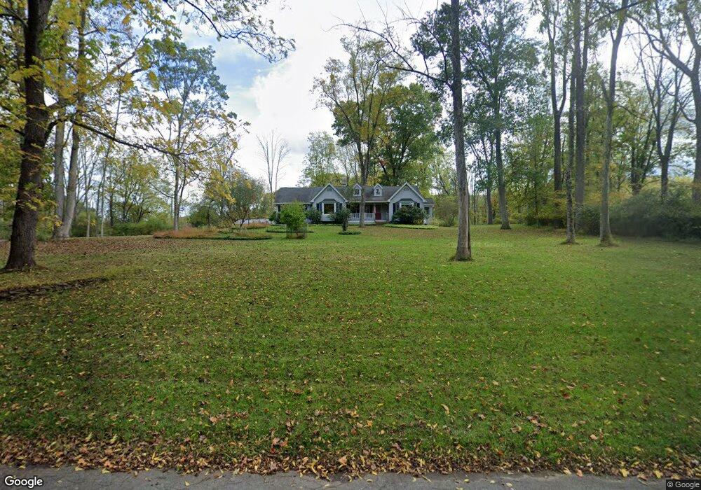
19 Old Turnpike Rd Port Murray, NJ 07865
Washington Township Morris NeighborhoodEstimated Value: $601,787 - $738,000
--
Bed
--
Bath
2,384
Sq Ft
$270/Sq Ft
Est. Value
About This Home
This home is located at 19 Old Turnpike Rd, Port Murray, NJ 07865 and is currently estimated at $644,197, approximately $270 per square foot. 19 Old Turnpike Rd is a home located in Morris County with nearby schools including Flocktown-Kossmann Elementary School, Long Valley Middle School, and West Morris Central High School.
Ownership History
Date
Name
Owned For
Owner Type
Purchase Details
Closed on
Mar 12, 2018
Sold by
Mea Bernice
Bought by
Mcnulty Robert and Bermel Sheila
Current Estimated Value
Home Financials for this Owner
Home Financials are based on the most recent Mortgage that was taken out on this home.
Original Mortgage
$359,200
Outstanding Balance
$308,169
Interest Rate
4.43%
Mortgage Type
New Conventional
Estimated Equity
$336,028
Purchase Details
Closed on
Nov 14, 2000
Sold by
Mea Bernice
Bought by
Mea Bernice
Purchase Details
Closed on
Jun 20, 2000
Sold by
Koopmann Rochelle J and Koopmann William H
Bought by
Mea Bernice
Home Financials for this Owner
Home Financials are based on the most recent Mortgage that was taken out on this home.
Original Mortgage
$233,000
Interest Rate
8.5%
Mortgage Type
Purchase Money Mortgage
Create a Home Valuation Report for This Property
The Home Valuation Report is an in-depth analysis detailing your home's value as well as a comparison with similar homes in the area
Home Values in the Area
Average Home Value in this Area
Purchase History
| Date | Buyer | Sale Price | Title Company |
|---|---|---|---|
| Mcnulty Robert | $449,000 | Zwiren Title Agency Inc | |
| Mea Bernice | -- | Lawyers Title Insurance Corp | |
| Mea Bernice | $315,000 | -- |
Source: Public Records
Mortgage History
| Date | Status | Borrower | Loan Amount |
|---|---|---|---|
| Open | Mcnulty Robert | $359,200 | |
| Previous Owner | Mea Bernice | $233,000 |
Source: Public Records
Tax History Compared to Growth
Tax History
| Year | Tax Paid | Tax Assessment Tax Assessment Total Assessment is a certain percentage of the fair market value that is determined by local assessors to be the total taxable value of land and additions on the property. | Land | Improvement |
|---|---|---|---|---|
| 2025 | $11,331 | $390,600 | $159,700 | $230,900 |
| 2024 | $11,077 | $390,600 | $159,700 | $230,900 |
| 2023 | $11,077 | $390,600 | $159,700 | $230,900 |
| 2022 | $10,480 | $390,600 | $159,700 | $230,900 |
| 2021 | $10,480 | $390,600 | $159,700 | $230,900 |
| 2020 | $10,308 | $390,600 | $159,700 | $230,900 |
| 2019 | $10,202 | $390,600 | $159,700 | $230,900 |
| 2018 | $9,976 | $390,600 | $159,700 | $230,900 |
| 2017 | $9,761 | $390,600 | $159,700 | $230,900 |
| 2016 | $9,464 | $390,600 | $159,700 | $230,900 |
| 2015 | $9,273 | $390,600 | $159,700 | $230,900 |
| 2014 | $9,191 | $384,300 | $159,700 | $224,600 |
Source: Public Records
Map
Nearby Homes
- 1404 New Jersey 57
- 40 Heiser Rd
- 1 Heather Ct
- 17 Meadow Ln
- 50 Thomas Rd
- 9 Brantwood Terrace
- 149 Old Turnpike Rd
- 21 Highland Ave
- 19 E Mill Rd
- 2 Budd Ln
- 130 Kings Hwy
- 48 Brantwood Terrace
- 3 Cobblestone Ln
- 5 Settlers Ridge Ct
- 7 Settlers Ridge Ct
- 000 Pleasant Grove Rd
- 102 Mountain View Ln
- 414 Rockport Rd
- 355 Rockport Rd
- 25 Mountain View Ln