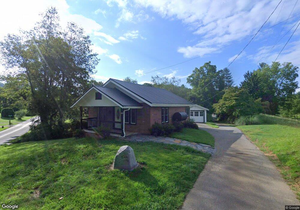
19 Parham Rd Canton, NC 28716
Estimated Value: $221,000 - $308,000
2
Beds
1
Bath
780
Sq Ft
$332/Sq Ft
Est. Value
About This Home
This home is located at 19 Parham Rd, Canton, NC 28716 and is currently estimated at $259,119, approximately $332 per square foot. 19 Parham Rd is a home located in Haywood County with nearby schools including North Canton Elementary School, Canton Middle, and Pisgah High School.
Ownership History
Date
Name
Owned For
Owner Type
Purchase Details
Closed on
Aug 9, 2024
Sold by
Zogg Allison Q and Zogg Jason A
Bought by
Hodorowski Michael and Ferro Sean
Current Estimated Value
Home Financials for this Owner
Home Financials are based on the most recent Mortgage that was taken out on this home.
Original Mortgage
$210,600
Outstanding Balance
$208,212
Interest Rate
6.86%
Mortgage Type
VA
Estimated Equity
$50,907
Purchase Details
Closed on
Aug 25, 2015
Sold by
Willis Michael D and Willis Ruth L
Bought by
Queen Carroll
Home Financials for this Owner
Home Financials are based on the most recent Mortgage that was taken out on this home.
Original Mortgage
$55,000
Interest Rate
4.09%
Mortgage Type
Seller Take Back
Purchase Details
Closed on
Nov 1, 2006
Sold by
Moffitt Bessie
Bought by
Willis Michael D and Willis Ruth L
Create a Home Valuation Report for This Property
The Home Valuation Report is an in-depth analysis detailing your home's value as well as a comparison with similar homes in the area
Home Values in the Area
Average Home Value in this Area
Purchase History
| Date | Buyer | Sale Price | Title Company |
|---|---|---|---|
| Hodorowski Michael | $260,000 | None Listed On Document | |
| Queen Carroll | $65,000 | Attorney | |
| Willis Michael D | -- | None Available |
Source: Public Records
Mortgage History
| Date | Status | Borrower | Loan Amount |
|---|---|---|---|
| Open | Hodorowski Michael | $210,600 | |
| Previous Owner | Queen Carroll | $55,000 |
Source: Public Records
Tax History
| Year | Tax Paid | Tax Assessment Tax Assessment Total Assessment is a certain percentage of the fair market value that is determined by local assessors to be the total taxable value of land and additions on the property. | Land | Improvement |
|---|---|---|---|---|
| 2025 | -- | $108,300 | $29,400 | $78,900 |
| 2024 | $3 | $108,300 | $29,400 | $78,900 |
| 2023 | $336 | $108,300 | $29,400 | $78,900 |
| 2022 | $328 | $108,300 | $29,400 | $78,900 |
| 2021 | $328 | $108,300 | $29,400 | $78,900 |
| 2020 | $16,001 | $79,500 | $25,700 | $53,800 |
| 2019 | $260 | $79,500 | $25,700 | $53,800 |
| 2018 | $260 | $79,500 | $25,700 | $53,800 |
| 2017 | $685 | $79,500 | $0 | $0 |
| 2016 | $688 | $82,400 | $0 | $0 |
| 2015 | $680 | $82,400 | $0 | $0 |
| 2014 | $587 | $82,400 | $0 | $0 |
Source: Public Records
Map
Nearby Homes
- 229 Crabtree Mountain Rd
- 58 Mcclellan Dr
- 74 Buckeye Cove Rd
- 00 Seasons Dr Unit Lot 43
- 3383 Thickety Rd
- Lot 50 Winter Green Dr
- 955 N Canton Rd
- 415 Pigeon Ford Rd
- 105 Riverview Dr
- 2 Roberts Mountain Rd Unit 2
- 284 Northridge Dr
- 00 Runaway Ridge
- 177 Dewey Ave
- 57 Fiddle Dr
- 21 Lisa Dr
- 195 Terrace Dr
- 22 Mountain Spring Ln
- 82 Morgan St
- 36 Harkins Ave
- 12 Harkins Ave
- 741 Crabtree Farm Rd
- 794 Crabtree Farm Rd
- 795 Crabtree Farm Rd
- 634 Crabtree Mountain Rd
- 22 Pheasant Ln
- 83 Parham Rd
- 65 Pheasant Ln
- 672 Crabtree Mountain Rd
- 715 Crabtree Mountain Rd
- 135 Carswell Rd
- 794 Crabtree Mountain Rd
- 795 Crabtree Mountain Rd
- 134 Pheasant Ln
- 533 Crabtree Mountain Rd
- 87 Carswell Rd
- 505 Crabtree Mountain Rd
- 231 Bull Frog Ln
- 106 Carswell Rd
- 245 Clark Cemetery Dr
- 395 Crabtree Mountain Rd
Your Personal Tour Guide
Ask me questions while you tour the home.