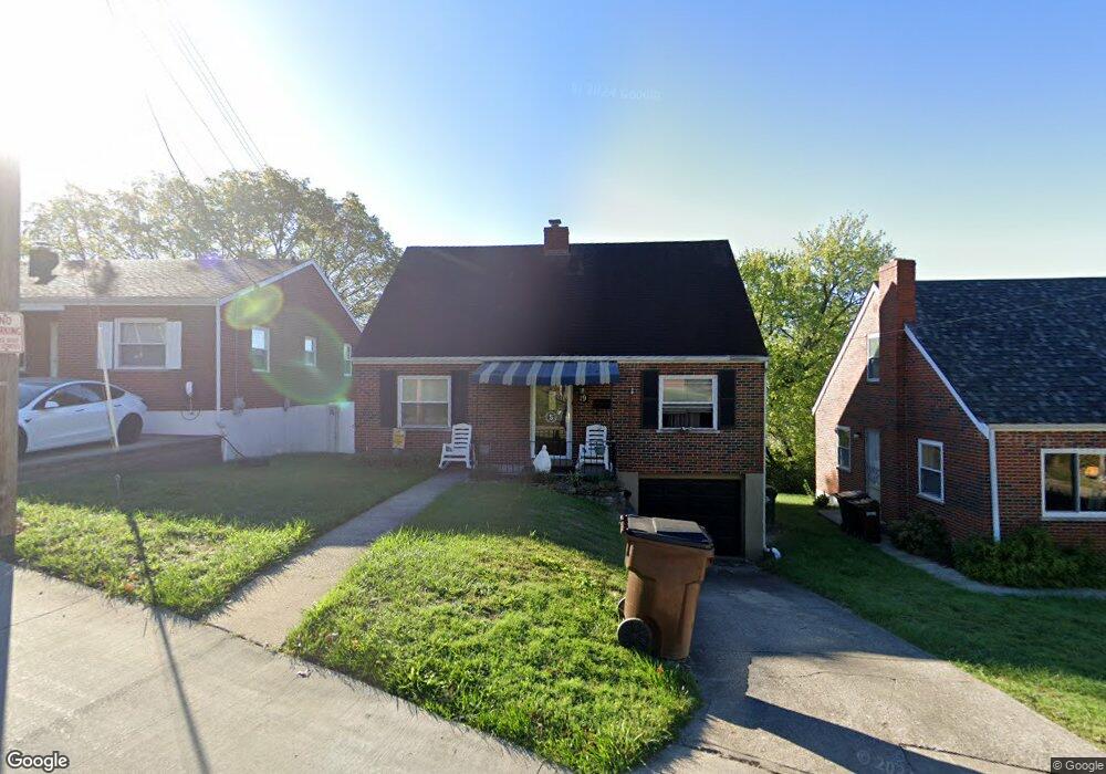
19 Parker Rd Newport, KY 41071
Estimated Value: $200,517 - $219,000
3
Beds
1
Bath
1,248
Sq Ft
$169/Sq Ft
Est. Value
About This Home
This home is located at 19 Parker Rd, Newport, KY 41071 and is currently estimated at $210,629, approximately $168 per square foot. 19 Parker Rd is a home located in Campbell County with nearby schools including Newport Primary School, Newport Intermediate School, and Newport High School.
Ownership History
Date
Name
Owned For
Owner Type
Purchase Details
Closed on
Feb 1, 2001
Sold by
Est Janet S Rawlings
Bought by
Stevenson Jeffrey and Stevenson Karen
Current Estimated Value
Home Financials for this Owner
Home Financials are based on the most recent Mortgage that was taken out on this home.
Original Mortgage
$86,807
Outstanding Balance
$30,386
Interest Rate
7.18%
Mortgage Type
FHA
Estimated Equity
$180,243
Create a Home Valuation Report for This Property
The Home Valuation Report is an in-depth analysis detailing your home's value as well as a comparison with similar homes in the area
Home Values in the Area
Average Home Value in this Area
Purchase History
| Date | Buyer | Sale Price | Title Company |
|---|---|---|---|
| Stevenson Jeffrey | $87,500 | -- |
Source: Public Records
Mortgage History
| Date | Status | Borrower | Loan Amount |
|---|---|---|---|
| Open | Stevenson Jeffrey | $86,807 |
Source: Public Records
Tax History Compared to Growth
Tax History
| Year | Tax Paid | Tax Assessment Tax Assessment Total Assessment is a certain percentage of the fair market value that is determined by local assessors to be the total taxable value of land and additions on the property. | Land | Improvement |
|---|---|---|---|---|
| 2025 | $558 | $145,000 | $20,000 | $125,000 |
| 2024 | $558 | $145,000 | $20,000 | $125,000 |
| 2023 | $441 | $111,600 | $9,100 | $102,500 |
| 2022 | $513 | $111,600 | $9,100 | $102,500 |
| 2021 | $526 | $111,600 | $9,100 | $102,500 |
| 2020 | $535 | $111,600 | $9,100 | $102,500 |
| 2019 | $529 | $109,000 | $9,100 | $99,900 |
| 2018 | $522 | $109,000 | $9,100 | $99,900 |
| 2017 | $524 | $109,000 | $9,100 | $99,900 |
| 2016 | $493 | $109,000 | $0 | $0 |
| 2015 | $501 | $109,000 | $0 | $0 |
| 2014 | $492 | $109,000 | $0 | $0 |
Source: Public Records
Map
Nearby Homes
- 8 W Ridge Place
- 2220 New Linden Rd
- 2023 New Linden Rd
- 2007 Monmouth St
- 100 Mayo Cir
- 39 19th St
- 254 Linden Ave
- 43.5-45.5, Kentucky Dr
- 85 & 87 Kentucky Dr
- 17 Parkview Ave
- 2318 Joyce Ave
- 37 Parkview Ave
- 234 Evergreen Ave
- 2413 Joyce Ave
- 94 Home St
- 12 Amelia St
- 225 Beech Rd
- 3008 Nob Hill Dr
- 41 W 14th St
- 120 Main St Unit 205