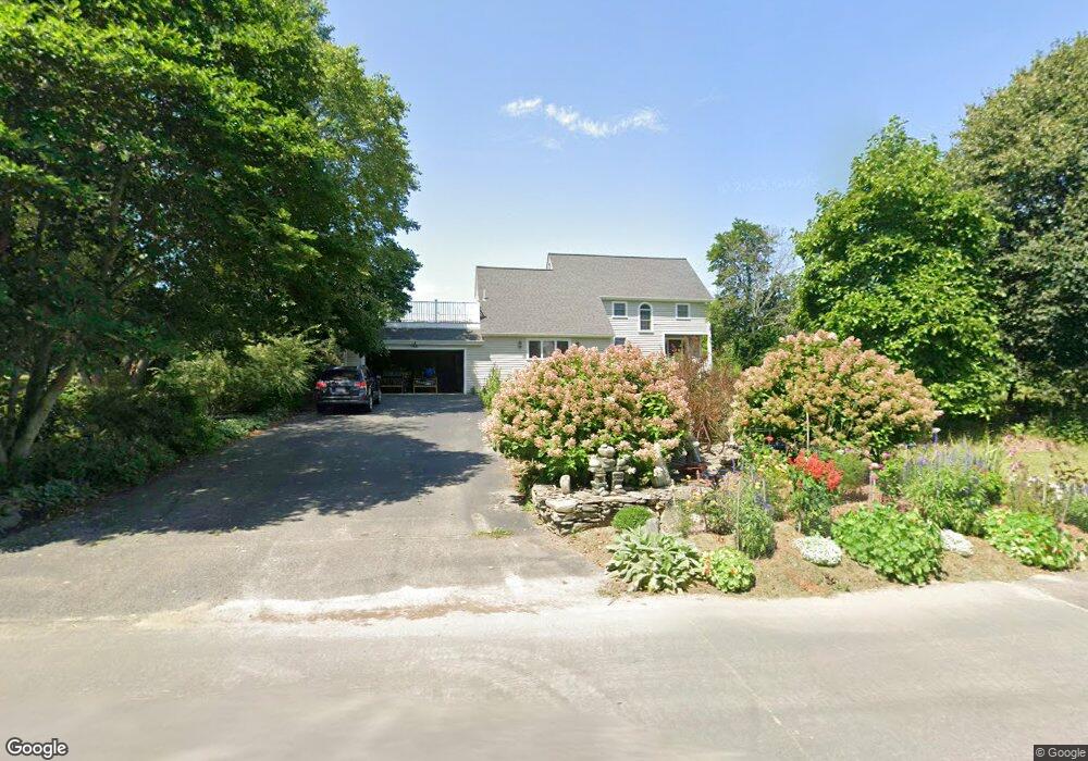
19 Pickard Ln Littleton, MA 01460
Estimated Value: $788,000 - $925,000
4
Beds
4
Baths
2,132
Sq Ft
$396/Sq Ft
Est. Value
About This Home
This home is located at 19 Pickard Ln, Littleton, MA 01460 and is currently estimated at $843,679, approximately $395 per square foot. 19 Pickard Ln is a home located in Middlesex County with nearby schools including Shaker Lane Elementary School, Russell Street Elementary School, and Littleton Middle School.
Create a Home Valuation Report for This Property
The Home Valuation Report is an in-depth analysis detailing your home's value as well as a comparison with similar homes in the area
Home Values in the Area
Average Home Value in this Area
Tax History Compared to Growth
Tax History
| Year | Tax Paid | Tax Assessment Tax Assessment Total Assessment is a certain percentage of the fair market value that is determined by local assessors to be the total taxable value of land and additions on the property. | Land | Improvement |
|---|---|---|---|---|
| 2025 | $97 | $655,700 | $254,600 | $401,100 |
| 2024 | $9,150 | $616,600 | $245,900 | $370,700 |
| 2023 | $9,705 | $597,200 | $226,500 | $370,700 |
| 2022 | $9,285 | $524,300 | $226,500 | $297,800 |
| 2021 | $9,128 | $515,700 | $217,900 | $297,800 |
| 2020 | $8,807 | $495,600 | $201,800 | $293,800 |
| 2019 | $8,624 | $472,800 | $176,000 | $296,800 |
| 2018 | $8,462 | $466,500 | $173,900 | $292,600 |
| 2017 | $8,467 | $466,500 | $173,900 | $292,600 |
| 2016 | $8,268 | $467,400 | $173,900 | $293,500 |
| 2015 | $7,848 | $433,600 | $150,300 | $283,300 |
Source: Public Records
Map
Nearby Homes
- 4 Powers Rd
- 25 Grist Mill Rd
- 84 Powers Rd
- 35 Queen Rd
- 25 Laurel Rd
- 517 Tumbling Hawk
- 522 Tumbling Hawk
- 237 Brown Bear Crossing Unit 237
- 20 Dean Ln Unit 20
- 484 Great Road -6
- 484 Great Road -4
- 484 Great Road -3
- 601 Old Stone Brook
- 150 Goldsmith St
- 9 Breezy Point Rd
- 445 Old Stone Brook
- 484 Great Rd
- 484 Great Rd
- 115 Goldsmith St
- 38 George St