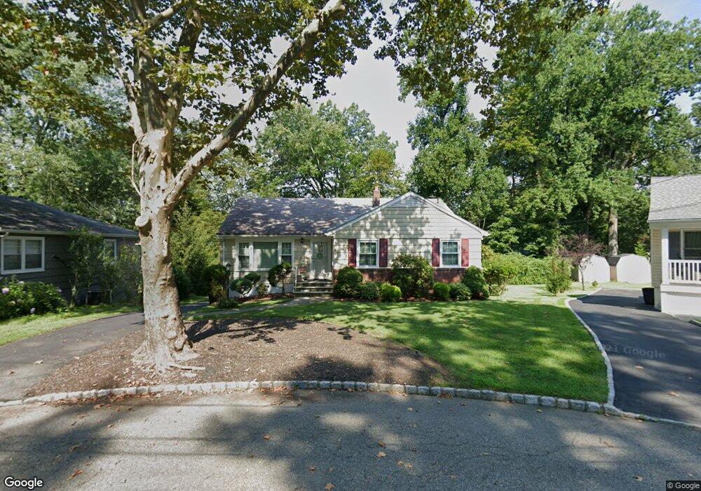
19 Pier Ln Roseland, NJ 07068
Estimated Value: $500,000 - $651,000
3
Beds
3
Baths
1,525
Sq Ft
$377/Sq Ft
Est. Value
About This Home
This home is located at 19 Pier Ln, Roseland, NJ 07068 and is currently estimated at $574,395, approximately $376 per square foot. 19 Pier Ln is a home located in Essex County with nearby schools including Lester C. Noecker Elementary School, Elmwood Elementary School, and West Essex Middle School.
Ownership History
Date
Name
Owned For
Owner Type
Purchase Details
Closed on
Jun 9, 2022
Sold by
Patrick Fell
Bought by
Condon Shane
Current Estimated Value
Home Financials for this Owner
Home Financials are based on the most recent Mortgage that was taken out on this home.
Original Mortgage
$240,000
Outstanding Balance
$228,020
Interest Rate
5.1%
Mortgage Type
New Conventional
Estimated Equity
$346,375
Purchase Details
Closed on
Nov 21, 1996
Sold by
Eng Bryon
Bought by
Fell Patrick and Fell Kathleen
Home Financials for this Owner
Home Financials are based on the most recent Mortgage that was taken out on this home.
Original Mortgage
$75,000
Interest Rate
7.81%
Purchase Details
Closed on
May 20, 1992
Sold by
Eng Edwin and Yo Ching
Bought by
Eng Bryon and Eng Burton K
Create a Home Valuation Report for This Property
The Home Valuation Report is an in-depth analysis detailing your home's value as well as a comparison with similar homes in the area
Home Values in the Area
Average Home Value in this Area
Purchase History
| Date | Buyer | Sale Price | Title Company |
|---|---|---|---|
| Condon Shane | $400,000 | Max Title | |
| Fell Patrick | $223,000 | -- | |
| Eng Bryon | -- | -- |
Source: Public Records
Mortgage History
| Date | Status | Borrower | Loan Amount |
|---|---|---|---|
| Open | Condon Shane | $240,000 | |
| Previous Owner | Fell Patrick | $75,000 |
Source: Public Records
Tax History Compared to Growth
Tax History
| Year | Tax Paid | Tax Assessment Tax Assessment Total Assessment is a certain percentage of the fair market value that is determined by local assessors to be the total taxable value of land and additions on the property. | Land | Improvement |
|---|---|---|---|---|
| 2025 | $9,066 | $481,800 | $335,500 | $146,300 |
| 2024 | $9,066 | $481,800 | $335,500 | $146,300 |
| 2022 | $9,144 | $391,600 | $244,600 | $147,000 |
| 2021 | $9,019 | $391,600 | $244,600 | $147,000 |
| 2020 | $8,987 | $391,600 | $244,600 | $147,000 |
| 2019 | $8,905 | $391,600 | $244,600 | $147,000 |
| 2018 | $8,827 | $391,600 | $244,600 | $147,000 |
| 2017 | $8,823 | $391,600 | $244,600 | $147,000 |
| 2016 | $8,686 | $391,600 | $244,600 | $147,000 |
| 2015 | $8,705 | $391,600 | $244,600 | $147,000 |
| 2014 | $8,462 | $391,600 | $244,600 | $147,000 |
Source: Public Records
Map
Nearby Homes
- 34 Lincoln St
- 27-29 Roseland Ave
- 331 Roseland Ave
- 194 Eagle Rock Ave
- 201 Eagle Rock Ave
- 4 Williamsburg Dr
- 37 Dalewood Rd
- 58 Leonard Terrace
- 14 Mitchell Ave
- 5 Beechtree Ln
- 9 Beechtree Ln
- 30 Schweinberg Dr
- 26 Bovensiepen Ct
- 26 Bovensiepen Ct Unit 3526
- 192 Eagle Rock Ave
- 254 Runnymede Rd
- 326 Runnymede Rd
- 131 Rensselaer Rd
- 173 Runnymede Rd
- 356 Fells Rd
- 21 Pier Ln
- 17 Pier Ln
- 25 Roosevelt St
- 23 Roosevelt St
- 27 Roosevelt St
- 22 Pier Ln
- 21 Roosevelt St
- 29 Roosevelt St
- 15 Pier Ln
- 19 Roosevelt St
- 22 Roosevelt St C0005
- 17 Roosevelt St
- 37 Roosevelt St
- 35 Roosevelt St
- 33 Roosevelt St
- 65 Roosevelt St
- 39 Roosevelt St
- 63 Roosevelt St
- 61 Roosevelt St
- 11 Pier Ln