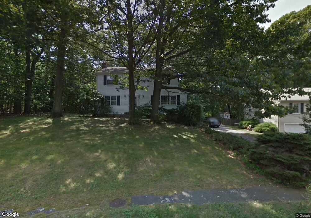
19 Possum Cir Norwalk, CT 06854
Brookside NeighborhoodEstimated Value: $869,000 - $1,002,000
4
Beds
3
Baths
1,824
Sq Ft
$518/Sq Ft
Est. Value
About This Home
This home is located at 19 Possum Cir, Norwalk, CT 06854 and is currently estimated at $945,704, approximately $518 per square foot. 19 Possum Cir is a home located in Fairfield County with nearby schools including Rowayton Elementary School, Roton Middle School, and Brien Mcmahon High School.
Ownership History
Date
Name
Owned For
Owner Type
Purchase Details
Closed on
Jan 4, 2016
Sold by
Kingston Kathleen
Bought by
Kingston Kathleen and Mitchell James
Current Estimated Value
Home Financials for this Owner
Home Financials are based on the most recent Mortgage that was taken out on this home.
Original Mortgage
$900,000
Outstanding Balance
$714,346
Interest Rate
3.98%
Mortgage Type
Credit Line Revolving
Estimated Equity
$231,358
Purchase Details
Closed on
Jul 18, 1986
Bought by
Kingston Kathleen and Mitchell James
Create a Home Valuation Report for This Property
The Home Valuation Report is an in-depth analysis detailing your home's value as well as a comparison with similar homes in the area
Home Values in the Area
Average Home Value in this Area
Purchase History
| Date | Buyer | Sale Price | Title Company |
|---|---|---|---|
| Kingston Kathleen | -- | -- | |
| Kingston Kathleen | -- | -- | |
| Kingston Kathleen | -- | -- |
Source: Public Records
Mortgage History
| Date | Status | Borrower | Loan Amount |
|---|---|---|---|
| Open | Kingston Kathleen | $900,000 | |
| Closed | Kingston Kathleen | $900,000 |
Source: Public Records
Tax History Compared to Growth
Tax History
| Year | Tax Paid | Tax Assessment Tax Assessment Total Assessment is a certain percentage of the fair market value that is determined by local assessors to be the total taxable value of land and additions on the property. | Land | Improvement |
|---|---|---|---|---|
| 2025 | $12,381 | $517,040 | $298,280 | $218,760 |
| 2024 | $12,197 | $517,040 | $298,280 | $218,760 |
| 2023 | $8,990 | $357,280 | $191,390 | $165,890 |
| 2022 | $8,822 | $357,290 | $191,400 | $165,890 |
| 2021 | $8,593 | $357,280 | $191,390 | $165,890 |
| 2020 | $8,588 | $357,280 | $191,390 | $165,890 |
| 2019 | $8,347 | $357,280 | $191,390 | $165,890 |
| 2018 | $8,667 | $325,080 | $208,380 | $116,700 |
| 2017 | $8,370 | $325,080 | $208,380 | $116,700 |
| 2016 | $8,290 | $325,080 | $208,380 | $116,700 |
| 2015 | $8,267 | $325,080 | $208,380 | $116,700 |
| 2014 | $8,160 | $325,080 | $208,380 | $116,700 |
Source: Public Records
Map
Nearby Homes
- 40 Arnold Ln
- 113 Rowayton Woods Dr
- 171 Rowayton Woods Dr Unit 171
- 73 Devils Garden Rd
- 181 Highland Ave
- 19 Woodchuck Ct
- 108 Witch Ln
- 28 Old Trolley Way
- 209 Rowayton Ave
- 5 Rockland Rd Unit A8
- 309 Ely Ave Unit A2
- 19 Littlebrook Rd
- 9 Flicker Ln
- 1 Flicker Ln
- 166 Rowayton Ave Unit 2
- 47 Glasser St
- 7 Moscariello Place
- 7 Hadik Pkwy
- 9 Observatory Place Unit A
- 5 Wakeman Rd