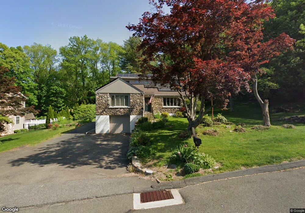
19 Rennison Rd Trumbull, CT 06611
Trumbull Center NeighborhoodEstimated Value: $521,000 - $825,000
4
Beds
4
Baths
2,500
Sq Ft
$286/Sq Ft
Est. Value
About This Home
This home is located at 19 Rennison Rd, Trumbull, CT 06611 and is currently estimated at $715,281, approximately $286 per square foot. 19 Rennison Rd is a home located in Fairfield County with nearby schools including Booth Hill School, Hillcrest Middle School, and Trumbull High School.
Ownership History
Date
Name
Owned For
Owner Type
Purchase Details
Closed on
Sep 18, 2019
Sold by
Minopoli Mark
Bought by
Minipoli Winnie and Minopoli Mark
Current Estimated Value
Purchase Details
Closed on
Sep 30, 1994
Sold by
Minopoli Ralph and Minopoli Mary
Bought by
Minopoli Mark and Minopoli Pintha
Home Financials for this Owner
Home Financials are based on the most recent Mortgage that was taken out on this home.
Original Mortgage
$85,000
Interest Rate
8.5%
Mortgage Type
Unknown
Create a Home Valuation Report for This Property
The Home Valuation Report is an in-depth analysis detailing your home's value as well as a comparison with similar homes in the area
Home Values in the Area
Average Home Value in this Area
Purchase History
| Date | Buyer | Sale Price | Title Company |
|---|---|---|---|
| Minipoli Winnie | -- | -- | |
| Minipoli Winnie | -- | -- | |
| Minopoli Mark | $150,000 | -- | |
| Minopoli Mark | $150,000 | -- |
Source: Public Records
Mortgage History
| Date | Status | Borrower | Loan Amount |
|---|---|---|---|
| Previous Owner | Minopoli Mark | $250,000 | |
| Previous Owner | Minopoli Mark | $95,000 | |
| Previous Owner | Minopoli Mark | $108,000 | |
| Previous Owner | Minopoli Mark | $85,000 |
Source: Public Records
Tax History
| Year | Tax Paid | Tax Assessment Tax Assessment Total Assessment is a certain percentage of the fair market value that is determined by local assessors to be the total taxable value of land and additions on the property. | Land | Improvement |
|---|---|---|---|---|
| 2025 | $12,851 | $347,690 | $148,890 | $198,800 |
| 2024 | $12,481 | $347,690 | $148,890 | $198,800 |
| 2023 | $12,291 | $347,690 | $148,890 | $198,800 |
| 2022 | $12,102 | $347,690 | $148,890 | $198,800 |
| 2021 | $10,991 | $305,690 | $141,260 | $164,430 |
| 2020 | $10,991 | $305,690 | $141,260 | $164,430 |
| 2018 | $10,751 | $305,690 | $141,260 | $164,430 |
| 2017 | $10,546 | $305,690 | $141,260 | $164,430 |
| 2016 | $10,349 | $305,690 | $141,260 | $164,430 |
| 2015 | $10,343 | $306,900 | $141,300 | $165,600 |
| 2014 | $10,122 | $306,900 | $141,300 | $165,600 |
Source: Public Records
Map
Nearby Homes
- 22 Beverly Rd
- 7 E Lake Rd
- 0 Lot #4 & Lot #5 W Mischa Rd Unit 24138429
- 40 Puritan Rd
- 68 Old Dike Rd
- 85 Teeter Rock Rd
- 0 Pinewood Trail
- 101 Golden Hill St
- 3 Wheeler Dr
- 38 Macdonald Rd
- 2449 Huntington Turnpike
- 220 Hilltop Cir
- 244 Strobel Rd
- 10 Foxwood Rd
- 60 Quail Trail
- 176 Strobel Rd
- 311 Isinglass Rd
- 2 Doe Hollow Dr
- 9 Sunnyridge Pkwy
- 58 Daniels Farm Rd
- 15 Rennison Rd
- 20 Rennison Rd
- 29 Rennison Rd
- 18 Rennison Rd
- 24 Rennison Rd
- 11 Rennison Rd
- 12 Rennison Rd
- 26 Rennison Rd
- 8 Rennison Rd
- 23 Beverly Rd
- 19 Beverly Rd
- 25 Beverly Rd
- 29 Beverly Rd
- 32 Rennison Rd
- 390 Booth Hill Rd
- 22 Green Ridge Rd
- 28 Green Ridge Rd
- 33 Beverly Rd
- 370 Booth Hill Rd
- 9 Beverly Rd
Your Personal Tour Guide
Ask me questions while you tour the home.