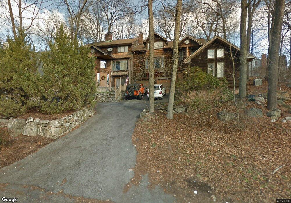
19 River St New Canaan, CT 06840
Estimated Value: $1,013,762 - $1,256,000
3
Beds
2
Baths
2,070
Sq Ft
$555/Sq Ft
Est. Value
About This Home
This home is located at 19 River St, New Canaan, CT 06840 and is currently estimated at $1,149,441, approximately $555 per square foot. 19 River St is a home located in Fairfield County with nearby schools including East Elementary School, Saxe Middle School, and New Canaan High School.
Ownership History
Date
Name
Owned For
Owner Type
Purchase Details
Closed on
May 3, 2010
Sold by
Boski 3Rd Stephen L
Bought by
Corker Cathleen R
Current Estimated Value
Purchase Details
Closed on
Dec 8, 1994
Sold by
Purcell Steven D and Purcell Maud H
Bought by
Clark Newlo Maureen and Newlove David
Purchase Details
Closed on
Nov 10, 1987
Sold by
Knothe Jacek
Bought by
Purcell Steven
Create a Home Valuation Report for This Property
The Home Valuation Report is an in-depth analysis detailing your home's value as well as a comparison with similar homes in the area
Home Values in the Area
Average Home Value in this Area
Purchase History
| Date | Buyer | Sale Price | Title Company |
|---|---|---|---|
| Corker Cathleen R | -- | -- | |
| Clark Newlo Maureen | $265,000 | -- | |
| Purcell Steven | $287,500 | -- |
Source: Public Records
Mortgage History
| Date | Status | Borrower | Loan Amount |
|---|---|---|---|
| Previous Owner | Purcell Steven | $169,474 | |
| Previous Owner | Purcell Steven | $82,000 | |
| Previous Owner | Purcell Steven | $192,000 |
Source: Public Records
Tax History Compared to Growth
Tax History
| Year | Tax Paid | Tax Assessment Tax Assessment Total Assessment is a certain percentage of the fair market value that is determined by local assessors to be the total taxable value of land and additions on the property. | Land | Improvement |
|---|---|---|---|---|
| 2025 | $9,898 | $593,040 | $0 | $593,040 |
| 2024 | $9,572 | $593,040 | $0 | $593,040 |
| 2023 | $8,730 | $460,950 | $0 | $460,950 |
| 2022 | $8,468 | $460,950 | $0 | $460,950 |
| 2021 | $8,371 | $460,950 | $0 | $460,950 |
| 2020 | $8,371 | $460,950 | $0 | $460,950 |
| 2019 | $8,408 | $460,950 | $0 | $460,950 |
| 2018 | $7,684 | $436,380 | $0 | $436,380 |
| 2017 | $7,545 | $436,380 | $0 | $436,380 |
| 2016 | $7,373 | $436,380 | $0 | $436,380 |
| 2015 | $7,227 | $436,380 | $0 | $436,380 |
| 2014 | $7,026 | $436,380 | $0 | $436,380 |
Source: Public Records
Map
Nearby Homes
- 79 Locust Ave Unit 212
- 96 East Ave Unit C
- 42 Forest St Unit A
- 60 East Ave
- 64 East Ave
- 289 New Norwalk Rd Unit 22
- 145 River St
- 15 Burtis Ave Unit Townhome D
- 15 Burtis Ave Unit West Penthouse B
- 15 Burtis Ave Unit Townhome A
- 15 Burtis Ave Unit East Plaza 203
- 180 Summer St
- 61 Smith Ridge Rd
- 52 Garibaldi Ln
- 262 Brushy Ridge Rd
- 101 Parade Hill Rd
- 38 Fitch Ln
- 136 South Ave
- 204 Parade Hill Rd
- 197 Park St Unit 13
- 17 River St Unit 17
- 23 River St
- 10 Nutmeg Ln
- 7 River St
- 16 River St
- 18 River St
- 24 River St
- 24 River St Unit 24
- 26 River St
- 12 River St
- 33 River St
- 33 River St Unit 1
- 33 River St Unit B
- 33 River St Unit A
- 33 River St Unit 2
- 33 River St Unit Second floor
- 33 River St Unit FIRST FLOOR
- 10 River St
- 36 Brushy Ridge Rd
- 12 Brushy Ridge Rd