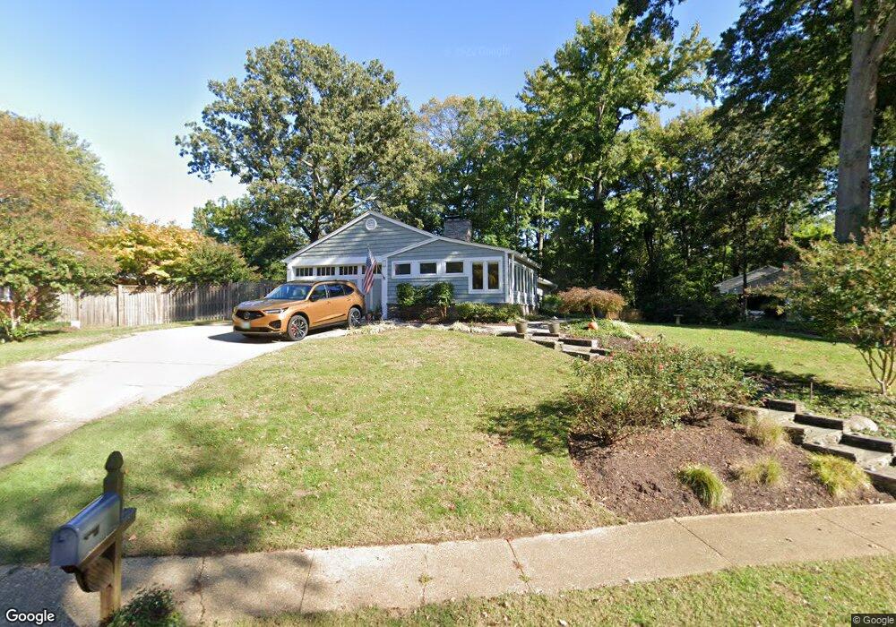
19 Romar Dr Annapolis, MD 21403
Estimated Value: $784,000 - $976,000
About This Home
This home is located at 19 Romar Dr, Annapolis, MD 21403 and is currently estimated at $856,844, approximately $465 per square foot. 19 Romar Dr is a home located in Anne Arundel County with nearby schools including Hillsmere Elementary School, Annapolis Middle School, and Annapolis High School.
Ownership History
We collect this data history from publicly available records. To have your information removed, we recommend requesting removal directly through your county’s website.
Purchase Details
Home Financials for this Owner
Home Financials are based on the most recent Mortgage that was taken out on this home.Purchase Details
Home Financials for this Owner
Home Financials are based on the most recent Mortgage that was taken out on this home.Purchase Details
Home Values in the Area
Average Home Value in this Area
Purchase History
We collect this data history from publicly available records. To have your information removed, we recommend requesting removal directly through your county’s website.
| Date | Buyer | Sale Price | Title Company |
|---|---|---|---|
| $530,000 | -- | ||
| $530,000 | -- | ||
| -- | -- |
Mortgage History
We collect this data history from publicly available records. To have your information removed, we recommend requesting removal directly through your county’s website.
| Date | Status | Borrower | Loan Amount |
|---|---|---|---|
| Open | $424,000 | ||
| Previous Owner | $424,000 |
Tax History
We collect this data history from publicly available records. To have your information removed, we recommend requesting removal directly through your county’s website.
| Year | Tax Paid | Tax Assessment Tax Assessment Total Assessment is a certain percentage of the fair market value that is determined by local assessors to be the total taxable value of land and additions on the property. | Land | Improvement |
|---|---|---|---|---|
| 2025 | $6,514 | $607,267 | -- | -- |
| 2024 | $6,514 | $573,733 | $0 | $0 |
| 2023 | $6,327 | $540,200 | $317,300 | $222,900 |
| 2022 | $5,922 | $529,600 | $0 | $0 |
| 2021 | $6,192 | $519,000 | $0 | $0 |
| 2020 | $6,192 | $508,400 | $317,300 | $191,100 |
| 2019 | $6,083 | $497,433 | $0 | $0 |
| 2018 | $5,812 | $486,467 | $0 | $0 |
| 2017 | $5,738 | $475,500 | $0 | $0 |
| 2016 | -- | $475,500 | $0 | $0 |
| 2015 | -- | $475,500 | $0 | $0 |
| 2014 | -- | $485,400 | $0 | $0 |
Map
- 317 Canterfield Rd
- 20 Ironstone Ct Unit 20 F
- 50 Hearthstone Ct
- 40 Ironstone Ct Unit J
- 10 Ironstone Ct
- 10 Sandstone Ct
- 40 Greystone Ct Unit L
- 40 Greystone Ct Unit G
- 10 Amberstone Ct
- 403 Riding Ridge Rd
- 105 Rosecrest Dr
- 15 Landings Ct
- 1226 Tyler Ave
- 26 Janwall Ct
- 118 Treblis Way
- 209 Garden Gate Ln
- 15 Copley Ct
- 3285 Harness Creek Rd
- 3307 Harness Creek Rd
- 113 Stilly Way
Ask me questions while you tour the home.