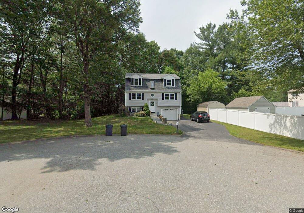
19 Ronald Ln Lowell, MA 01854
Pawtucketville NeighborhoodEstimated Value: $577,000 - $632,000
3
Beds
3
Baths
1,791
Sq Ft
$343/Sq Ft
Est. Value
About This Home
This home is located at 19 Ronald Ln, Lowell, MA 01854 and is currently estimated at $614,003, approximately $342 per square foot. 19 Ronald Ln is a home located in Middlesex County with nearby schools including Joseph McAvinnue Elementary School, Charlotte M. Murkland Elementary School, and Dr. Gertrude Bailey Elementary School.
Ownership History
Date
Name
Owned For
Owner Type
Purchase Details
Closed on
Mar 31, 2000
Sold by
Christina Rt and Gomes Christina
Bought by
Gokey Karen
Current Estimated Value
Purchase Details
Closed on
May 21, 1999
Sold by
Oneil John R and Autiello Kimberly A
Bought by
Gomes Cristina L
Purchase Details
Closed on
Jun 20, 1990
Sold by
Totman Road Ltd
Bought by
Oneil John R
Create a Home Valuation Report for This Property
The Home Valuation Report is an in-depth analysis detailing your home's value as well as a comparison with similar homes in the area
Home Values in the Area
Average Home Value in this Area
Purchase History
| Date | Buyer | Sale Price | Title Company |
|---|---|---|---|
| Gokey Karen | $188,000 | -- | |
| Gokey Karen | $188,000 | -- | |
| Gomes Cristina L | $174,000 | -- | |
| Gomes Cristina L | $174,000 | -- | |
| Oneil John R | $124,990 | -- | |
| Oneil John R | $124,990 | -- |
Source: Public Records
Mortgage History
| Date | Status | Borrower | Loan Amount |
|---|---|---|---|
| Open | Oneil John R | $144,150 | |
| Closed | Oneil John R | $76,300 |
Source: Public Records
Tax History Compared to Growth
Tax History
| Year | Tax Paid | Tax Assessment Tax Assessment Total Assessment is a certain percentage of the fair market value that is determined by local assessors to be the total taxable value of land and additions on the property. | Land | Improvement |
|---|---|---|---|---|
| 2025 | $5,745 | $500,400 | $179,100 | $321,300 |
| 2024 | $5,823 | $488,900 | $167,400 | $321,500 |
| 2023 | $5,588 | $449,900 | $145,600 | $304,300 |
| 2022 | $5,079 | $400,200 | $132,300 | $267,900 |
| 2021 | $4,751 | $353,000 | $115,100 | $237,900 |
| 2020 | $4,613 | $345,300 | $117,400 | $227,900 |
| 2019 | $4,459 | $317,600 | $103,400 | $214,200 |
| 2018 | $4,325 | $312,500 | $98,400 | $214,100 |
| 2017 | $4,319 | $289,500 | $89,500 | $200,000 |
| 2016 | $4,243 | $279,900 | $83,500 | $196,400 |
| 2015 | $3,992 | $257,900 | $81,700 | $176,200 |
| 2013 | $3,936 | $262,200 | $102,700 | $159,500 |
Source: Public Records
Map
Nearby Homes
- 49 Coburn Dr
- 69 Coburn Dr
- 101 Laurie Ln
- 6 Louis Farm Rd Unit 6
- 3 Louis Farm Rd Unit 3
- 240 Trotting Park Rd
- 1820 Skyline Dr Unit 18
- 20 Sandy Ln
- 54 Shirley Ave
- 527 Pawtucket Blvd Unit 304
- 1410 Skyline Dr Unit 9
- 1710 Skyline Dr Unit 10
- 1600 Skyline Dr Unit 2
- 2200 Skyline Dr Unit 5
- 1370 Varnum Ave
- 15 Dowling Dr
- 1401 Pawtucket Blvd Unit 10
- 1461 Pawtucket Blvd Unit 12
- 33 W Meadow Rd
- 307 Pawtucket Blvd Unit 13