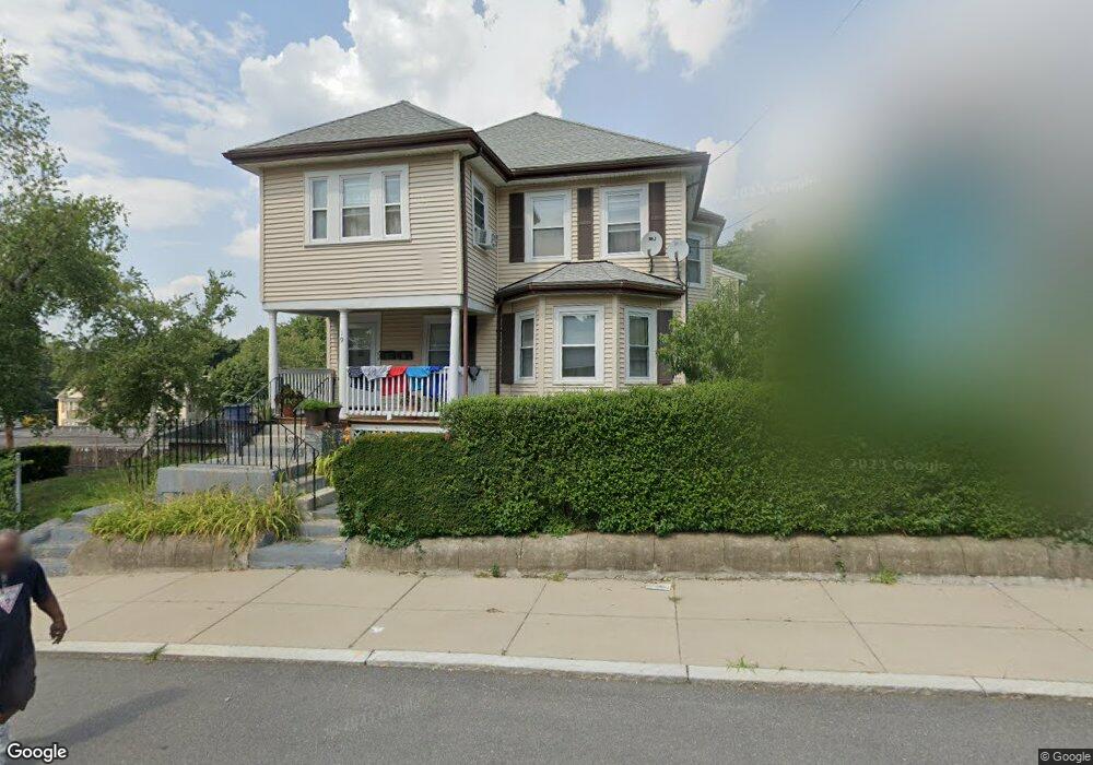
19 Ruxton Rd Mattapan, MA 02126
Southern Mattapan NeighborhoodEstimated Value: $694,042 - $855,000
4
Beds
2
Baths
2,531
Sq Ft
$311/Sq Ft
Est. Value
About This Home
This home is located at 19 Ruxton Rd, Mattapan, MA 02126 and is currently estimated at $787,511, approximately $311 per square foot. 19 Ruxton Rd is a home located in Suffolk County with nearby schools including KIPP Academy Boston Charter School, Boston Preparatory Charter Public School, and Berea Seventh-day Adventist Academy.
Ownership History
Date
Name
Owned For
Owner Type
Purchase Details
Closed on
Jun 19, 1990
Sold by
Mcgarth John A
Bought by
Hunte Clyde N
Current Estimated Value
Home Financials for this Owner
Home Financials are based on the most recent Mortgage that was taken out on this home.
Original Mortgage
$157,000
Interest Rate
10.54%
Mortgage Type
Purchase Money Mortgage
Create a Home Valuation Report for This Property
The Home Valuation Report is an in-depth analysis detailing your home's value as well as a comparison with similar homes in the area
Home Values in the Area
Average Home Value in this Area
Purchase History
| Date | Buyer | Sale Price | Title Company |
|---|---|---|---|
| Hunte Clyde N | $175,000 | -- |
Source: Public Records
Mortgage History
| Date | Status | Borrower | Loan Amount |
|---|---|---|---|
| Open | Hunte Clyde N | $221,600 | |
| Closed | Hunte Clyde N | $145,800 | |
| Closed | Hunte Clyde N | $157,000 |
Source: Public Records
Tax History Compared to Growth
Tax History
| Year | Tax Paid | Tax Assessment Tax Assessment Total Assessment is a certain percentage of the fair market value that is determined by local assessors to be the total taxable value of land and additions on the property. | Land | Improvement |
|---|---|---|---|---|
| 2025 | $6,722 | $580,500 | $203,300 | $377,200 |
| 2024 | $6,179 | $566,900 | $180,700 | $386,200 |
| 2023 | $5,744 | $534,800 | $170,500 | $364,300 |
| 2022 | $5,819 | $534,800 | $170,500 | $364,300 |
| 2021 | $5,188 | $486,200 | $155,000 | $331,200 |
| 2020 | $4,693 | $444,400 | $147,400 | $297,000 |
| 2019 | $4,358 | $413,500 | $115,000 | $298,500 |
| 2018 | $3,869 | $369,200 | $115,000 | $254,200 |
| 2017 | $3,759 | $355,000 | $115,000 | $240,000 |
| 2016 | $3,551 | $322,800 | $115,000 | $207,800 |
| 2015 | $3,362 | $277,600 | $120,000 | $157,600 |
| 2014 | $3,233 | $257,000 | $120,000 | $137,000 |
Source: Public Records
Map
Nearby Homes
- 34 Ridlon Rd
- 839-843 Cummins Hwy
- 231 Itasca St
- 179 Hebron St
- 265 Hebron St
- 770 Cummins Hwy Unit 1
- 770 Cummins Hwy Unit 22
- 10 Brockton St
- 72 Livermore St
- 0 Tina Ave
- 90 Hollingsworth St
- 7 Winborough St
- 23 Caton St
- 95 Woodhaven St
- 25 Alpine St Unit 7
- 100 Itasca St
- 48-50 Rockdale St
- 645 River St
- 20 Monterey Ave
- 14-14R Kennebec St
- 17 Ruxton Rd
- 63 Ridlon Rd
- 585 Cummins Hwy
- 22 Ruxton Rd
- 64 Ridlon Rd
- 823 Cummins Hwy
- 9 Ruxton Rd
- 62 Ridlon Rd
- 55 Ridlon Rd
- 55 Ridlon Rd Unit 1 Room C
- 55 Ridlon Rd Unit 2
- 55 Ridlon Rd Unit 3
- 55 Ridlon Rd Unit 1
- 637 Cummins Hwy Unit 641
- 60 Ridlon Rd
- 669 Cummins Hwy
- 171 Greenfield Rd
- 7 Ruxton Rd
- 10 Ruxton Rd
- 635 Cummins Hwy