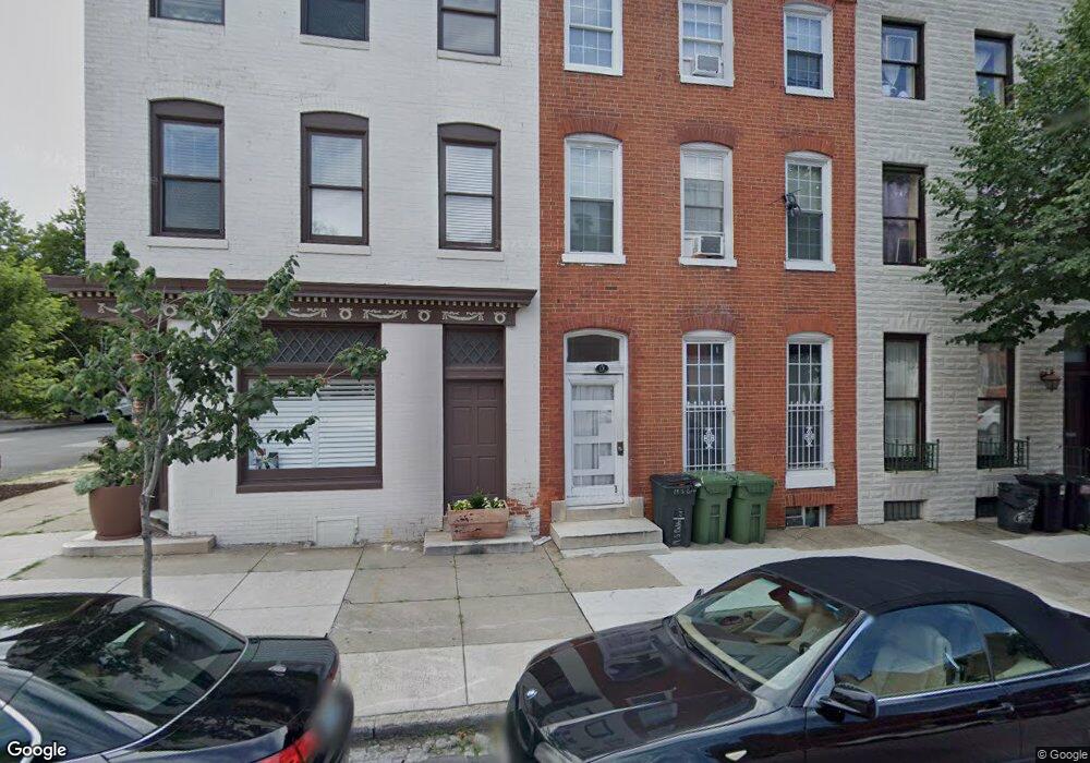
19 S Calhoun St Baltimore, MD 21223
Union Square NeighborhoodEstimated Value: $285,203 - $334,000
Studio
4
Baths
2,527
Sq Ft
$123/Sq Ft
Est. Value
About This Home
This home is located at 19 S Calhoun St, Baltimore, MD 21223 and is currently estimated at $309,602, approximately $122 per square foot. 19 S Calhoun St is a home located in Baltimore City with nearby schools including Franklin Square Elementary/Middle School, Booker T. Washington Middle School, and Digital Harbor High School.
Ownership History
Date
Name
Owned For
Owner Type
Purchase Details
Closed on
Sep 17, 2021
Sold by
19 S Calhoun Street Llc
Bought by
2000 Neptune Llc
Current Estimated Value
Purchase Details
Closed on
Aug 13, 2021
Sold by
Mitchell Willie J and Mitchell Rita L
Bought by
19 S Calhoun Street Street Llc
Purchase Details
Closed on
Feb 7, 2007
Sold by
Johnson Raygan J
Bought by
Mitchell Willie J and Mitchell Rita L
Purchase Details
Closed on
Dec 7, 2006
Sold by
Johnson Raygan J
Bought by
Mitchell Willie J and Mitchell Rita L
Purchase Details
Closed on
Oct 28, 2005
Sold by
Carter Jimmie
Bought by
Carter Jimmie
Purchase Details
Closed on
Jan 29, 2002
Sold by
Carter Jimmie
Bought by
Carter Jimmie and Millner Bruce
Purchase Details
Closed on
Jun 20, 2001
Sold by
Robinson Dollitte C
Bought by
Carter Jimmie
Create a Home Valuation Report for This Property
The Home Valuation Report is an in-depth analysis detailing your home's value as well as a comparison with similar homes in the area
Home Values in the Area
Average Home Value in this Area
Purchase History
| Date | Buyer | Sale Price | Title Company |
|---|---|---|---|
| 2000 Neptune Llc | $260,000 | Castle Title Llc | |
| 19 S Calhoun Street Street Llc | -- | Castle Title Llc | |
| Mitchell Willie J | $220,000 | -- | |
| Mitchell Willie J | $220,000 | -- | |
| Carter Jimmie | -- | -- | |
| Johnson Raygan J | $115,000 | -- | |
| Carter Jimmie | -- | -- | |
| Carter Jimmie | -- | -- |
Source: Public Records
Tax History
| Year | Tax Paid | Tax Assessment Tax Assessment Total Assessment is a certain percentage of the fair market value that is determined by local assessors to be the total taxable value of land and additions on the property. | Land | Improvement |
|---|---|---|---|---|
| 2025 | $5,085 | $227,100 | -- | -- |
| 2024 | $5,085 | $216,500 | -- | -- |
| 2023 | $4,836 | $205,900 | $60,000 | $145,900 |
| 2022 | $4,613 | $195,467 | $0 | $0 |
| 2021 | $4,367 | $185,033 | $0 | $0 |
| 2020 | $4,121 | $174,600 | $60,000 | $114,600 |
| 2019 | $4,101 | $174,600 | $60,000 | $114,600 |
| 2018 | $4,121 | $174,600 | $60,000 | $114,600 |
| 2017 | $4,439 | $188,100 | $0 | $0 |
| 2016 | $4,863 | $181,433 | $0 | $0 |
| 2015 | $4,863 | $174,767 | $0 | $0 |
| 2014 | $4,863 | $168,100 | $0 | $0 |
Source: Public Records
Map
Nearby Homes
- 1433 W Lombard St
- 50 S Stockton St
- 113 S Stricker St
- 39 S Stockton St
- 215 S Calhoun St
- 1226 W Pratt St
- 1220 W Pratt St
- 1412 W Baltimore St
- 210 S Carey St
- 208 S Norris St
- 1309 Kuper St
- 1509 Lemmon St
- 1512 W Pratt St
- 1316 Mchenry St
- 1500 W Baltimore St
- 119 S Carrollton Ave
- 1127 W Lombard St
- 1317 W Fayette St Unit 3B
- 1525 W Pratt St
- 307 S Calhoun St
- 21 S Calhoun St
- 17 S Calhoun St
- 23 S Calhoun St
- 23 S Calhoun St Unit 1
- 23 S Calhoun St Unit 3
- 1327 Hollins St
- 27 S Calhoun St
- 1325 Hollins St
- 29 S Calhoun St
- 1326 Boyd St
- 1323 Hollins St
- 1321 Hollins St
- 1401 Hollins St
- 31 S Calhoun St
- 1319 Hollins St
- 33 S Calhoun St
- 1338 Hollins St
- 1338 Hollins St Unit 2
- 1324 Hollins St
- 1334 Hollins St
Your Personal Tour Guide
Ask me questions while you tour the home.