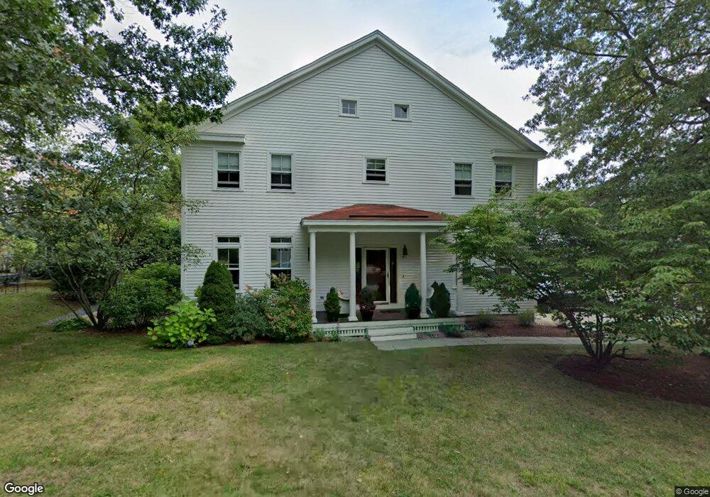
19 S Commons Unit A Lincoln, MA 01773
Estimated Value: $595,000 - $745,000
2
Beds
2
Baths
1,366
Sq Ft
$478/Sq Ft
Est. Value
About This Home
This home is located at 19 S Commons Unit A, Lincoln, MA 01773 and is currently estimated at $653,597, approximately $478 per square foot. 19 S Commons Unit A is a home located in Middlesex County with nearby schools including Lincoln-Sudbury Regional High School and Tremont School.
Ownership History
Date
Name
Owned For
Owner Type
Purchase Details
Closed on
Feb 1, 2022
Sold by
Darcy Patricia M
Bought by
P Margaret Darcy Ret
Current Estimated Value
Purchase Details
Closed on
Jun 9, 2006
Sold by
Hamel Richard P
Bought by
Darcy Patricia
Home Financials for this Owner
Home Financials are based on the most recent Mortgage that was taken out on this home.
Original Mortgage
$250,000
Interest Rate
6.62%
Mortgage Type
Purchase Money Mortgage
Create a Home Valuation Report for This Property
The Home Valuation Report is an in-depth analysis detailing your home's value as well as a comparison with similar homes in the area
Home Values in the Area
Average Home Value in this Area
Purchase History
| Date | Buyer | Sale Price | Title Company |
|---|---|---|---|
| P Margaret Darcy Ret | -- | None Available | |
| P Margaret Darcy Ret | -- | None Available | |
| Darcy Patricia | $400,000 | -- |
Source: Public Records
Mortgage History
| Date | Status | Borrower | Loan Amount |
|---|---|---|---|
| Previous Owner | Darcy Patricia | $250,000 |
Source: Public Records
Tax History Compared to Growth
Tax History
| Year | Tax Paid | Tax Assessment Tax Assessment Total Assessment is a certain percentage of the fair market value that is determined by local assessors to be the total taxable value of land and additions on the property. | Land | Improvement |
|---|---|---|---|---|
| 2025 | $71 | $550,700 | $0 | $550,700 |
| 2024 | $6,640 | $515,100 | $0 | $515,100 |
| 2023 | $6,829 | $490,600 | $0 | $490,600 |
| 2022 | $7,143 | $478,400 | $0 | $478,400 |
| 2021 | $6,896 | $444,300 | $0 | $444,300 |
| 2020 | $6,319 | $411,400 | $0 | $411,400 |
| 2019 | $5,584 | $398,000 | $0 | $398,000 |
| 2018 | $5,413 | $398,000 | $0 | $398,000 |
| 2017 | $5,098 | $372,100 | $0 | $372,100 |
| 2016 | $5,161 | $368,900 | $0 | $368,900 |
| 2015 | $5,036 | $355,900 | $0 | $355,900 |
| 2014 | $4,849 | $336,500 | $0 | $336,500 |
Source: Public Records
Map
Nearby Homes
- 5 South Commons Unit D
- 36 Indian Camp Ln Unit D
- 29 S Commons Unit D
- 241 Shadyside Ave
- 16 Old Cambridge Turnpike
- 646 Cambridge Turnpike
- 10 Reiling Pond Rd
- 16 Hatch Farm Ln
- 28 Hatch Farm Ln
- 9 Garland Rd
- 10 Hatch Farm Ln
- 50 Summer St Unit A
- 52 Summer St Unit B
- 39 Neillian St Unit 39
- 644 Old Bedford Rd
- 7 Blue Heron Way
- 84 Davison Dr
- 75 Westview St
- 86 Butternut Cir
- 6 Revolutionary Rd
- 19 S Commons Unit D
- 19 S Commons Unit C
- 19 S Commons Unit B
- 19 South Commons Unit C
- 19 S Commons Unit A-19
- 19a South Commons Unit 19 A
- 15 S Commons Unit D
- 15 S Commons Unit C
- 15 S Commons Unit B
- 15 S Commons Unit A
- 15 South Commons Unit D
- 15 S Commons
- 15-D South Commons Unit D,15
- 15 South Commons Unit C
- 15C S Commons
- 15 A South Commons Unit 15A
- 15 C South Commons Unit 15C
- 23 S Commons
- 23 S Commons Unit D
- 23 S Commons Unit C