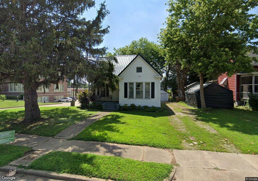
19 S Pacific St Cape Girardeau, MO 63703
Estimated Value: $73,443 - $127,000
2
Beds
1
Bath
1,128
Sq Ft
$85/Sq Ft
Est. Value
About This Home
This home is located at 19 S Pacific St, Cape Girardeau, MO 63703 and is currently estimated at $96,111, approximately $85 per square foot. 19 S Pacific St is a home located in Cape Girardeau County with nearby schools including Franklin Elementary School, Central Junior High School, and Central Middle School.
Ownership History
Date
Name
Owned For
Owner Type
Purchase Details
Closed on
Aug 15, 2007
Sold by
Dodd Edward L and Dodd Mayilyn
Bought by
Neher Janese Annetta and The Revocable Living Trust Of Janese Ann
Current Estimated Value
Home Financials for this Owner
Home Financials are based on the most recent Mortgage that was taken out on this home.
Original Mortgage
$47,000
Outstanding Balance
$31,009
Interest Rate
7.5%
Mortgage Type
Adjustable Rate Mortgage/ARM
Estimated Equity
$65,102
Create a Home Valuation Report for This Property
The Home Valuation Report is an in-depth analysis detailing your home's value as well as a comparison with similar homes in the area
Home Values in the Area
Average Home Value in this Area
Purchase History
| Date | Buyer | Sale Price | Title Company |
|---|---|---|---|
| Neher Janese Annetta | -- | Abstract And Title Co Inc |
Source: Public Records
Mortgage History
| Date | Status | Borrower | Loan Amount |
|---|---|---|---|
| Open | Neher Janese Annetta | $47,000 |
Source: Public Records
Tax History Compared to Growth
Tax History
| Year | Tax Paid | Tax Assessment Tax Assessment Total Assessment is a certain percentage of the fair market value that is determined by local assessors to be the total taxable value of land and additions on the property. | Land | Improvement |
|---|---|---|---|---|
| 2025 | $3 | $5,300 | $960 | $4,340 |
| 2024 | $3 | $5,050 | $920 | $4,130 |
| 2023 | $262 | $5,050 | $920 | $4,130 |
| 2022 | $242 | $4,660 | $850 | $3,810 |
| 2021 | $242 | $4,660 | $850 | $3,810 |
| 2020 | $243 | $4,660 | $850 | $3,810 |
| 2019 | $242 | $4,650 | $0 | $0 |
| 2018 | $242 | $4,650 | $0 | $0 |
| 2017 | $242 | $4,650 | $0 | $0 |
| 2016 | $241 | $4,650 | $0 | $0 |
| 2015 | $241 | $4,650 | $0 | $0 |
| 2014 | $243 | $4,650 | $0 | $0 |
Source: Public Records
Map
Nearby Homes
- 18 S Benton St
- 25 S Benton St
- 803 Independence St
- 26 N Pacific St
- 128 S Pacific St
- 820 824 Themis St
- 926 William St
- 63 N Hanover St
- 1114 William St
- 1219 Merriwether St
- 123 S Park Ave
- 12 N West End Blvd
- 327 S Hanover St
- 325 N Sprigg St
- 344 N Ellis St
- 1419 Themis St
- 239 N Middle St
- 1401 Bessie St
- 1455 Whitener St
- 1317 Bloomfield Rd
- 15 S Pacific St
- 24 S Pacific St
- 16 S Pacific St
- 24 S Benton St
- 834 Merriwether St
- 921 Independence St
- 825 Independence St
- 820 Merriwether St
- 9 N Pacific St
- 910 Independence St
- 4 N Pacific St
- 918 Independence St
- 815 Independence St
- 920 Independence St
- 10 N Pacific St
- 19 S Benton St
- 23 S Benton St
- 11 S Benton St
- 2 N Benton St
- 833 Merriwether St