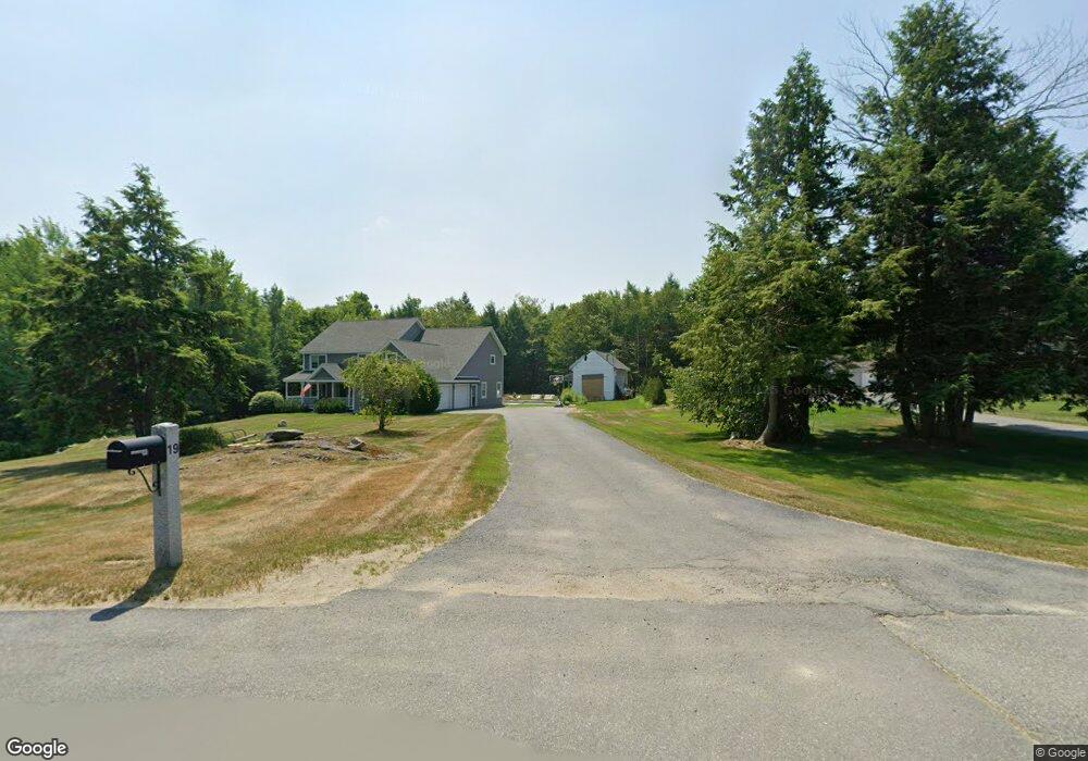
19 S Ridge Dr Winslow, ME 04901
Estimated Value: $709,000 - $751,068
4
Beds
4
Baths
4,474
Sq Ft
$165/Sq Ft
Est. Value
About This Home
This home is located at 19 S Ridge Dr, Winslow, ME 04901 and is currently estimated at $737,767, approximately $164 per square foot. 19 S Ridge Dr is a home located in Kennebec County with nearby schools including Winslow Elementary School, Winslow Junior High School, and Winslow High School.
Ownership History
Date
Name
Owned For
Owner Type
Purchase Details
Closed on
Jul 12, 2019
Sold by
Dibiase Marlo J
Bought by
Hilton Chelsea J and Hilton Kenneth A
Current Estimated Value
Home Financials for this Owner
Home Financials are based on the most recent Mortgage that was taken out on this home.
Original Mortgage
$311,200
Outstanding Balance
$271,924
Interest Rate
3.9%
Mortgage Type
New Conventional
Estimated Equity
$465,843
Purchase Details
Closed on
Aug 20, 2010
Sold by
Rock Ridges Inc Est
Bought by
Dibiase Marlo J
Create a Home Valuation Report for This Property
The Home Valuation Report is an in-depth analysis detailing your home's value as well as a comparison with similar homes in the area
Home Values in the Area
Average Home Value in this Area
Purchase History
| Date | Buyer | Sale Price | Title Company |
|---|---|---|---|
| Hilton Chelsea J | -- | -- | |
| Dibiase Marlo J | -- | -- |
Source: Public Records
Mortgage History
| Date | Status | Borrower | Loan Amount |
|---|---|---|---|
| Open | Hilton Chelsea J | $311,200 |
Source: Public Records
Tax History Compared to Growth
Tax History
| Year | Tax Paid | Tax Assessment Tax Assessment Total Assessment is a certain percentage of the fair market value that is determined by local assessors to be the total taxable value of land and additions on the property. | Land | Improvement |
|---|---|---|---|---|
| 2024 | $9,123 | $608,200 | $55,900 | $552,300 |
| 2023 | $8,981 | $598,700 | $55,900 | $542,800 |
| 2022 | $8,168 | $385,300 | $29,800 | $355,500 |
| 2021 | $7,415 | $367,100 | $29,800 | $337,300 |
| 2020 | $6,892 | $366,200 | $29,800 | $336,400 |
| 2019 | $6,641 | $356,300 | $29,800 | $326,500 |
| 2018 | $6,033 | $356,300 | $29,800 | $326,500 |
| 2017 | $5,964 | $356,300 | $29,800 | $326,500 |
| 2016 | $5,608 | $356,300 | $29,800 | $326,500 |
| 2015 | $5,543 | $357,600 | $31,100 | $326,500 |
| 2014 | $5,543 | $357,600 | $31,100 | $326,500 |
Source: Public Records
Map
Nearby Homes
- 1 S Ridge Dr
- 1 S Reynolds Rd
- 484 China Rd
- Lot 5B China Rd
- TBD China Rd
- 105 S Pond Rd
- 235 S Reynolds Rd
- M2, L48B S Reynolds Rd
- 51 N Reynolds Rd
- Lot 76 Bassett Rd
- lot 75 Bassett Rd
- 2 and 3 Blue Heron Ln
- 441 S Reynolds Rd
- 242 China Rd
- 5 Mar Val Terrace Unit B1
- 134 Wyman Bog Rd
- 0 S Reynolds Road Lot 2 Rd Unit 1632273
- 4 Marie St
- 5 Robert St
- 364 Cushman Rd