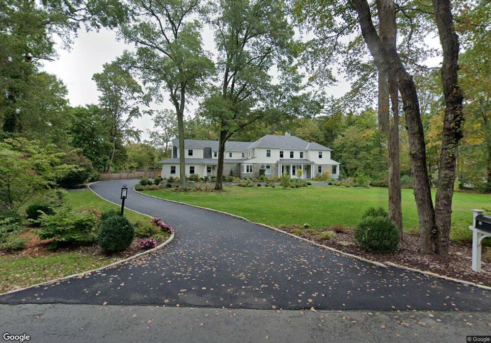
19 Salisbury Rd Darien, CT 06820
Estimated Value: $2,726,000 - $4,987,000
4
Beds
3
Baths
3,603
Sq Ft
$1,192/Sq Ft
Est. Value
About This Home
This home is located at 19 Salisbury Rd, Darien, CT 06820 and is currently estimated at $4,294,588, approximately $1,191 per square foot. 19 Salisbury Rd is a home located in Fairfield County with nearby schools including Ox Ridge Elementary School, Middlesex Middle School, and Darien High School.
Ownership History
Date
Name
Owned For
Owner Type
Purchase Details
Closed on
Aug 11, 2015
Sold by
Conze Michael F and Russell Conze M
Bought by
Schenk Everett M and Schenk Sarah E
Current Estimated Value
Home Financials for this Owner
Home Financials are based on the most recent Mortgage that was taken out on this home.
Original Mortgage
$1,000,000
Outstanding Balance
$755,863
Interest Rate
3.25%
Mortgage Type
Adjustable Rate Mortgage/ARM
Estimated Equity
$3,538,725
Purchase Details
Closed on
Jun 25, 2010
Sold by
Irvine Jamie T and Irvine Alicia S
Bought by
Conze Michael F and Russell Conze M
Create a Home Valuation Report for This Property
The Home Valuation Report is an in-depth analysis detailing your home's value as well as a comparison with similar homes in the area
Home Values in the Area
Average Home Value in this Area
Purchase History
| Date | Buyer | Sale Price | Title Company |
|---|---|---|---|
| Schenk Everett M | $1,650,000 | -- | |
| Conze Michael F | $1,000,000 | -- |
Source: Public Records
Mortgage History
| Date | Status | Borrower | Loan Amount |
|---|---|---|---|
| Open | Conze Michael F | $1,000,000 |
Source: Public Records
Tax History
| Year | Tax Paid | Tax Assessment Tax Assessment Total Assessment is a certain percentage of the fair market value that is determined by local assessors to be the total taxable value of land and additions on the property. | Land | Improvement |
|---|---|---|---|---|
| 2025 | $44,094 | $2,848,440 | $920,220 | $1,928,220 |
| 2024 | $41,844 | $2,848,440 | $920,220 | $1,928,220 |
| 2023 | $35,449 | $2,012,990 | $613,480 | $1,399,510 |
| 2022 | $34,684 | $2,012,990 | $613,480 | $1,399,510 |
| 2021 | $15,625 | $2,012,990 | $613,480 | $1,399,510 |
| 2020 | $32,933 | $2,012,990 | $613,480 | $1,399,510 |
| 2019 | $33,154 | $2,012,990 | $613,480 | $1,399,510 |
| 2018 | $24,341 | $1,513,750 | $657,300 | $856,450 |
| 2017 | $14,422 | $695,100 | $695,100 | $0 |
| 2016 | $15,364 | $974,260 | $695,100 | $279,160 |
| 2015 | $14,955 | $974,260 | $695,100 | $279,160 |
| 2014 | $14,624 | $974,260 | $695,100 | $279,160 |
Source: Public Records
Map
Nearby Homes
- 63 Dorchester Rd
- 15 Marianne Rd
- 20 Marianne Rd
- 561 Middlesex Rd
- 7 Tommys Ln
- 201 W Norwalk Rd
- 7 Buttonwood Ln
- 28 Crooked Mile Rd
- 45 Princes Pine Rd
- 58 Old Rock Ln
- 12 Dellwood Rd
- 5 Wheat Ln
- 9 Point o Woods Rd S
- 97 Richards Ave Unit B10
- 29 Richmond Dr
- 226 Putnam Rd
- 105 Richards Ave Unit 1407
- 112 Camp Ave
- 1 Douglas Dr
- 6 Ward Ln Unit 6
- 25 Salisbury Rd
- 9 Salisbury Rd
- 45 Salisbury Rd
- 86 Pembroke Rd
- 54 Pembroke Rd
- 100 Pembroke Rd
- 88 Pembroke Rd
- 34 Salisbury Rd
- 74 Pembroke Rd
- 43 Salisbury Rd
- 1 Wrenfield Ln
- 42 Salisbury Rd
- 4 Wrenfield Ln
- 95 Pembroke Rd
- 38 Pembroke Rd
- 55 Pembroke Rd
- 65 Pembroke Rd
- 48 Salisbury Rd
- 104 Pembroke Rd
- 45 Pembroke Rd
Your Personal Tour Guide
Ask me questions while you tour the home.