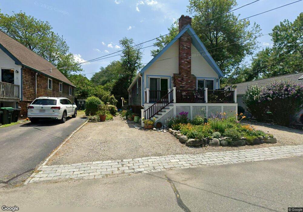
19 Sheridan Dr Marshfield, MA 02050
Ocean Bluff-Brant Rock NeighborhoodEstimated Value: $642,089 - $728,000
2
Beds
1
Bath
1,188
Sq Ft
$577/Sq Ft
Est. Value
About This Home
This home is located at 19 Sheridan Dr, Marshfield, MA 02050 and is currently estimated at $685,522, approximately $577 per square foot. 19 Sheridan Dr is a home located in Plymouth County with nearby schools including Daniel Webster, Furnace Brook Middle School, and Marshfield High School.
Ownership History
Date
Name
Owned For
Owner Type
Purchase Details
Closed on
Dec 6, 2023
Sold by
Cawley Richard T
Bought by
Richard Thomas Cawley Ft and Lutz
Current Estimated Value
Purchase Details
Closed on
Jan 31, 2005
Sold by
Rancatore Laura
Bought by
Cawley Richard T
Purchase Details
Closed on
Nov 30, 1994
Sold by
Murtagh Michael F
Bought by
Mcgovern Robert F and Mcgovern Laura
Home Financials for this Owner
Home Financials are based on the most recent Mortgage that was taken out on this home.
Original Mortgage
$129,978
Interest Rate
8.81%
Mortgage Type
Purchase Money Mortgage
Create a Home Valuation Report for This Property
The Home Valuation Report is an in-depth analysis detailing your home's value as well as a comparison with similar homes in the area
Home Values in the Area
Average Home Value in this Area
Purchase History
| Date | Buyer | Sale Price | Title Company |
|---|---|---|---|
| Richard Thomas Cawley Ft | -- | None Available | |
| Cawley Richard T | $325,000 | -- | |
| Cawley Richard T | $325,000 | -- | |
| Mcgovern Robert F | $126,500 | -- |
Source: Public Records
Mortgage History
| Date | Status | Borrower | Loan Amount |
|---|---|---|---|
| Previous Owner | Mcgovern Robert F | $133,000 | |
| Previous Owner | Mcgovern Robert F | $133,041 | |
| Previous Owner | Mcgovern Robert F | $129,978 |
Source: Public Records
Tax History
| Year | Tax Paid | Tax Assessment Tax Assessment Total Assessment is a certain percentage of the fair market value that is determined by local assessors to be the total taxable value of land and additions on the property. | Land | Improvement |
|---|---|---|---|---|
| 2025 | $5,338 | $539,200 | $317,600 | $221,600 |
| 2024 | $5,328 | $512,800 | $297,800 | $215,000 |
| 2023 | $4,830 | $448,800 | $268,000 | $180,800 |
| 2022 | $4,830 | $373,000 | $228,300 | $144,700 |
| 2021 | $4,735 | $359,000 | $218,400 | $140,600 |
| 2020 | $4,260 | $319,600 | $188,600 | $131,000 |
| 2019 | $4,402 | $329,000 | $188,600 | $140,400 |
| 2018 | $4,269 | $319,300 | $188,600 | $130,700 |
| 2017 | $4,168 | $303,800 | $178,700 | $125,100 |
| 2016 | $3,959 | $285,200 | $168,700 | $116,500 |
| 2015 | $3,696 | $278,100 | $168,700 | $109,400 |
| 2014 | $3,748 | $282,000 | $168,700 | $113,300 |
Source: Public Records
Map
Nearby Homes
- 25 Sheridan Dr
- 15 Sheridan Dr
- 11 Sheridan Dr
- 29 Sheridan Dr
- 12 Homestead Ave
- 18 Homestead Ave
- 16 Sheridan Dr
- 22 Homestead Ave
- 6 Homestead Ave
- 24 Sheridan Dr
- 7 Sheridan Dr
- 12 Sheridan Dr
- 33 Sheridan Dr
- 26 Homestead Ave
- 30 Sheridan Dr
- 255 Winslow St
- 8 Sheridan Dr
- 32 Homestead Ave
- 9 Ellis Ave
- 15 Homestead Ave
Your Personal Tour Guide
Ask me questions while you tour the home.