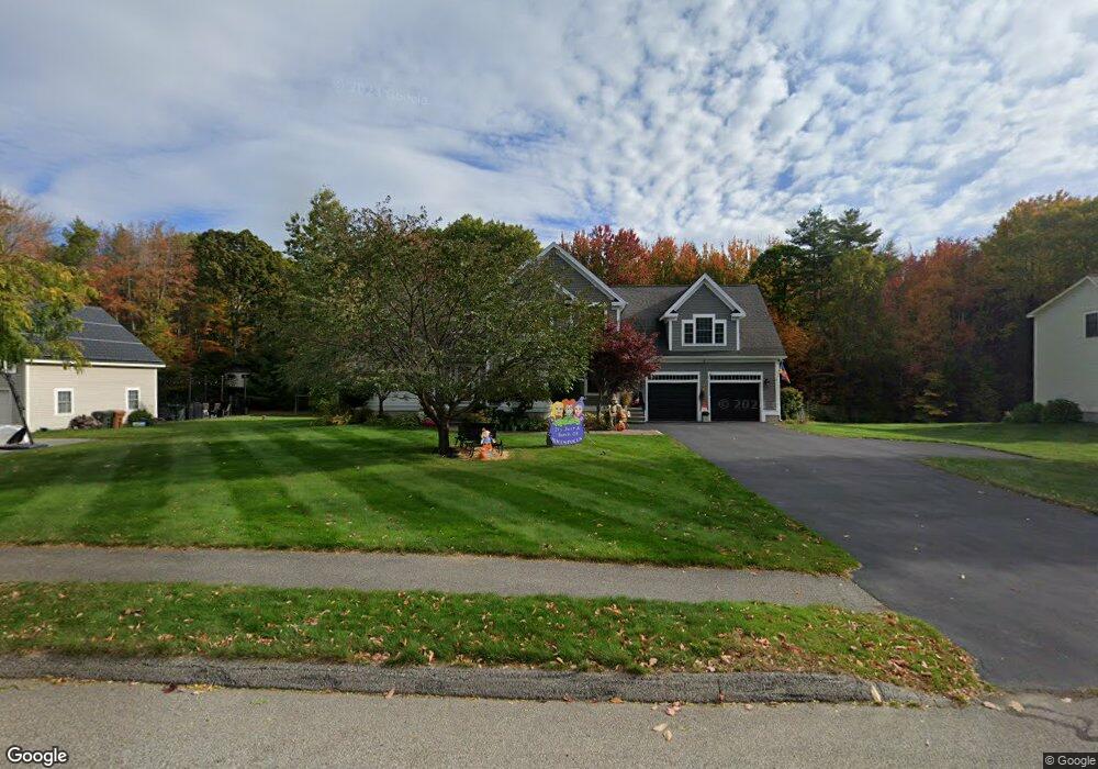
19 Sofia Rd Saco, ME 04072
North Saco NeighborhoodEstimated Value: $744,000 - $871,000
3
Beds
3
Baths
2,781
Sq Ft
$285/Sq Ft
Est. Value
About This Home
This home is located at 19 Sofia Rd, Saco, ME 04072 and is currently estimated at $792,261, approximately $284 per square foot. 19 Sofia Rd is a home located in York County with nearby schools including C K Burns School, Saco Middle School, and Saint James School.
Ownership History
Date
Name
Owned For
Owner Type
Purchase Details
Closed on
Dec 13, 2010
Sold by
Waters Dennis M
Bought by
Laverriere Denise L and Laverriere Randy C
Current Estimated Value
Home Financials for this Owner
Home Financials are based on the most recent Mortgage that was taken out on this home.
Original Mortgage
$345,600
Outstanding Balance
$226,779
Interest Rate
4.24%
Mortgage Type
Purchase Money Mortgage
Estimated Equity
$565,482
Purchase Details
Closed on
Jan 31, 2006
Sold by
Tierney Caryn E
Bought by
Waters Dennis
Create a Home Valuation Report for This Property
The Home Valuation Report is an in-depth analysis detailing your home's value as well as a comparison with similar homes in the area
Home Values in the Area
Average Home Value in this Area
Purchase History
| Date | Buyer | Sale Price | Title Company |
|---|---|---|---|
| Laverriere Denise L | -- | -- | |
| Waters Dennis | -- | -- |
Source: Public Records
Mortgage History
| Date | Status | Borrower | Loan Amount |
|---|---|---|---|
| Open | Laverriere Denise L | $345,600 | |
| Previous Owner | Laverriere Denise L | $80,000 | |
| Previous Owner | Laverriere Denise L | $215,000 |
Source: Public Records
Tax History
| Year | Tax Paid | Tax Assessment Tax Assessment Total Assessment is a certain percentage of the fair market value that is determined by local assessors to be the total taxable value of land and additions on the property. | Land | Improvement |
|---|---|---|---|---|
| 2024 | $8,895 | $633,100 | $164,600 | $468,500 |
| 2023 | $9,338 | $633,100 | $164,600 | $468,500 |
| 2022 | $8,276 | $451,500 | $125,300 | $326,200 |
| 2021 | $8,047 | $426,200 | $115,700 | $310,500 |
| 2020 | $7,498 | $381,200 | $106,300 | $274,900 |
| 2019 | $7,388 | $381,200 | $106,300 | $274,900 |
| 2018 | $7,240 | $373,600 | $98,700 | $274,900 |
| 2017 | $7,142 | $368,500 | $89,700 | $278,800 |
| 2016 | $7,286 | $375,200 | $73,700 | $301,500 |
| 2015 | $7,140 | $371,500 | $73,700 | $297,800 |
| 2014 | $6,917 | $371,500 | $73,700 | $297,800 |
| 2013 | $6,902 | $371,500 | $73,700 | $297,800 |
Source: Public Records
Map
Nearby Homes
- 5 Coltons Way
- 121 Buxton Rd
- 18 Buxton Rd
- 15 Wendy Way
- 800 Portland Rd
- 73 Hillview Ave
- 4 Lebanon Rd
- 213 Buxton Rd
- 747 Portland Rd
- 4 Primrose Ln
- 6 Lina Ave
- 16 Pine Haven St
- 1 Shamrock Dr
- 43 New County Rd
- 20 Fenderson Rd
- 17 Clayton Dr
- 18A Garfield St
- 642 Main St
- 5 Blaine St Unit 101
- 5 Blaine St Unit 104
Your Personal Tour Guide
Ask me questions while you tour the home.