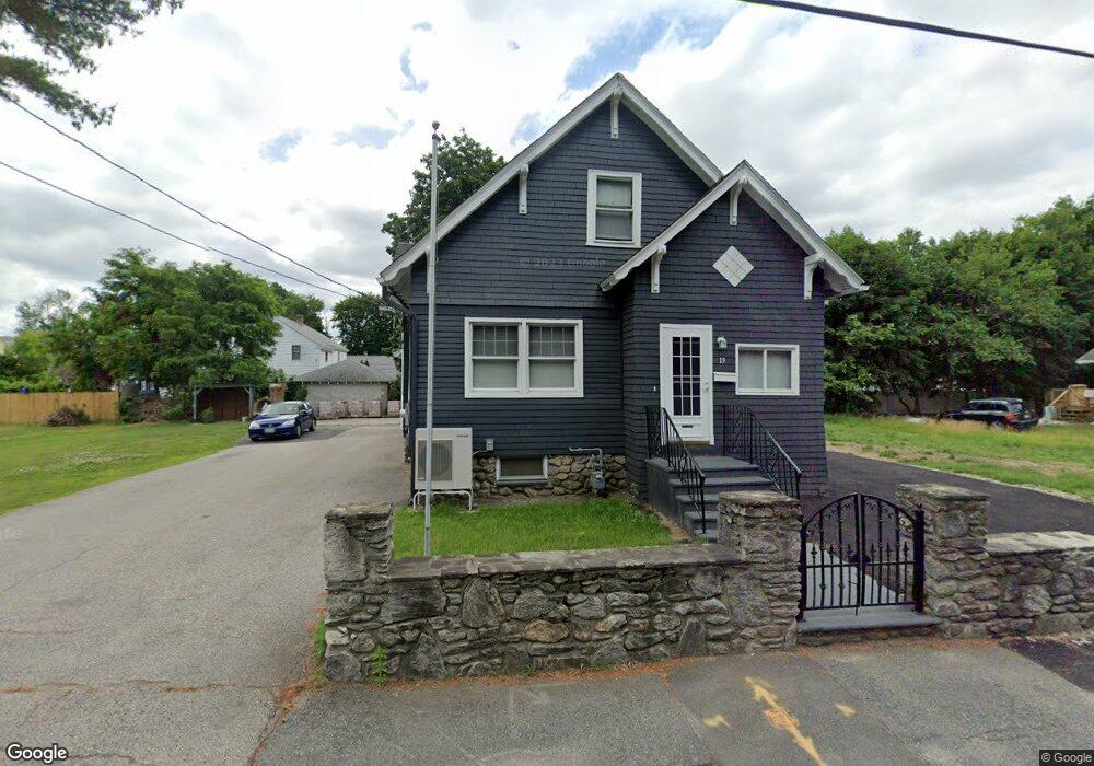
19 Spofford Rd Worcester, MA 01607
South Quinsigamond Village NeighborhoodEstimated Value: $440,000 - $464,305
3
Beds
1
Bath
1,820
Sq Ft
$247/Sq Ft
Est. Value
About This Home
This home is located at 19 Spofford Rd, Worcester, MA 01607 and is currently estimated at $450,326, approximately $247 per square foot. 19 Spofford Rd is a home located in Worcester County with nearby schools including Quinsigamond School, Jacob Hiatt Magnet School, and Chandler Magnet.
Create a Home Valuation Report for This Property
The Home Valuation Report is an in-depth analysis detailing your home's value as well as a comparison with similar homes in the area
Home Values in the Area
Average Home Value in this Area
Tax History Compared to Growth
Tax History
| Year | Tax Paid | Tax Assessment Tax Assessment Total Assessment is a certain percentage of the fair market value that is determined by local assessors to be the total taxable value of land and additions on the property. | Land | Improvement |
|---|---|---|---|---|
| 2025 | $5,426 | $411,400 | $119,100 | $292,300 |
| 2024 | $5,294 | $385,000 | $119,100 | $265,900 |
| 2023 | $5,096 | $355,400 | $103,500 | $251,900 |
| 2022 | $4,666 | $306,800 | $82,800 | $224,000 |
| 2021 | $4,628 | $284,300 | $66,300 | $218,000 |
| 2020 | $4,512 | $265,400 | $66,200 | $199,200 |
| 2019 | $4,261 | $236,700 | $59,800 | $176,900 |
| 2018 | $4,236 | $224,000 | $59,800 | $164,200 |
| 2017 | $4,082 | $212,400 | $59,800 | $152,600 |
| 2016 | $4,108 | $199,300 | $44,600 | $154,700 |
| 2015 | $4,000 | $199,300 | $44,600 | $154,700 |
| 2014 | $3,894 | $199,300 | $44,600 | $154,700 |
Source: Public Records
Map
Nearby Homes
- 2 Mystic St
- 29 Steele St
- 78 Greenwood St
- 10 Steele St
- 3 Lower Windbrook Dr
- 22 Lesley Ave
- 557 SW Cutoff Unit 107
- 557 SW Cutoff Unit 35
- 557 SW Cutoff Unit 17
- 557 SW Cutoff Unit 79
- 28 Bittersweet Blvd
- 47 Washington St Unit 26
- 72 Sophia Dr
- 55 Tennyson St
- 1295 Millbury St Unit B
- 17 Thenius St
- 2 Breezy Bend
- 30 Davenport St
- 405 Granite St
- 10 Gensell Ave