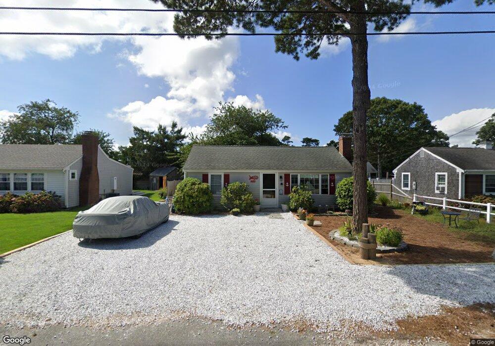
19 Susan Ruth Rd Dennis Port, MA 02639
Dennis Port NeighborhoodEstimated Value: $548,000 - $689,000
2
Beds
1
Bath
650
Sq Ft
$1,001/Sq Ft
Est. Value
About This Home
This home is located at 19 Susan Ruth Rd, Dennis Port, MA 02639 and is currently estimated at $650,818, approximately $1,001 per square foot. 19 Susan Ruth Rd is a home located in Barnstable County with nearby schools including Dennis-Yarmouth Regional High School and St. Pius X. School.
Ownership History
Date
Name
Owned For
Owner Type
Purchase Details
Closed on
Nov 30, 2016
Sold by
Doherty James M and Doherty Elaine L
Bought by
Doherty 2016 Elaine L
Current Estimated Value
Purchase Details
Closed on
Apr 29, 1996
Sold by
Landry Kathleen D and Landry Raymond J
Bought by
Doherty James M and Doherty Elaine L
Home Financials for this Owner
Home Financials are based on the most recent Mortgage that was taken out on this home.
Original Mortgage
$85,500
Interest Rate
7.81%
Mortgage Type
Purchase Money Mortgage
Create a Home Valuation Report for This Property
The Home Valuation Report is an in-depth analysis detailing your home's value as well as a comparison with similar homes in the area
Home Values in the Area
Average Home Value in this Area
Purchase History
| Date | Buyer | Sale Price | Title Company |
|---|---|---|---|
| Doherty 2016 Elaine L | -- | -- | |
| Doherty James M | $95,000 | -- |
Source: Public Records
Mortgage History
| Date | Status | Borrower | Loan Amount |
|---|---|---|---|
| Previous Owner | Doherty James M | $85,500 |
Source: Public Records
Tax History Compared to Growth
Tax History
| Year | Tax Paid | Tax Assessment Tax Assessment Total Assessment is a certain percentage of the fair market value that is determined by local assessors to be the total taxable value of land and additions on the property. | Land | Improvement |
|---|---|---|---|---|
| 2025 | $2,764 | $638,400 | $283,900 | $354,500 |
| 2024 | $2,615 | $595,700 | $273,000 | $322,700 |
| 2023 | $2,529 | $541,600 | $248,200 | $293,400 |
| 2022 | $2,311 | $412,700 | $195,600 | $217,100 |
| 2021 | $2,234 | $370,400 | $191,800 | $178,600 |
| 2020 | $2,159 | $353,900 | $191,800 | $162,100 |
| 2019 | $2,011 | $325,900 | $204,200 | $121,700 |
| 2018 | $1,943 | $306,400 | $194,400 | $112,000 |
| 2017 | $1,768 | $287,500 | $179,000 | $108,500 |
| 2016 | $1,707 | $261,400 | $168,800 | $92,600 |
| 2015 | $1,673 | $261,400 | $168,800 | $92,600 |
| 2014 | $1,595 | $251,200 | $158,600 | $92,600 |
Source: Public Records
Map
Nearby Homes
- 37 Ocean Dr Unit 2
- 64 Beaten Rd
- 112 Old Wharf Rd Unit E4
- 112 Old Wharf Rd Unit E1
- 120 Old Wharf Rd Unit 11
- 154 Old Wharf Rd Unit 26
- 154 Old Wharf Rd Unit 14
- 80 Michaels Ave
- 217 Old Wharf Rd Unit 64
- 241 Old Wharf Rd Unit 82
- 241 Old Wharf Rd Unit 127
- 241 Old Wharf Rd Unit 90
- 31 Easy St
- 262 Old Wharf Rd Unit 67
- 262 Old Wharf Rd Unit 5
- 262 Old Wharf Rd Unit 5
- 262 Old Wharf Rd Unit 20
- 262 Old Wharf Rd Unit 87
- 37 Beach Hills Rd
- 37-A Beach Hills Rd