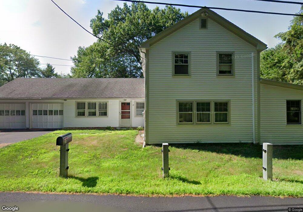
19 Texas Rd Westford, MA 01886
Estimated Value: $572,000 - $829,000
2
Beds
1
Bath
1,800
Sq Ft
$384/Sq Ft
Est. Value
About This Home
This home is located at 19 Texas Rd, Westford, MA 01886 and is currently estimated at $691,860, approximately $384 per square foot. 19 Texas Rd is a home located in Middlesex County with nearby schools including Col John Robinson, John A. Crisafulli Elementary School, and Blanchard Middle School.
Ownership History
Date
Name
Owned For
Owner Type
Purchase Details
Closed on
Apr 4, 2013
Sold by
Scanlan Gerald F
Bought by
Scanlan Matthew F
Current Estimated Value
Home Financials for this Owner
Home Financials are based on the most recent Mortgage that was taken out on this home.
Original Mortgage
$100,000
Outstanding Balance
$70,937
Interest Rate
3.58%
Mortgage Type
New Conventional
Estimated Equity
$620,923
Create a Home Valuation Report for This Property
The Home Valuation Report is an in-depth analysis detailing your home's value as well as a comparison with similar homes in the area
Home Values in the Area
Average Home Value in this Area
Purchase History
| Date | Buyer | Sale Price | Title Company |
|---|---|---|---|
| Scanlan Matthew F | $100,000 | -- |
Source: Public Records
Mortgage History
| Date | Status | Borrower | Loan Amount |
|---|---|---|---|
| Open | Scanlan Matthew F | $100,000 |
Source: Public Records
Tax History Compared to Growth
Tax History
| Year | Tax Paid | Tax Assessment Tax Assessment Total Assessment is a certain percentage of the fair market value that is determined by local assessors to be the total taxable value of land and additions on the property. | Land | Improvement |
|---|---|---|---|---|
| 2025 | $6,718 | $487,900 | $296,500 | $191,400 |
| 2024 | $6,718 | $487,900 | $296,500 | $191,400 |
| 2023 | $6,672 | $452,000 | $282,200 | $169,800 |
| 2022 | $6,337 | $393,100 | $229,300 | $163,800 |
| 2021 | $6,180 | $371,400 | $229,300 | $142,100 |
| 2020 | $6,065 | $371,400 | $229,300 | $142,100 |
| 2019 | $5,957 | $359,700 | $229,300 | $130,400 |
| 2018 | $5,689 | $351,600 | $221,200 | $130,400 |
| 2017 | $5,566 | $339,200 | $221,200 | $118,000 |
| 2016 | $5,366 | $329,200 | $211,200 | $118,000 |
| 2015 | $5,239 | $322,600 | $204,600 | $118,000 |
| 2014 | $5,148 | $310,100 | $196,400 | $113,700 |
Source: Public Records
Map
Nearby Homes
- 122 Carlisle Rd
- 14 Banbury Dr
- 17 Carlisle Rd
- 14 Fieldstone Dr
- 32 Vose Hill Rd
- 875 Acton St
- 1 Fieldstone Dr
- 601 Old Stone Brook
- 27 Hartland Way Unit 309
- 511 Tumbling Hawk Unit 511
- 522 Tumbling Hawk
- 4 Powers Rd
- 422 Great Elm Way
- 445 Old Stone Brook
- 484 Great Road -6
- 484 Great Road -4
- 484 Great Road -3
- 1420 Curve St
- 5 Carriage Dr
- 1056 Curve St