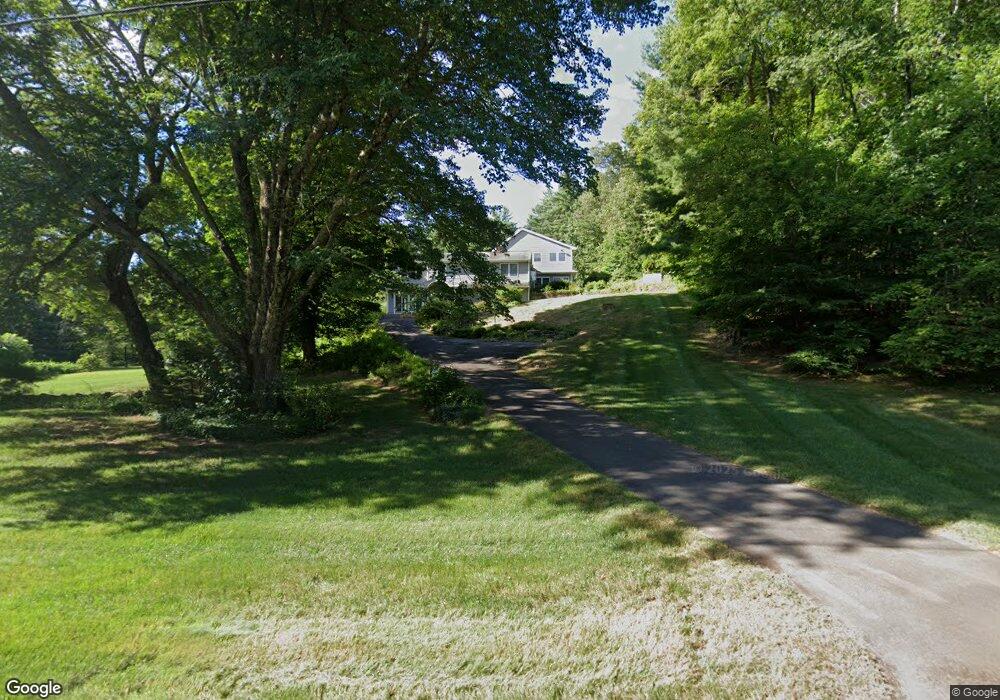
19 Tootin Hill Rd West Simsbury, CT 06092
Estimated Value: $674,000 - $878,000
3
Beds
3
Baths
2,924
Sq Ft
$256/Sq Ft
Est. Value
About This Home
This home is located at 19 Tootin Hill Rd, West Simsbury, CT 06092 and is currently estimated at $747,352, approximately $255 per square foot. 19 Tootin Hill Rd is a home located in Hartford County with nearby schools including Tootin' Hills School, Henry James Memorial School, and Simsbury High School.
Ownership History
Date
Name
Owned For
Owner Type
Purchase Details
Closed on
Sep 17, 2003
Sold by
Brochu Paul R and Brochu Nasly F
Bought by
Hoffman Joel M and Hoffman Maureen L
Current Estimated Value
Purchase Details
Closed on
Dec 20, 2000
Sold by
Wyatt March
Bought by
Brochu Paul R and Brochu Nasly F
Purchase Details
Closed on
Aug 22, 1988
Sold by
Daley James
Bought by
Dahmer March
Create a Home Valuation Report for This Property
The Home Valuation Report is an in-depth analysis detailing your home's value as well as a comparison with similar homes in the area
Home Values in the Area
Average Home Value in this Area
Purchase History
| Date | Buyer | Sale Price | Title Company |
|---|---|---|---|
| Hoffman Joel M | $496,000 | -- | |
| Brochu Paul R | $235,000 | -- | |
| Dahmer March | $234,000 | -- |
Source: Public Records
Mortgage History
| Date | Status | Borrower | Loan Amount |
|---|---|---|---|
| Open | Dahmer March | $150,000 | |
| Open | Dahmer March | $312,000 |
Source: Public Records
Tax History Compared to Growth
Tax History
| Year | Tax Paid | Tax Assessment Tax Assessment Total Assessment is a certain percentage of the fair market value that is determined by local assessors to be the total taxable value of land and additions on the property. | Land | Improvement |
|---|---|---|---|---|
| 2025 | $11,509 | $336,910 | $112,000 | $224,910 |
| 2024 | $10,784 | $323,750 | $112,000 | $211,750 |
| 2023 | $10,302 | $323,750 | $112,000 | $211,750 |
| 2022 | $10,371 | $268,460 | $113,050 | $155,410 |
| 2021 | $10,371 | $268,460 | $113,050 | $155,410 |
| 2020 | $9,957 | $268,460 | $113,050 | $155,410 |
| 2019 | $10,019 | $268,460 | $113,050 | $155,410 |
| 2018 | $10,091 | $268,460 | $113,050 | $155,410 |
| 2017 | $10,897 | $281,140 | $111,730 | $169,410 |
| 2016 | $10,436 | $281,140 | $111,730 | $169,410 |
| 2015 | $12,515 | $337,160 | $126,420 | $210,740 |
| 2014 | $12,522 | $337,160 | $126,420 | $210,740 |
Source: Public Records
Map
Nearby Homes
- 10 Sachems Trail
- 8 Quorn Hunt Rd
- 18 Meadowlark Rd
- 143 N Mountain Rd
- 23 Red Fox Run
- 5 Fox Den Rd
- 21 Christmas Tree Hill
- 15 Red Fox Run
- 121 Gracey Rd
- 269 W Mountain Rd
- 301 Bushy Hill Rd
- 302 Bushy Hill Rd
- 42 Garrett Rd
- 265 E Hill Rd
- 395 Bushy Hill Rd
- 391 Cherry Brook Rd
- 16 Stratton Forest Way
- 6 Highwood Rd
- 8 Crane Place
- 35 Rustle Meadow Ln
- 11 Tootin Hill Rd
- 31 Tootin Hill Rd
- 31 Tootin Hill Rd Unit RD
- 28 Tootin Hill Rd
- 8 Nimrod Rd
- 34 Tootin Hill Rd
- 96 W Mountain Rd
- 5 John Peel Rd
- 10 Tootin Hill Rd
- 102 W Mountain Rd
- 11 Nimrod Rd
- 26 Nimrod Rd
- 12 John Peel Rd
- 7 Nimrod Rd
- 9 John Peel Rd
- 6 Tootin Hill Rd
- 32 Nimrod Rd
- 11 John Peel Rd
- 107 W Mountain Rd
- 2 Tootin Hill Rd