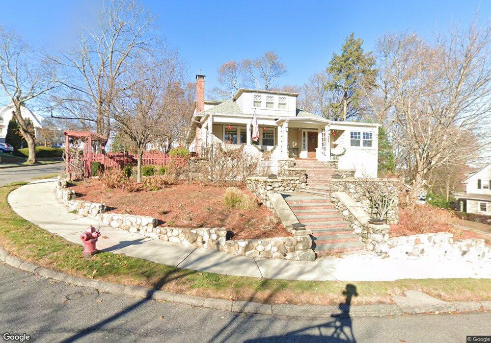
19 Upland Rd Arlington, MA 02474
Arlington Center NeighborhoodEstimated Value: $1,721,000 - $2,068,000
5
Beds
3
Baths
3,079
Sq Ft
$621/Sq Ft
Est. Value
About This Home
This home is located at 19 Upland Rd, Arlington, MA 02474 and is currently estimated at $1,911,267, approximately $620 per square foot. 19 Upland Rd is a home located in Middlesex County with nearby schools including Bishop Elementary School, Ottoson Middle School, and Arlington High School.
Ownership History
Date
Name
Owned For
Owner Type
Purchase Details
Closed on
May 3, 2010
Sold by
Traer Mary
Bought by
Traer Mary and Braman James Brett
Current Estimated Value
Purchase Details
Closed on
Mar 23, 2007
Sold by
Damon Kent T and Damon Lori N
Bought by
Tracer Mary and Traer Mary
Home Financials for this Owner
Home Financials are based on the most recent Mortgage that was taken out on this home.
Original Mortgage
$300,000
Interest Rate
6.33%
Mortgage Type
Purchase Money Mortgage
Create a Home Valuation Report for This Property
The Home Valuation Report is an in-depth analysis detailing your home's value as well as a comparison with similar homes in the area
Home Values in the Area
Average Home Value in this Area
Purchase History
| Date | Buyer | Sale Price | Title Company |
|---|---|---|---|
| Traer Mary | -- | -- | |
| Tracer Mary | $815,000 | -- |
Source: Public Records
Mortgage History
| Date | Status | Borrower | Loan Amount |
|---|---|---|---|
| Previous Owner | Tracer Mary | $300,000 |
Source: Public Records
Tax History Compared to Growth
Tax History
| Year | Tax Paid | Tax Assessment Tax Assessment Total Assessment is a certain percentage of the fair market value that is determined by local assessors to be the total taxable value of land and additions on the property. | Land | Improvement |
|---|---|---|---|---|
| 2025 | $15,524 | $1,441,400 | $640,000 | $801,400 |
| 2024 | $14,083 | $1,329,800 | $640,000 | $689,800 |
| 2023 | $14,064 | $1,254,600 | $550,700 | $703,900 |
| 2022 | $13,606 | $1,191,400 | $520,900 | $670,500 |
| 2021 | $12,970 | $1,143,700 | $520,900 | $622,800 |
| 2020 | $12,648 | $1,143,600 | $520,900 | $622,700 |
| 2019 | $11,569 | $1,027,400 | $520,900 | $506,500 |
| 2018 | $11,560 | $953,000 | $446,500 | $506,500 |
| 2017 | $11,597 | $923,300 | $416,800 | $506,500 |
| 2016 | $11,055 | $863,700 | $357,200 | $506,500 |
| 2015 | $10,291 | $759,500 | $320,000 | $439,500 |
Source: Public Records
Map
Nearby Homes
- 334 Mystic St
- 335 Mystic St
- 12 Longmeadow Rd
- 5 Wood Ln
- 5A Wood Ln
- 10 Apache Trail
- 37 Pine St
- 3 Victoria Rd Unit 3
- 3 Victoria Rd Unit 5
- 5 Norwich Cir
- 211 Grove St
- 97 Mystic St Unit B
- 6 Pawnee Dr
- 52-56 Dudley St
- 7 Court Street Place Unit 7
- 7 Mill St Unit 7
- 12 Canterbury Rd
- 975 Mass Ave Unit 106
- 975 Massachusetts Ave Unit 307
- 18-20 Brattle St