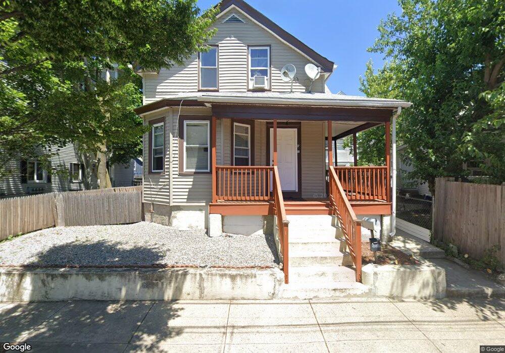
19 Utton Ave Pawtucket, RI 02860
Woodlawn NeighborhoodEstimated Value: $378,682 - $476,000
2
Beds
1
Bath
1,037
Sq Ft
$415/Sq Ft
Est. Value
About This Home
This home is located at 19 Utton Ave, Pawtucket, RI 02860 and is currently estimated at $430,421, approximately $415 per square foot. 19 Utton Ave is a home located in Providence County with nearby schools including International Charter School, Blackstone Valley Prep Junior High School, and Blackstone Academy Charter School.
Ownership History
Date
Name
Owned For
Owner Type
Purchase Details
Closed on
Nov 18, 2009
Sold by
Prestige Builders Llc
Bought by
Keil Shary and Keil Merry
Current Estimated Value
Home Financials for this Owner
Home Financials are based on the most recent Mortgage that was taken out on this home.
Original Mortgage
$52,500
Interest Rate
4.86%
Mortgage Type
Purchase Money Mortgage
Purchase Details
Closed on
Sep 22, 2008
Sold by
Espina Charles H
Bought by
Federal National Mortgage Association
Create a Home Valuation Report for This Property
The Home Valuation Report is an in-depth analysis detailing your home's value as well as a comparison with similar homes in the area
Home Values in the Area
Average Home Value in this Area
Purchase History
| Date | Buyer | Sale Price | Title Company |
|---|---|---|---|
| Keil Shary | $70,000 | -- | |
| Federal National Mortgage Association | $167,264 | -- |
Source: Public Records
Mortgage History
| Date | Status | Borrower | Loan Amount |
|---|---|---|---|
| Open | Federal National Mortgage Association | $39,743 | |
| Closed | Federal National Mortgage Association | $52,500 |
Source: Public Records
Tax History
| Year | Tax Paid | Tax Assessment Tax Assessment Total Assessment is a certain percentage of the fair market value that is determined by local assessors to be the total taxable value of land and additions on the property. | Land | Improvement |
|---|---|---|---|---|
| 2025 | $3,860 | $293,500 | $103,600 | $189,900 |
| 2024 | $3,622 | $293,500 | $103,600 | $189,900 |
| 2023 | $2,968 | $175,200 | $46,600 | $128,600 |
| 2022 | $2,905 | $175,200 | $46,600 | $128,600 |
| 2021 | $2,905 | $175,200 | $46,600 | $128,600 |
| 2020 | $2,795 | $133,800 | $47,200 | $86,600 |
| 2019 | $2,795 | $133,800 | $47,200 | $86,600 |
| 2018 | $2,693 | $133,800 | $47,200 | $86,600 |
| 2017 | $2,374 | $104,500 | $37,900 | $66,600 |
| 2016 | $2,288 | $104,500 | $37,900 | $66,600 |
| 2015 | $2,288 | $104,500 | $37,900 | $66,600 |
| 2014 | $2,686 | $116,500 | $48,800 | $67,700 |
Source: Public Records
Map
Nearby Homes
- 187 Sisson St
- 11 Sherman St
- 41 Campbell Terrace
- 126 Dunnell Ave
- 0 Webb St Unit 1406927
- 0 Webb St Unit 73489835
- 159 Dunnell Ave
- 18 Dunnell Ave
- 35 Hurley Ave
- 54 Jefferson Ave
- 50 Jefferson Ave
- 32 Carver St
- 76 Slater St
- 107 Mulberry St
- 193 Harrison St
- 122 Lowden St
- 80 Hillside Ave
- 167 George St
- 75 Baldwin St
- 136 Hillside Ave
Your Personal Tour Guide
Ask me questions while you tour the home.