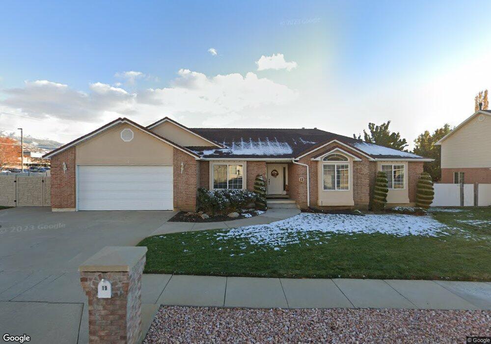
19 W 550 S Centerville, UT 84014
Estimated Value: $650,000 - $795,000
4
Beds
3
Baths
3,262
Sq Ft
$220/Sq Ft
Est. Value
About This Home
This home is located at 19 W 550 S, Centerville, UT 84014 and is currently estimated at $719,246, approximately $220 per square foot. 19 W 550 S is a home located in Davis County with nearby schools including J A Taylor Elementary School, Centerville Jr High, and Viewmont High School.
Ownership History
Date
Name
Owned For
Owner Type
Purchase Details
Closed on
Apr 13, 2010
Sold by
Houtz Russell D and Houtz Jolene
Bought by
Houtz Russell D and Houtz Jolene
Current Estimated Value
Purchase Details
Closed on
Apr 27, 2000
Sold by
Hatch Ralph C and Hatch Deon J
Bought by
Houtz Russell D and Houtz Jolene
Home Financials for this Owner
Home Financials are based on the most recent Mortgage that was taken out on this home.
Original Mortgage
$100,000
Interest Rate
7.86%
Create a Home Valuation Report for This Property
The Home Valuation Report is an in-depth analysis detailing your home's value as well as a comparison with similar homes in the area
Purchase History
| Date | Buyer | Sale Price | Title Company |
|---|---|---|---|
| Houtz Russell D | -- | None Available | |
| Houtz Russell D | -- | Associated Title Company |
Source: Public Records
Mortgage History
| Date | Status | Borrower | Loan Amount |
|---|---|---|---|
| Closed | Houtz Russell D | $100,000 |
Source: Public Records
Tax History
| Year | Tax Paid | Tax Assessment Tax Assessment Total Assessment is a certain percentage of the fair market value that is determined by local assessors to be the total taxable value of land and additions on the property. | Land | Improvement |
|---|---|---|---|---|
| 2025 | $3,985 | $381,150 | $163,748 | $217,402 |
| 2024 | $3,867 | $376,200 | $149,293 | $226,907 |
| 2023 | $3,516 | $618,000 | $242,113 | $375,887 |
| 2022 | $3,653 | $353,650 | $122,818 | $230,832 |
| 2021 | $3,117 | $470,000 | $190,586 | $279,414 |
| 2020 | $2,846 | $429,000 | $184,580 | $244,420 |
| 2019 | $2,893 | $426,000 | $179,830 | $246,170 |
| 2018 | $2,750 | $400,000 | $166,585 | $233,415 |
| 2016 | $2,298 | $185,790 | $55,283 | $130,507 |
| 2015 | $2,290 | $174,680 | $55,283 | $119,397 |
| 2014 | $1,974 | $154,059 | $55,283 | $98,776 |
| 2013 | -- | $156,706 | $47,747 | $108,959 |
Source: Public Records
Map
Nearby Homes
- 96 Village Square Rd
- 951 Centerville Commons Way
- 967 S Courtyard Ln
- 345 E 600 S
- 330 W Paradiso Ln
- 88 W 50 S Unit A4
- 88 W 50 S Unit C-3
- 88 W 50 S Unit B5
- 204 Lyman Ln
- 495 E 475 S
- 328 E 1100 S
- 324 S 600 W
- 1420 N Main St
- 360 E Center St
- 328 W Pages Ln
- 282 E 1400 N
- 287 S 680 W Unit 9
- 147 N 360 W Unit 21
- 56 W 200 N
- 610 E Pages Ln
Your Personal Tour Guide
Ask me questions while you tour the home.