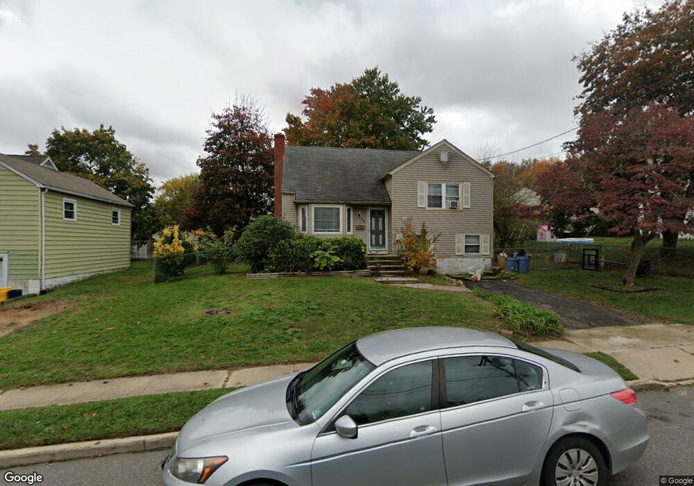
19 W Baylor Dr Trenton, NJ 08610
Estimated Value: $354,000 - $404,000
--
Bed
--
Bath
1,383
Sq Ft
$273/Sq Ft
Est. Value
About This Home
This home is located at 19 W Baylor Dr, Trenton, NJ 08610 and is currently estimated at $377,784, approximately $273 per square foot. 19 W Baylor Dr is a home located in Mercer County with nearby schools including Robinson Elementary School, Albert E. Grice Middle School, and Hamilton West-Watson High School.
Ownership History
Date
Name
Owned For
Owner Type
Purchase Details
Closed on
Jul 22, 2013
Sold by
Pierre Colens
Bought by
Pierre Colens
Current Estimated Value
Purchase Details
Closed on
Nov 30, 2007
Sold by
Wells Fargo Bank Natl Assn Tr
Bought by
Signey Margaret and Colons Pierre
Home Financials for this Owner
Home Financials are based on the most recent Mortgage that was taken out on this home.
Original Mortgage
$182,141
Interest Rate
5.9%
Mortgage Type
New Conventional
Purchase Details
Closed on
Sep 18, 2002
Sold by
Hannawacker Robert
Bought by
Goff Alma and Goff Harold
Purchase Details
Closed on
Jan 15, 1996
Sold by
Quinn Pete
Bought by
Hannawacker Robert and Hannawacker Dana
Create a Home Valuation Report for This Property
The Home Valuation Report is an in-depth analysis detailing your home's value as well as a comparison with similar homes in the area
Home Values in the Area
Average Home Value in this Area
Purchase History
| Date | Buyer | Sale Price | Title Company |
|---|---|---|---|
| Pierre Colens | -- | None Available | |
| Signey Margaret | $185,000 | -- | |
| Goff Alma | $162,500 | -- | |
| Hannawacker Robert | $94,000 | -- |
Source: Public Records
Mortgage History
| Date | Status | Borrower | Loan Amount |
|---|---|---|---|
| Previous Owner | Signey Margaret | $182,141 | |
| Closed | Hannawacker Robert | $0 |
Source: Public Records
Tax History Compared to Growth
Tax History
| Year | Tax Paid | Tax Assessment Tax Assessment Total Assessment is a certain percentage of the fair market value that is determined by local assessors to be the total taxable value of land and additions on the property. | Land | Improvement |
|---|---|---|---|---|
| 2025 | $5,744 | $163,000 | $51,000 | $112,000 |
| 2024 | $5,384 | $163,000 | $51,000 | $112,000 |
| 2023 | $5,384 | $163,000 | $51,000 | $112,000 |
| 2022 | $5,299 | $163,000 | $51,000 | $112,000 |
| 2021 | $6,574 | $163,000 | $51,000 | $112,000 |
| 2020 | $5,987 | $163,000 | $51,000 | $112,000 |
| 2019 | $5,811 | $163,000 | $51,000 | $112,000 |
| 2018 | $5,767 | $163,000 | $51,000 | $112,000 |
| 2017 | $5,464 | $163,000 | $51,000 | $112,000 |
| 2016 | $4,408 | $163,000 | $51,000 | $112,000 |
| 2015 | $5,642 | $107,900 | $36,400 | $71,500 |
| 2014 | $5,526 | $107,900 | $36,400 | $71,500 |
Source: Public Records
Map
Nearby Homes
- 7 Alfred Ave
- 29 Oregon Ave
- 28 Thropp Ave
- 2325 S Broad St
- 156 Maddock Ave
- 158 Churchill Ave
- 316 W Park Ave
- 204 Thropp Ave
- 27 Westcott Ave
- 234 Thropp Ave
- 164 Lillian Ave
- 1782 Exton Ave
- 14 James Cubberly Ct
- 604 Schiller Ave
- 555 U S 206
- 1961 S Broad St
- 1782 Orchard Ave
- 250 Lacy Ave
- 1857 S Broad St
- 218 Sewell Ave