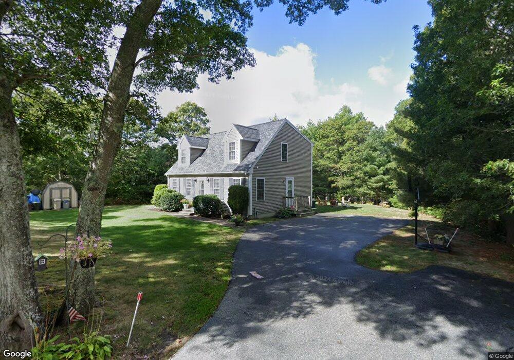
19 Wagner Way Bourne, MA 2532
Buzzards Bay NeighborhoodEstimated Value: $514,000 - $549,000
3
Beds
2
Baths
1,428
Sq Ft
$376/Sq Ft
Est. Value
About This Home
This home is located at 19 Wagner Way, Bourne, MA 2532 and is currently estimated at $537,437, approximately $376 per square foot. 19 Wagner Way is a home located in Barnstable County with nearby schools including Bourne High School and St Margaret Regional School.
Ownership History
Date
Name
Owned For
Owner Type
Purchase Details
Closed on
Aug 31, 2016
Sold by
Elmore Shellene S and Elmore Melissa
Bought by
Maritime Holdings Llc
Current Estimated Value
Home Financials for this Owner
Home Financials are based on the most recent Mortgage that was taken out on this home.
Original Mortgage
$206,250
Outstanding Balance
$163,956
Interest Rate
3.45%
Mortgage Type
New Conventional
Estimated Equity
$373,481
Purchase Details
Closed on
May 28, 2004
Sold by
Mulligan Company Inc
Bought by
Elmore Melissa and Elmore Shellene S
Home Financials for this Owner
Home Financials are based on the most recent Mortgage that was taken out on this home.
Original Mortgage
$233,910
Interest Rate
5.88%
Mortgage Type
Purchase Money Mortgage
Purchase Details
Closed on
Feb 18, 2004
Sold by
Snapper Rt and Ditalia
Bought by
Mulligan Company Inc
Home Financials for this Owner
Home Financials are based on the most recent Mortgage that was taken out on this home.
Original Mortgage
$40,000
Interest Rate
5.83%
Mortgage Type
Purchase Money Mortgage
Purchase Details
Closed on
Nov 20, 2003
Sold by
Ann K Cote T and Cote Ann K
Bought by
Snapper Rt and Ditalia John J
Create a Home Valuation Report for This Property
The Home Valuation Report is an in-depth analysis detailing your home's value as well as a comparison with similar homes in the area
Home Values in the Area
Average Home Value in this Area
Purchase History
| Date | Buyer | Sale Price | Title Company |
|---|---|---|---|
| Maritime Holdings Llc | $275,000 | -- | |
| Maritime Holdings Llc | $275,000 | -- | |
| Elmore Melissa | $259,900 | -- | |
| Elmore Melissa | $259,900 | -- | |
| Mulligan Company Inc | $85,000 | -- | |
| Mulligan Company Inc | $85,000 | -- | |
| Snapper Rt | $35,000 | -- | |
| Snapper Rt | $35,000 | -- |
Source: Public Records
Mortgage History
| Date | Status | Borrower | Loan Amount |
|---|---|---|---|
| Open | Maritime Holdings Llc | $206,250 | |
| Closed | Maritime Holdings Llc | $206,250 | |
| Previous Owner | Elmore Melissa | $233,910 | |
| Previous Owner | Mulligan Company Inc | $40,000 |
Source: Public Records
Tax History Compared to Growth
Tax History
| Year | Tax Paid | Tax Assessment Tax Assessment Total Assessment is a certain percentage of the fair market value that is determined by local assessors to be the total taxable value of land and additions on the property. | Land | Improvement |
|---|---|---|---|---|
| 2025 | $3,765 | $482,100 | $187,700 | $294,400 |
| 2024 | $3,707 | $462,200 | $178,700 | $283,500 |
| 2023 | $3,350 | $380,300 | $126,600 | $253,700 |
| 2022 | $3,184 | $315,600 | $112,000 | $203,600 |
| 2021 | $3,116 | $289,300 | $101,900 | $187,400 |
| 2020 | $2,878 | $268,000 | $101,000 | $167,000 |
| 2019 | $2,736 | $260,300 | $101,000 | $159,300 |
| 2018 | $2,631 | $249,600 | $96,200 | $153,400 |
| 2017 | $2,390 | $232,000 | $95,200 | $136,800 |
| 2016 | $2,321 | $228,400 | $95,200 | $133,200 |
| 2015 | $2,300 | $228,400 | $95,200 | $133,200 |
Source: Public Records
Map
Nearby Homes
- 17 Maple St
- 304 Main St
- 162 Puritan Rd
- 38 Old Bridge Rd
- 46 Holt Rd
- 46 Holt Rd Unit A
- 171 Puritan Rd
- 151 - 153 Main St
- 41 Lewis Point Rd
- 4 Knob Ln
- 0 Lewis Point Rd
- 65 Lewis Point Rd
- 60 Sandwich Rd
- 34 Washington Ave
- 90-92 Sandwich Rd Unit 9C
- 16 Washington Ave
- 73 Lewis Point Rd
- 90-92 Sandwich Rd Unit 2
- 3 Wolf Rd
- 44 Cotuit Rd