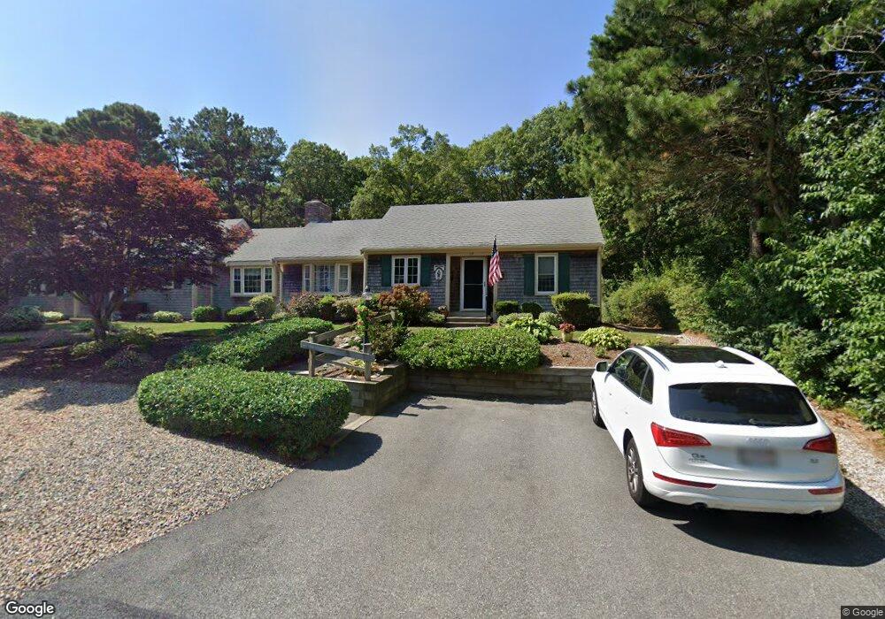
19 Warren Rd Yarmouth Port, MA 02675
Yarmouth Port NeighborhoodEstimated Value: $445,307 - $492,000
2
Beds
2
Baths
1,170
Sq Ft
$401/Sq Ft
Est. Value
About This Home
This home is located at 19 Warren Rd, Yarmouth Port, MA 02675 and is currently estimated at $469,577, approximately $401 per square foot. 19 Warren Rd is a home located in Barnstable County with nearby schools including Dennis-Yarmouth Regional High School and St. Pius X. School.
Ownership History
Date
Name
Owned For
Owner Type
Purchase Details
Closed on
Dec 31, 2024
Sold by
Desisto Paul and Desisto Sharon A
Bought by
Desisto James P and Marino Leanney Y
Current Estimated Value
Purchase Details
Closed on
Apr 27, 2007
Sold by
Nicoll Ft and Nicoll
Bought by
Desisto Paul and Desisto Sharon A
Home Financials for this Owner
Home Financials are based on the most recent Mortgage that was taken out on this home.
Original Mortgage
$75,000
Interest Rate
6.18%
Mortgage Type
Purchase Money Mortgage
Create a Home Valuation Report for This Property
The Home Valuation Report is an in-depth analysis detailing your home's value as well as a comparison with similar homes in the area
Home Values in the Area
Average Home Value in this Area
Purchase History
| Date | Buyer | Sale Price | Title Company |
|---|---|---|---|
| Desisto James P | -- | None Available | |
| Desisto James P | -- | None Available | |
| Desisto Paul | $275,000 | -- | |
| Desisto Paul | $275,000 | -- | |
| Desisto Paul | $275,000 | -- |
Source: Public Records
Mortgage History
| Date | Status | Borrower | Loan Amount |
|---|---|---|---|
| Previous Owner | Desisto Paul | $75,000 |
Source: Public Records
Tax History Compared to Growth
Tax History
| Year | Tax Paid | Tax Assessment Tax Assessment Total Assessment is a certain percentage of the fair market value that is determined by local assessors to be the total taxable value of land and additions on the property. | Land | Improvement |
|---|---|---|---|---|
| 2025 | $2,785 | $393,400 | $0 | $393,400 |
| 2024 | $3,049 | $413,200 | $0 | $413,200 |
| 2023 | $2,924 | $360,500 | $0 | $360,500 |
| 2022 | $2,377 | $258,900 | $0 | $258,900 |
| 2021 | $2,536 | $265,300 | $0 | $265,300 |
| 2020 | $2,559 | $255,900 | $0 | $255,900 |
| 2019 | $2,279 | $225,600 | $0 | $225,600 |
| 2018 | $2,243 | $218,000 | $0 | $218,000 |
| 2017 | $2,184 | $218,000 | $0 | $218,000 |
| 2016 | $1,949 | $195,300 | $0 | $195,300 |
| 2015 | $1,941 | $193,300 | $0 | $193,300 |
Source: Public Records
Map
Nearby Homes
- 16 Warren Rd Unit 16
- 16 Warren Rd
- 8 Rowley Ln
- 0 Forsyth Ave
- 32 Deveau Ln
- 68 Seminole Dr
- 40 Deveau Ln
- 209 Union St
- 176 Beacon St
- 33 Sparrow Way
- 30 Quartermaster Row
- 72 Quartermaster Row
- 1 Barnacle Rd
- 4 Old Colony Way
- 38 N Dennis Rd
- 76 Captain Chase Rd
- 17 Trowbridge Path
- 37 Winsome Rd
- 882 W Yarmouth Rd
- 140 Diane Ave
- 17 Warren Rd
- 17 Warren Rd Unit 17
- 17 Warren Rd Unit 26A
- 23 Warren Rd
- 23 Warren Rd Unit 23
- 23 Warren Rd Unit 27A
- 11 Warren Rd
- 9 Warren Rd
- 9 Warren Rd Unit 2
- 9 Warren Rd Unit 9
- 9 Warren Rd Unit 25A
- 25 Warren Rd
- 25 Warren Rd Unit 27B
- 18 Warren Rd
- 18 Warren Rd Unit 31A
- 16 Warren Rd Unit 31B
- 22 S Warren Unit 30B
- 42 Miriah Dr
- 22 Warren Rd
- 24 Warren Rd