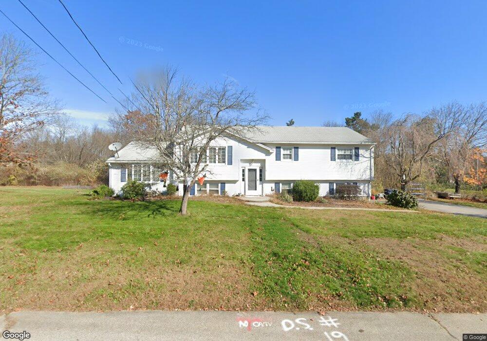
19 Wayne Ave Dudley, MA 01571
Estimated Value: $437,000 - $490,000
4
Beds
2
Baths
1,600
Sq Ft
$293/Sq Ft
Est. Value
About This Home
This home is located at 19 Wayne Ave, Dudley, MA 01571 and is currently estimated at $468,361, approximately $292 per square foot. 19 Wayne Ave is a home located in Worcester County with nearby schools including Shepherd Hill Regional High School, All Saints Academy, and St Joseph School.
Ownership History
Date
Name
Owned For
Owner Type
Purchase Details
Closed on
Aug 1, 2006
Sold by
Levangie Robin
Bought by
Wilson Christopher L and Adkins Jessica L
Current Estimated Value
Home Financials for this Owner
Home Financials are based on the most recent Mortgage that was taken out on this home.
Original Mortgage
$221,600
Outstanding Balance
$132,393
Interest Rate
6.67%
Mortgage Type
Purchase Money Mortgage
Estimated Equity
$335,968
Purchase Details
Closed on
Oct 30, 2002
Sold by
Clark Kathleen A
Bought by
Levangie Robin
Home Financials for this Owner
Home Financials are based on the most recent Mortgage that was taken out on this home.
Original Mortgage
$190,400
Interest Rate
6.09%
Mortgage Type
Purchase Money Mortgage
Create a Home Valuation Report for This Property
The Home Valuation Report is an in-depth analysis detailing your home's value as well as a comparison with similar homes in the area
Home Values in the Area
Average Home Value in this Area
Purchase History
| Date | Buyer | Sale Price | Title Company |
|---|---|---|---|
| Wilson Christopher L | $277,000 | -- | |
| Levangie Robin | $238,000 | -- |
Source: Public Records
Mortgage History
| Date | Status | Borrower | Loan Amount |
|---|---|---|---|
| Open | Wilson Christopher L | $221,600 | |
| Previous Owner | Levangie Robin | $190,400 | |
| Previous Owner | Levangie Robin | $115,000 | |
| Previous Owner | Levangie Robin | $50,000 | |
| Previous Owner | Levangie Robin | $112,000 |
Source: Public Records
Tax History Compared to Growth
Tax History
| Year | Tax Paid | Tax Assessment Tax Assessment Total Assessment is a certain percentage of the fair market value that is determined by local assessors to be the total taxable value of land and additions on the property. | Land | Improvement |
|---|---|---|---|---|
| 2025 | $41 | $387,500 | $76,100 | $311,400 |
| 2024 | $3,982 | $380,000 | $76,100 | $303,900 |
| 2023 | $3,663 | $360,500 | $66,700 | $293,800 |
| 2022 | $3,569 | $305,000 | $65,400 | $239,600 |
| 2021 | $3,384 | $275,100 | $61,700 | $213,400 |
| 2020 | $3,363 | $257,500 | $57,700 | $199,800 |
| 2019 | $3,573 | $264,700 | $57,700 | $207,000 |
| 2018 | $2,915 | $248,500 | $57,700 | $190,800 |
| 2017 | $2,790 | $233,700 | $57,700 | $176,000 |
| 2016 | $2,697 | $221,400 | $54,900 | $166,500 |
| 2015 | $2,616 | $213,400 | $54,900 | $158,500 |
Source: Public Records
Map
Nearby Homes
- 143 Charlton Rd
- 20 Brentwood Dr
- 0 Putnam Rd
- 337 Mason Road Extension
- 33 Alton Dr
- 46 Ramshorn Rd
- 113 W Main St
- 3 Wysocki Dr Unit 6
- 16 Village St
- 11 Ardlock Place
- 73 Dudley Hill Rd
- 55 Brandon Rd
- 145 Center Rd
- 3 6th Ave
- 11 Williams St
- 13 Oxford Ave
- 7 3rd Ave
- 2 Warsaw Ave Unit 3
- 58 Eagle Dr
- 6 Brandon Rd