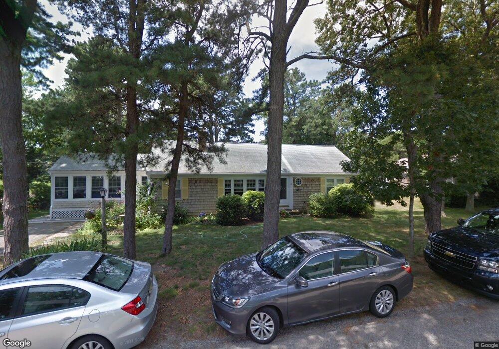
19 Windshore St Dennis, MA 02638
Dennis Village NeighborhoodEstimated Value: $702,000 - $1,105,000
3
Beds
2
Baths
1,152
Sq Ft
$718/Sq Ft
Est. Value
About This Home
This home is located at 19 Windshore St, Dennis, MA 02638 and is currently estimated at $827,057, approximately $717 per square foot. 19 Windshore St is a home located in Barnstable County with nearby schools including Dennis-Yarmouth Regional High School.
Ownership History
Date
Name
Owned For
Owner Type
Purchase Details
Closed on
May 2, 1990
Sold by
Primeau Maureen A
Bought by
Danesi Paul P
Current Estimated Value
Home Financials for this Owner
Home Financials are based on the most recent Mortgage that was taken out on this home.
Original Mortgage
$96,000
Interest Rate
10.18%
Mortgage Type
Purchase Money Mortgage
Create a Home Valuation Report for This Property
The Home Valuation Report is an in-depth analysis detailing your home's value as well as a comparison with similar homes in the area
Home Values in the Area
Average Home Value in this Area
Purchase History
| Date | Buyer | Sale Price | Title Company |
|---|---|---|---|
| Danesi Paul P | $120,000 | -- |
Source: Public Records
Mortgage History
| Date | Status | Borrower | Loan Amount |
|---|---|---|---|
| Closed | Danesi Paul P | $96,000 |
Source: Public Records
Tax History
| Year | Tax Paid | Tax Assessment Tax Assessment Total Assessment is a certain percentage of the fair market value that is determined by local assessors to be the total taxable value of land and additions on the property. | Land | Improvement |
|---|---|---|---|---|
| 2025 | $2,971 | $686,100 | $324,200 | $361,900 |
| 2024 | $2,840 | $647,000 | $311,700 | $335,300 |
| 2023 | $2,747 | $588,300 | $283,400 | $304,900 |
| 2022 | $2,341 | $418,100 | $194,500 | $223,600 |
| 2021 | $2,269 | $376,300 | $190,700 | $185,600 |
| 2020 | $2,300 | $377,100 | $208,600 | $168,500 |
| 2019 | $2,018 | $327,100 | $175,300 | $151,800 |
| 2018 | $2,961 | $347,500 | $211,300 | $136,200 |
| 2017 | $1,753 | $285,100 | $153,200 | $131,900 |
| 2016 | $2,075 | $317,800 | $207,900 | $109,900 |
| 2015 | $2,034 | $317,800 | $207,900 | $109,900 |
| 2014 | $2,018 | $317,800 | $207,900 | $109,900 |
Source: Public Records
Map
Nearby Homes
- 74 Robbins Cir
- 480 Main St
- 19 Whig St
- 25 Whig St
- 946 Route 6a
- 69 Horsefoot Path
- 268 Main St
- 15 Signal Hill Dr
- 6 Thomas Ct
- 46 Forest Gate Unit 46
- 46 Forest Gate Unit 8
- 4 Spadoni Rd
- 4 Spadoni Way
- 7 Collins Ave
- 73 Pilgrim Rd
- 94 Horsefoot Path
- 26 Forest Gate Unit 26
- 156 Shore Dr
- 54 Kates Path Unit 54
- 568 Route 6a
- 253 New Boston Rd
- 5 Patti Dr
- 20 Windshore St
- 16 Windshore St
- 254 New Boston Rd
- 262 New Boston Rd
- 258 New Boston Rd
- 245 New Boston Rd
- 250 New Boston Rd
- 8 Windshore St
- 246 New Boston Rd
- 240 New Boston Rd
- 228 New Boston Rd
- 236 New Boston Rd
- 252 New Boston Rd
- 225 New Boston Rd
- 9 Fieldstone Dr
- 15 Fieldstone Dr
- 221 New Boston Rd
- 224 New Boston Rd
Your Personal Tour Guide
Ask me questions while you tour the home.