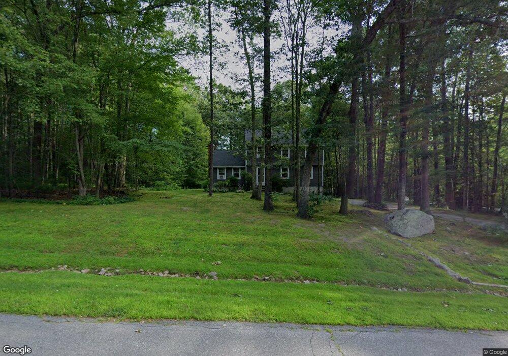
19 Windsor Dr MerriMacK, NH 03054
Estimated Value: $587,519 - $645,000
3
Beds
3
Baths
2,118
Sq Ft
$289/Sq Ft
Est. Value
About This Home
This home is located at 19 Windsor Dr, MerriMacK, NH 03054 and is currently estimated at $611,630, approximately $288 per square foot. 19 Windsor Dr is a home located in Hillsborough County with nearby schools including James Mastricola Elementary School, Merrimack Middle School, and James Mastricola Upper Elementary School.
Ownership History
Date
Name
Owned For
Owner Type
Purchase Details
Closed on
Nov 18, 2022
Sold by
Robinson Christine M
Bought by
Christine M Robinson Ret
Current Estimated Value
Purchase Details
Closed on
Nov 19, 1985
Bought by
Robinson Gary M and Robinson Christine
Create a Home Valuation Report for This Property
The Home Valuation Report is an in-depth analysis detailing your home's value as well as a comparison with similar homes in the area
Home Values in the Area
Average Home Value in this Area
Purchase History
Date | Buyer | Sale Price | Title Company |
---|---|---|---|
Christine M Robinson Ret | -- | None Available | |
Robinson Gary M | -- | -- |
Source: Public Records
Mortgage History
Date | Status | Borrower | Loan Amount |
---|---|---|---|
Previous Owner | Robinson Christine M | $87,600 | |
Previous Owner | Robinson Christine M | $100,000 | |
Previous Owner | Robinson Gary M | $235,000 | |
Previous Owner | Robinson Gary M | $205,000 | |
Previous Owner | Robinson Gary M | $150,000 |
Source: Public Records
Tax History Compared to Growth
Tax History
Year | Tax Paid | Tax Assessment Tax Assessment Total Assessment is a certain percentage of the fair market value that is determined by local assessors to be the total taxable value of land and additions on the property. | Land | Improvement |
---|---|---|---|---|
2024 | $8,578 | $414,600 | $232,400 | $182,200 |
2023 | $8,064 | $414,600 | $232,400 | $182,200 |
2022 | $7,206 | $414,600 | $232,400 | $182,200 |
2021 | $7,117 | $414,500 | $232,400 | $182,100 |
2020 | $7,086 | $294,500 | $164,000 | $130,500 |
2019 | $7,106 | $294,500 | $164,000 | $130,500 |
2018 | $7,103 | $294,500 | $164,000 | $130,500 |
2017 | $6,882 | $294,500 | $164,000 | $130,500 |
2016 | $6,712 | $294,500 | $164,000 | $130,500 |
2015 | $6,897 | $279,000 | $152,600 | $126,400 |
2014 | $6,721 | $279,000 | $152,600 | $126,400 |
2013 | $6,664 | $278,700 | $152,600 | $126,100 |
Source: Public Records
Map
Nearby Homes
- 24 Longa Rd
- 54-A Parkhurst Rd
- 28B Shore Dr
- 11 Clark Island Rd
- 24 Profile Dr
- 4 Norton St
- 70 Broadway
- 27 Grafton Dr
- 14 Captain Bannon Cir
- 19 Captain Bannon Cir
- 9 Carriage Ln
- 13 Holly Hill Dr
- 8 Bowman Ct
- 32 Valleyview Dr
- 20 Holly Hill Dr
- 60 Colonel Daniels Dr
- 10 Greenbriar Ln
- 25 Fells Dr
- 3 Powderhouse Rd
- 19 Pinnacle Rd
- 19 Windsor Dr
- 17 Windsor Dr
- 21 Windsor Dr
- 18 Windsor Dr
- 20 Windsor Dr
- 15 Windsor Dr
- 16 Windsor Dr
- 23 Windsor Dr
- 22 Windsor Dr
- 8 Windsor Dr
- 4 Westminster Ln
- 25 Windsor Dr
- 1 Westminster Ln
- 24 Windsor Dr
- 257 Baboosic Lake Rd
- 11 Windsor Dr
- 259 Baboosic Lake Rd
- 255 Baboosic Lake Rd
- 253 Baboosic Lake Rd
- 261 Baboosic Lake Rd