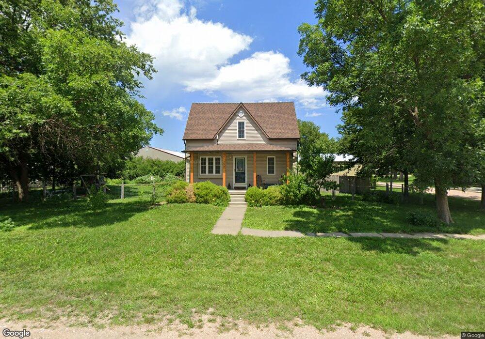
190 2nd St Garland, NE 68360
Estimated Value: $211,000 - $240,000
2
Beds
2
Baths
1,320
Sq Ft
$172/Sq Ft
Est. Value
About This Home
This home is located at 190 2nd St, Garland, NE 68360 and is currently estimated at $226,529, approximately $171 per square foot. 190 2nd St is a home located in Seward County with nearby schools including Seward Elementary School, Seward Middle School, and Seward High School.
Ownership History
Date
Name
Owned For
Owner Type
Purchase Details
Closed on
Jul 12, 2023
Sold by
David V Hartmann Trust
Bought by
Bauman Paul and Bauman Suzanna J
Current Estimated Value
Purchase Details
Closed on
Sep 20, 2021
Sold by
Uden Lori D and Uden Loren
Bought by
Richters Lonna M
Purchase Details
Closed on
Nov 4, 2016
Sold by
Lindau Brandon J and Lindau Lisa M
Bought by
Uden Daniel and Uden Annika
Home Financials for this Owner
Home Financials are based on the most recent Mortgage that was taken out on this home.
Original Mortgage
$110,000
Interest Rate
3.48%
Mortgage Type
New Conventional
Create a Home Valuation Report for This Property
The Home Valuation Report is an in-depth analysis detailing your home's value as well as a comparison with similar homes in the area
Home Values in the Area
Average Home Value in this Area
Purchase History
| Date | Buyer | Sale Price | Title Company |
|---|---|---|---|
| Bauman Paul | $190,000 | Home Services Title | |
| Richters Lonna M | $30,000 | -- | |
| Uden Daniel | $123,000 | None Available |
Source: Public Records
Mortgage History
| Date | Status | Borrower | Loan Amount |
|---|---|---|---|
| Previous Owner | Uden Daniel | $110,000 |
Source: Public Records
Tax History Compared to Growth
Tax History
| Year | Tax Paid | Tax Assessment Tax Assessment Total Assessment is a certain percentage of the fair market value that is determined by local assessors to be the total taxable value of land and additions on the property. | Land | Improvement |
|---|---|---|---|---|
| 2024 | $1,892 | $151,085 | $16,368 | $134,717 |
| 2023 | $2,274 | $144,707 | $16,368 | $128,339 |
| 2022 | $2,392 | $138,290 | $16,368 | $121,922 |
| 2021 | $2,076 | $123,158 | $16,368 | $106,790 |
| 2020 | $2,089 | $123,158 | $16,368 | $106,790 |
| 2019 | $2,037 | $123,158 | $16,368 | $106,790 |
| 2018 | $1,888 | $116,335 | $16,368 | $99,967 |
| 2017 | $1,874 | $120,413 | $14,240 | $106,173 |
| 2016 | $1,864 | $111,889 | $14,186 | $97,703 |
| 2015 | $1,892 | $111,889 | $14,186 | $97,703 |
| 2013 | $2,099 | $111,889 | $14,186 | $97,703 |
Source: Public Records
Map
Nearby Homes
- 109 Ryan St
- 141 Ryan St
- 51 Frazier St
- Bluff Rd Parcel 1
- Bluff Rd Parcel 2
- 0000 Branched Oak Rd
- 1887 Branched Oak Rd
- 1887 Branched Oak Rd Unit Tract B
- * 210th Rd
- 1793 154th
- 1826 238th Rd
- 1424 205th Dr
- 1711 140th
- 0000 County Rd 252
- 1663 140th
- LOT 3 252 County Rd
- 000 Waverly Rd
- Lot 1 W Branched Oak Rd
- 12727 W Waverly Rd
- Lot 4 W Branched Oak Rd