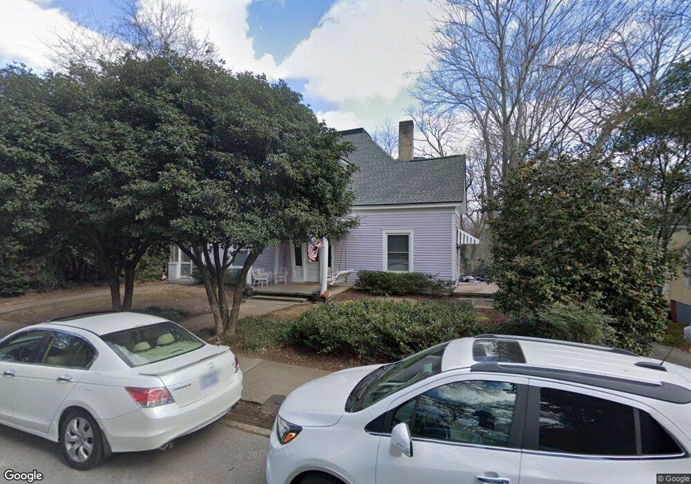
190 Barber St Athens, GA 30601
Newtown NeighborhoodEstimated Value: $639,000 - $841,000
--
Bed
3
Baths
2,758
Sq Ft
$265/Sq Ft
Est. Value
About This Home
This home is located at 190 Barber St, Athens, GA 30601 and is currently estimated at $730,694, approximately $264 per square foot. 190 Barber St is a home located in Clarke County with nearby schools including Johnnie Lay Burks Elementary School, Clarke Middle School, and Clarke Central High School.
Ownership History
Date
Name
Owned For
Owner Type
Purchase Details
Closed on
Aug 9, 2012
Sold by
Camp David W
Bought by
Peterson Christopher R
Current Estimated Value
Purchase Details
Closed on
Jul 20, 2002
Sold by
Camp David W
Bought by
Camp David W and Nelson Salina J
Purchase Details
Closed on
Jan 15, 2000
Sold by
Camp Ralph C
Bought by
Camp David W
Create a Home Valuation Report for This Property
The Home Valuation Report is an in-depth analysis detailing your home's value as well as a comparison with similar homes in the area
Home Values in the Area
Average Home Value in this Area
Purchase History
| Date | Buyer | Sale Price | Title Company |
|---|---|---|---|
| Peterson Christopher R | $250,000 | -- | |
| Camp David W | -- | -- | |
| Camp David W | -- | -- |
Source: Public Records
Tax History Compared to Growth
Tax History
| Year | Tax Paid | Tax Assessment Tax Assessment Total Assessment is a certain percentage of the fair market value that is determined by local assessors to be the total taxable value of land and additions on the property. | Land | Improvement |
|---|---|---|---|---|
| 2025 | $5,548 | $178,692 | $40,000 | $138,692 |
| 2024 | $5,548 | $178,692 | $40,000 | $138,692 |
| 2023 | $5,584 | $178,692 | $40,000 | $138,692 |
| 2022 | $5,014 | $157,172 | $40,000 | $117,172 |
| 2021 | $4,569 | $135,586 | $40,000 | $95,586 |
| 2020 | $4,422 | $131,208 | $36,000 | $95,208 |
| 2019 | $4,169 | $125,212 | $36,000 | $89,212 |
| 2018 | $4,113 | $121,145 | $36,000 | $85,145 |
| 2017 | $3,995 | $117,661 | $36,000 | $81,661 |
| 2016 | $3,723 | $109,668 | $36,000 | $73,668 |
| 2015 | $3,684 | $108,358 | $36,000 | $72,358 |
| 2014 | $2,350 | $69,005 | $34,200 | $34,805 |
Source: Public Records
Map
Nearby Homes
- 559 Pulaski St
- 100 Prince Ave Unit A404
- 100 Prince Ave Unit A407
- 570 Prince Ave
- 145 Hendrix Ave
- 600 Pulaski St
- 257 Hill St
- 668 Pulaski St
- 270 Atlanta Ave
- 468 N Milledge Ave Unit 203
- 195 Beulah Ave
- 269 N Hull St Unit 212
- 697 Barber St
- 250 W Broad St Unit 811
- 250 W Broad St Unit 521
- 250 W Broad St Unit 408
- 250 W Broad St Unit 615
- 131 E Broad St Unit 707
- 552 Cobb St
- 180 Barber St
- 293 Barrow St
- 273 Barrow St
- 263 Barrow St
- 263 Barrow St Unit A
- 263 Barrow St Unit B
- 170 Barber St
- 243 Barrow St
- 183 Childs St
- 181 Barber St
- 185 Childs St
- 179 Childs St
- 199 Barber St
- 173 Childs St
- 160 Barber St
- 169 Barber St
- 270 Barrow St
- 167 Childs St
- 197 Childs St Unit 2
- 197 Childs St