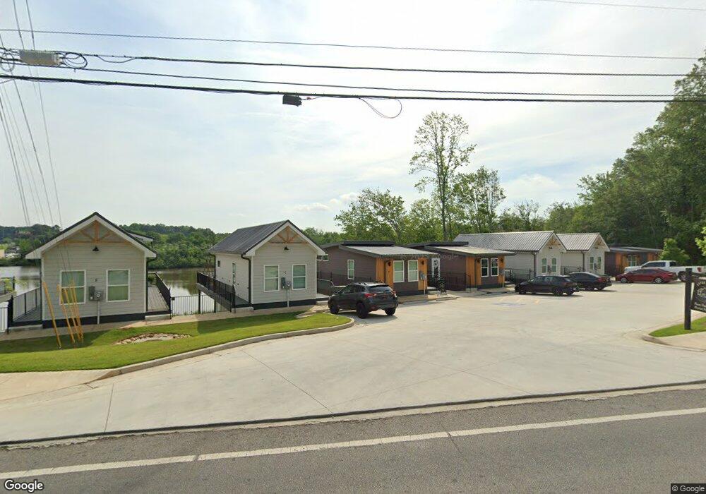
190 Burns Rd Unit Lot 2 Carrollton, GA 30117
Estimated Value: $243,000 - $1,695,322
18
Beds
18
Baths
4,212
Sq Ft
$230/Sq Ft
Est. Value
About This Home
This home is located at 190 Burns Rd Unit Lot 2, Carrollton, GA 30117 and is currently estimated at $969,161, approximately $230 per square foot. 190 Burns Rd Unit Lot 2 is a home located in Carroll County with nearby schools including Carrollton Elementary School, Carrollton Upper Elementary School, and Carrollton Middle School.
Ownership History
Date
Name
Owned For
Owner Type
Purchase Details
Closed on
Jul 5, 2021
Sold by
Preston Michael Brian
Bought by
Scrj Collaborators Lp
Current Estimated Value
Purchase Details
Closed on
Dec 31, 2020
Sold by
Lmt Consulting Advisory & Investments Ll
Bought by
Preston Michael Brian
Purchase Details
Closed on
Dec 21, 2017
Sold by
Wiggins Marian P
Bought by
Wiggins Phillip W
Purchase Details
Closed on
Jan 12, 2016
Sold by
Wiggins Phillip W
Bought by
Wiggins Phillip W
Purchase Details
Closed on
Jan 2, 1989
Bought by
Wiggins Phillips and Wiggins M
Create a Home Valuation Report for This Property
The Home Valuation Report is an in-depth analysis detailing your home's value as well as a comparison with similar homes in the area
Home Values in the Area
Average Home Value in this Area
Purchase History
| Date | Buyer | Sale Price | Title Company |
|---|---|---|---|
| Scrj Collaborators Lp | -- | -- | |
| Preston Michael Brian | $107,000 | -- | |
| Wiggins Phillip W | -- | -- | |
| Templeton Jason C | $16,500 | -- | |
| Wiggins Phillip W | $300,000 | -- | |
| Wiggins Phillips | -- | -- |
Source: Public Records
Tax History Compared to Growth
Tax History
| Year | Tax Paid | Tax Assessment Tax Assessment Total Assessment is a certain percentage of the fair market value that is determined by local assessors to be the total taxable value of land and additions on the property. | Land | Improvement |
|---|---|---|---|---|
| 2024 | $16,938 | $619,890 | $84,750 | $535,140 |
| 2023 | $16,938 | $315,942 | $84,750 | $231,192 |
| 2022 | $1,472 | $50,432 | $50,432 | $0 |
| 2021 | $1,249 | $50,432 | $50,432 | $0 |
| 2020 | $181 | $6,195 | $6,195 | $0 |
| 2019 | $183 | $6,195 | $6,195 | $0 |
| 2018 | $185 | $6,195 | $6,195 | $0 |
| 2017 | $149 | $4,956 | $4,956 | $0 |
| 2016 | $219 | $7,232 | $7,232 | $0 |
| 2015 | $223 | $7,232 | $7,232 | $0 |
| 2014 | $224 | $7,232 | $7,232 | $0 |
Source: Public Records
Map
Nearby Homes
- 0 Carroll Cir- Lots 4-8 Unit 148012
- 204 Burns Rd
- 3 Burns Rd
- 2 Burns Rd
- 150 Cedar Park Way
- 403 Burns Rd
- 0 Carroll Cir Unit LOTS 4-8 10571562
- 223 N Lakeshore Dr
- 0 Burns Rd Unit LOT 2 10571612
- 0 Burns Rd Unit LOT 3 10571635
- 0 Burns Rd Unit LOT 1 10571595
- 0 Burns Rd Unit 148013
- 231 N Lakeshore Dr
- 1711B Bankhead Hwy
- 115 N Lake Dr
- 114 Green Point Way
- 325 Almon Rd
- 180 Sunrise Ln
- 180 Sunrise Ln Unit 183
- 45 Sassafrass Way Unit 202
- 190 Burns Rd
- 190 Burns Rd Unit Lot 4
- 190 Burns Rd Unit Lot 3
- 190 Burns Rd Unit Lot 1
- 0 Carroll Cir- Lots 4-8 Unit 10571562
- 201 Burns Rd
- 202 Burns Rd
- 203 Burns Rd
- 104 Carroll Cir
- 45 Carroll Cir
- 106 Carroll Cir
- 207 Burns Rd
- 108 Carroll Cir
- 107 Cedar Heights Rd
- 104 Cedar Heights Rd
- 209 Burns Rd
- 815 Bankhead Hwy Unit SUITE F
- 815 Bankhead Hwy Unit SUITE E
- 815 Bankhead Hwy Unit SUITE H
- 815 Bankhead Hwy Unit SUITE G