Estimated Value: $238,418 - $309,000
4
Beds
1
Bath
2,168
Sq Ft
$121/Sq Ft
Est. Value
About This Home
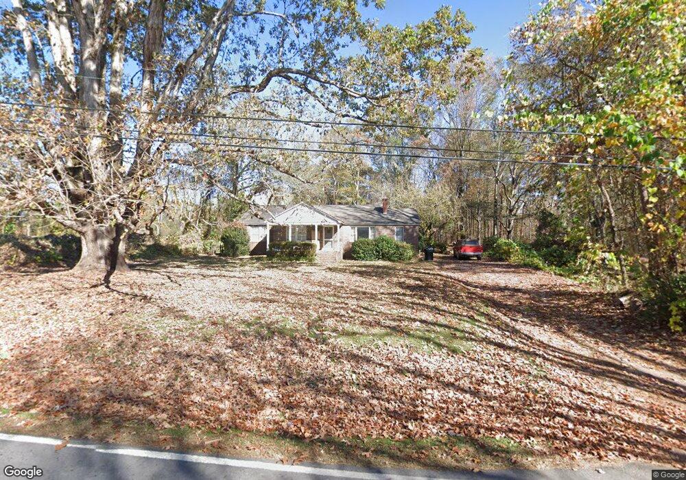
This home is located at 190 Carrollton St, Waco, GA 30182 and is currently estimated at $261,855, approximately $120 per square foot. 190 Carrollton St is a home located in Haralson County with nearby schools including Haralson County High School.
Ownership History
Date
Name
Owned For
Owner Type
Purchase Details
Closed on
Jul 19, 2023
Sold by
Stamps Rodney H
Bought by
Phillips Carrie Beth Stamps
Current Estimated Value
Purchase Details
Closed on
Jun 8, 2006
Sold by
Not Provided
Bought by
Stamps Rodney H and Marlow Sheila S
Purchase Details
Closed on
Sep 17, 1998
Sold by
Stamps William Hulet
Bought by
City Of Waco
Purchase Details
Closed on
May 28, 1992
Sold by
Bishop Mattie E Estate By Stamps Wilma B
Bought by
Stamps William Hulett and Wilma Bisho
Create a Home Valuation Report for This Property
The Home Valuation Report is an in-depth analysis detailing your home's value as well as a comparison with similar homes in the area
Home Values in the Area
Average Home Value in this Area
Purchase History
| Date | Buyer | Sale Price | Title Company |
|---|---|---|---|
| Phillips Carrie Beth Stamps | -- | -- | |
| Stamps Rodney H | -- | -- | |
| City Of Waco | -- | -- | |
| Stamps William Hulett | -- | -- |
Source: Public Records
Tax History Compared to Growth
Tax History
| Year | Tax Paid | Tax Assessment Tax Assessment Total Assessment is a certain percentage of the fair market value that is determined by local assessors to be the total taxable value of land and additions on the property. | Land | Improvement |
|---|---|---|---|---|
| 2024 | $1,838 | $59,080 | $8,064 | $51,016 |
| 2023 | $1,836 | $65,292 | $7,968 | $57,324 |
| 2022 | $1,547 | $52,782 | $7,968 | $44,814 |
| 2021 | $1,551 | $50,482 | $7,968 | $42,514 |
| 2020 | $1,575 | $51,248 | $7,968 | $43,280 |
| 2019 | $1,572 | $49,599 | $7,968 | $41,631 |
| 2018 | $693 | $21,498 | $7,968 | $13,530 |
| 2017 | $722 | $20,409 | $7,968 | $12,441 |
| 2016 | $1,013 | $33,047 | $7,968 | $25,079 |
| 2015 | $990 | $32,282 | $7,968 | $24,314 |
| 2014 | $1,023 | $33,890 | $9,576 | $24,314 |
Source: Public Records
Map
Nearby Homes
- 67 Depot St
- 0 King St Unit 7692079
- 381 King St
- 0 Stonebridge Blvd Unit 143588
- 586 Old Bushmill Rd
- 0 Mt Zion St Unit 7399245
- 201 Stonebridge Blvd
- 6315 Highway 78
- 101 Bush Creek Way
- 327 Crest Pointe S
- 321 Stonebridge Blvd
- 319 Stonebridge Blvd
- 273 Sewell Rd
- 522 Atlantic Ave
- 0 Sewell Rd Unit 10624236
- 0 Sewell Rd Unit 7665305
- 318 Stonebridge Blvd
- 91 Sewell Rd
- 305 Crest Pointe S
- 153 Crest Pointe
- 200 Carrollton St
- 154 Carrollton St
- 164 Carrollton St
- 230 Carrollton St
- 189 Carrollton St
- 215 Carrollton St
- 229 Carrollton St
- 167 Carrollton St
- 148 Carrollton St
- 239 Carrollton St
- 56 Atlantic Ave
- 205 Carrollton St
- 255 Carrollton St
- 267 Carrollton St
- 32 Po Box
- 71 Atlantic Ave
- 285 Houston St
- 5881 U S Highway 78
- 79 Atlantic Ave
- 0 Houston St Unit 7117531