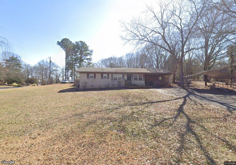
190 Cavalier Rd Athens, GA 30606
Estimated Value: $240,690 - $317,000
Studio
--
Bath
1,432
Sq Ft
$197/Sq Ft
Est. Value
About This Home
This home is located at 190 Cavalier Rd, Athens, GA 30606 and is currently estimated at $282,423, approximately $197 per square foot. 190 Cavalier Rd is a home located in Clarke County with nearby schools including Cleveland Road Elementary School, Burney-Harris-Lyons Middle School, and Clarke Central High School.
Ownership History
Date
Name
Owned For
Owner Type
Purchase Details
Closed on
Apr 8, 2010
Sold by
Bone Brian and Bone Mark Bone
Bought by
Bone Mark
Current Estimated Value
Purchase Details
Closed on
Apr 1, 2004
Sold by
Bone Harold F
Bought by
Bone Brian and Mark Bone
Purchase Details
Closed on
Jan 22, 2002
Sold by
Bone Brian C
Bought by
Bone Harold F
Purchase Details
Closed on
Jan 16, 2002
Sold by
Bone Mark
Bought by
Bone Harold F
Purchase Details
Closed on
Oct 1, 1999
Sold by
Bone Harold F
Bought by
Bone Harold F Brian C Bone and Bone Mark S
Purchase Details
Closed on
Apr 3, 1998
Sold by
Bone Harold F and Bone Carolyn H
Bought by
Bone Harold F
Create a Home Valuation Report for This Property
The Home Valuation Report is an in-depth analysis detailing your home's value as well as a comparison with similar homes in the area
Purchase History
| Date | Buyer | Sale Price | Title Company |
|---|---|---|---|
| Bone Mark | -- | -- | |
| Bone Brian | $45,000 | -- | |
| Bone Harold F | -- | -- | |
| Bone Harold F | -- | -- | |
| Bone Harold F Brian C Bone | -- | -- | |
| Bone Harold F | -- | -- |
Source: Public Records
Tax History
| Year | Tax Paid | Tax Assessment Tax Assessment Total Assessment is a certain percentage of the fair market value that is determined by local assessors to be the total taxable value of land and additions on the property. | Land | Improvement |
|---|---|---|---|---|
| 2025 | $2,087 | $84,508 | $12,000 | $72,508 |
| 2024 | $2,087 | $81,049 | $12,000 | $69,049 |
| 2023 | $1,227 | $74,249 | $12,000 | $62,249 |
| 2022 | $1,657 | $61,958 | $10,400 | $51,558 |
| 2021 | $1,470 | $53,613 | $10,400 | $43,213 |
| 2020 | $1,398 | $51,469 | $10,400 | $41,069 |
| 2019 | $1,255 | $46,974 | $9,600 | $37,374 |
| 2018 | $1,488 | $43,834 | $9,600 | $34,234 |
| 2017 | $1,398 | $41,192 | $9,600 | $31,592 |
| 2016 | $1,299 | $38,250 | $9,600 | $28,650 |
| 2015 | $1,314 | $38,638 | $9,600 | $29,038 |
| 2014 | $1,321 | $38,797 | $9,600 | $29,197 |
Source: Public Records
Map
Nearby Homes
- 170 Huntington Ct
- 460 Huntington Rd
- 470 Huntington Rd Unit 5
- 532 Huntington Rd Unit 7
- 637 Huntington Rd Unit C2
- 637 Huntington Rd Unit 2
- 637 Huntington Rd Unit B1
- 210 Arrowhead Rd
- 141 Mountain Laurel Run
- 116 Laurel Springs Dr
- 284 Meeler Cir
- 256 Cherokee Ridge
- 224 Westpark Dr
- 323 Summerville Ln
- 157 Kittle Ln
- 257 Meeler Cir
- 311 Summerville Ln
- 241 Meeler Cir
- 272 Chesterfield Rd
- 201 Chesterfield Rd
- 100 Cavalier Ct
- 160 Cavalier Rd
- 195 Cavalier Rd
- 125 Cavalier Ct
- 135 Cavalier Ct
- 110 Cavalier Ct
- 165 Cavalier Rd
- 168 Huntington Ct
- 175 Huntington Ct
- 100 Biscayne Dr
- 115 Biscayne Dr
- 125 Cavalier Rd
- 206 Cavalier Rd
- 190 Cavalier Ct
- 113 Huntington Ct
- 165 Cavalier Ct
- 185 Huntington Ct
- 110 Biscayne Dr
- 220 Huntington Rd
- 211 Cavalier Rd
Your Personal Tour Guide
Ask me questions while you tour the home.