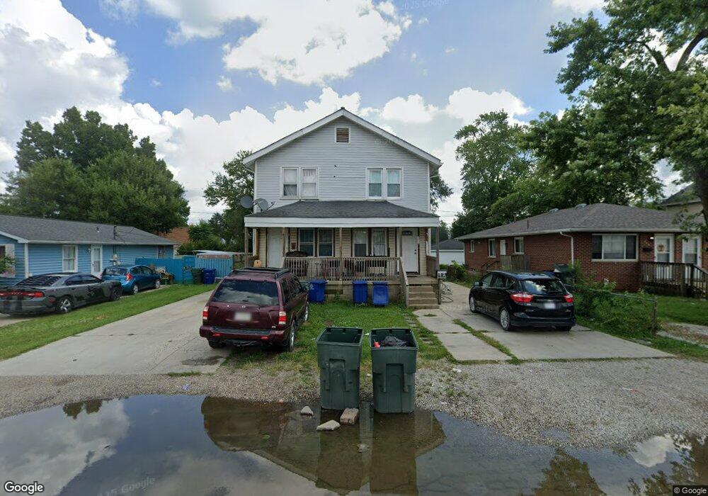
190 Derrer Rd Unit 192 Columbus, OH 43204
Westgate NeighborhoodEstimated Value: $179,000 - $243,000
6
Beds
2
Baths
2,184
Sq Ft
$101/Sq Ft
Est. Value
About This Home
This home is located at 190 Derrer Rd Unit 192, Columbus, OH 43204 and is currently estimated at $220,667, approximately $101 per square foot. 190 Derrer Rd Unit 192 is a home located in Franklin County with nearby schools including Westgate Alternative Elementary School, Westmoor Middle School, and West High School.
Ownership History
Date
Name
Owned For
Owner Type
Purchase Details
Closed on
Feb 4, 2010
Sold by
Stewardship Fund Lp
Bought by
Sandiego Realestate Investments Llc
Current Estimated Value
Purchase Details
Closed on
Oct 6, 2009
Sold by
Delboccio Richard T and Delboccio Patricia M
Bought by
Stewardship Fund Lp
Purchase Details
Closed on
May 5, 2006
Sold by
Paeltz Dan
Bought by
Delboccio Richard T and Delboccio Patricia M
Home Financials for this Owner
Home Financials are based on the most recent Mortgage that was taken out on this home.
Original Mortgage
$93,000
Interest Rate
8.62%
Mortgage Type
Fannie Mae Freddie Mac
Purchase Details
Closed on
Dec 10, 1992
Bought by
Paeltz Stephen D
Create a Home Valuation Report for This Property
The Home Valuation Report is an in-depth analysis detailing your home's value as well as a comparison with similar homes in the area
Home Values in the Area
Average Home Value in this Area
Purchase History
We collect this data history from publicly available records. To have your information removed, we recommend requesting removal directly through your county’s website.
| Date | Buyer | Sale Price | Title Company |
|---|---|---|---|
| Sandiego Realestate Investments Llc | $26,000 | Arrow Title | |
| Stewardship Fund Lp | -- | Arrow Title | |
| Delboccio Richard T | $93,000 | Integrated | |
| Paeltz Stephen D | $32,400 | -- |
Source: Public Records
Mortgage History
We collect this data history from publicly available records. To have your information removed, we recommend requesting removal directly through your county’s website.
| Date | Status | Borrower | Loan Amount |
|---|---|---|---|
| Previous Owner | Delboccio Richard T | $93,000 |
Source: Public Records
Tax History
| Year | Tax Paid | Tax Assessment Tax Assessment Total Assessment is a certain percentage of the fair market value that is determined by local assessors to be the total taxable value of land and additions on the property. | Land | Improvement |
|---|---|---|---|---|
| 2025 | $3,768 | $82,220 | $22,230 | $59,990 |
| 2024 | $3,768 | $82,220 | $22,230 | $59,990 |
| 2023 | $3,721 | $82,220 | $22,230 | $59,990 |
| 2022 | $1,396 | $26,260 | $10,610 | $15,650 |
| 2021 | $1,398 | $26,260 | $10,610 | $15,650 |
| 2020 | $1,400 | $26,260 | $10,610 | $15,650 |
| 2019 | $2,684 | $43,160 | $10,610 | $32,550 |
| 2018 | $1,340 | $43,160 | $10,610 | $32,550 |
| 2017 | $2,332 | $43,160 | $10,610 | $32,550 |
| 2016 | $1,931 | $27,690 | $6,690 | $21,000 |
| 2015 | $881 | $27,690 | $6,690 | $21,000 |
| 2014 | $1,717 | $27,690 | $6,690 | $21,000 |
| 2013 | $942 | $29,155 | $7,035 | $22,120 |
Source: Public Records
Map
Nearby Homes
- 174 Demorest Rd
- 139 Demorest Ave
- 121 S Southampton Ave
- 66 Demorest Rd
- 268 S Southampton Ave
- 277 Josephine Ave
- 129 S Sylvan Ave
- 273 S Sylvan Ave
- 182 S Sylvan Ave
- 136 S Sylvan Ave
- 32 S Southampton Ave
- 170 S Algonquin Ave
- 56 Broadlawn Ave
- 241 S Brinker Ave
- 0 S Brinker Ave
- 56 Florence Ave
- 312 S Brinker Ave
- 109 S Westgate Ave
- 3345 Parkside Rd
- 46 S Westgate Ave
- 190-192 Derrer Rd
- 186 Derrer Rd
- 200 Derrer Rd Unit 202
- 200-202 Derrer Rd
- 206 Derrer Rd Unit 208
- 180 Derrer Rd
- 206-208 Derrer Rd
- 193 Demorest Rd
- 193 Demorest Ave
- 187 Demorest Rd
- 199 Demorest Rd
- 187 Demorest Ave
- 174 Derrer Rd
- 207 Demorest Rd
- 179 Demorest Rd
- 207 Demorest Ave
- 207 Demorest Ave
- 220 Derrer Rd Unit 222
- 213 Demorest Rd
- 173 Demorest Rd
Your Personal Tour Guide
Ask me questions while you tour the home.