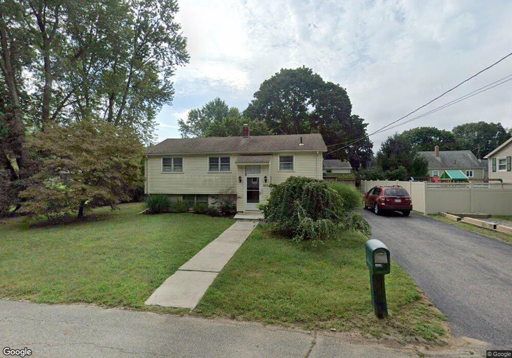
190 Donald Tennant Cir North Attleboro, MA 02760
North Attleboro NeighborhoodEstimated Value: $431,789 - $515,000
3
Beds
1
Bath
874
Sq Ft
$547/Sq Ft
Est. Value
About This Home
This home is located at 190 Donald Tennant Cir, North Attleboro, MA 02760 and is currently estimated at $478,197, approximately $547 per square foot. 190 Donald Tennant Cir is a home located in Bristol County with nearby schools including North Attleboro High School, Cadence Academy Preschool - North Attleborough, and Bishop Feehan High School.
Ownership History
Date
Name
Owned For
Owner Type
Purchase Details
Closed on
Jul 18, 2017
Sold by
Fitzsimmons Ft
Bought by
Fitzsimmons Paul B and Fitzsimmons Claudia A
Current Estimated Value
Purchase Details
Closed on
Aug 12, 2011
Sold by
Fitzsimmons Paul B and Fitzsimmons Claudia A
Bought by
Fitzsimmons Ft
Purchase Details
Closed on
Jan 1, 1984
Bought by
Fitzsimmons Ft
Create a Home Valuation Report for This Property
The Home Valuation Report is an in-depth analysis detailing your home's value as well as a comparison with similar homes in the area
Home Values in the Area
Average Home Value in this Area
Purchase History
| Date | Buyer | Sale Price | Title Company |
|---|---|---|---|
| Fitzsimmons Paul B | -- | -- | |
| Fitzsimmons Ft | -- | -- | |
| Fitzsimmons Ft | -- | -- |
Source: Public Records
Mortgage History
| Date | Status | Borrower | Loan Amount |
|---|---|---|---|
| Previous Owner | Fitzsimmons Ft | $50,000 | |
| Previous Owner | Fitzsimmons Ft | $10,000 | |
| Previous Owner | Fitzsimmons Ft | $60,000 |
Source: Public Records
Tax History Compared to Growth
Tax History
| Year | Tax Paid | Tax Assessment Tax Assessment Total Assessment is a certain percentage of the fair market value that is determined by local assessors to be the total taxable value of land and additions on the property. | Land | Improvement |
|---|---|---|---|---|
| 2025 | $4,197 | $356,000 | $115,600 | $240,400 |
| 2024 | $4,011 | $347,600 | $115,600 | $232,000 |
| 2023 | $4,150 | $324,500 | $115,600 | $208,900 |
| 2022 | $3,999 | $287,100 | $115,600 | $171,500 |
| 2021 | $3,794 | $265,900 | $115,600 | $150,300 |
| 2020 | $4,303 | $257,400 | $115,600 | $141,800 |
| 2019 | $3,516 | $246,900 | $105,100 | $141,800 |
| 2018 | $3,710 | $234,800 | $105,100 | $129,700 |
| 2017 | $2,993 | $226,400 | $105,100 | $121,300 |
| 2016 | $2,767 | $209,300 | $116,800 | $92,500 |
| 2015 | $2,671 | $203,300 | $122,600 | $80,700 |
| 2014 | $2,541 | $191,900 | $113,300 | $78,600 |
Source: Public Records
Map
Nearby Homes
- 196 Donald Tennant Cir
- 11 Landry Ave
- 115 Westfield Dr
- 57 Vine St
- 11 Buckthorn Ln
- Lot 2 Jeffrey Dr
- Lot 5 Jeffrey Dr
- 5 Old Wood Rd
- 116 George St
- 255 Mckeon Dr
- 12 Houde St
- 40 Natalie Dr
- 150 Gilbert St
- 24 Maverick Dr
- 20 Sperry Ln
- 835 Mt Hope St Unit 39
- 21 Shady Ln
- 28 Messenger St
- 9 Sunnyside Dr Unit 9
- 711 Mount Hope St Unit 13
- 42 Donald Tennant Cir
- 48 Donald Tennant Cir
- 191 Donald Tennant Cir
- 34 Donald Tennant Cir
- 199 Donald Tennant Cir
- 206 Donald Tennant Cir
- 206 Donald Tennant Cir
- 56 Donald Tennant Cir
- 26 Donald Tennant Cir
- 39 Donald Tennant Cir
- 47 Donald Tennant Cir
- 205 Donald Tennant Cir
- 66 Donald Tennant Cir
- 33 Donald Tennant Cir
- 27 Donald Tennant Cir
- 209 Donald Tennant Cir
- 53 Donald Tennant Cir
- 215 Donald Tennant Cir
- 70 Donald Tennant Cir
- 19 Donald Tennant Cir