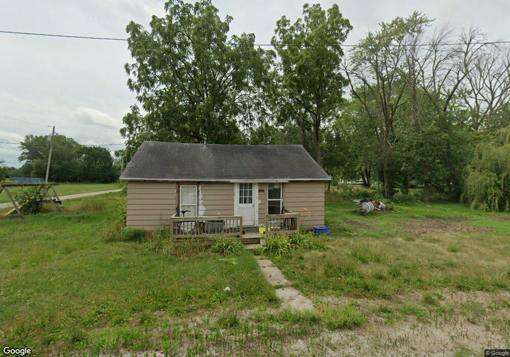
190 E Chestnut St Sheldon, IL 60966
Estimated Value: $41,040 - $158,000
Studio
--
Bath
--
Sq Ft
9,453
Sq Ft Lot
About This Home
This home is located at 190 E Chestnut St, Sheldon, IL 60966 and is currently estimated at $80,010. 190 E Chestnut St is a home with nearby schools including Milford Grade School West Campus and Milford High School Campus.
Ownership History
Date
Name
Owned For
Owner Type
Purchase Details
Closed on
Feb 11, 2022
Sold by
Bt Properties Of Vermilion County Llc
Bought by
Baker Kali and Taden Jarron
Current Estimated Value
Purchase Details
Closed on
Jul 15, 2020
Sold by
County Of Iroquois
Bought by
Bt Properties Of Vermilion County Llc
Purchase Details
Closed on
Feb 9, 2018
Sold by
Blomlie Bobbib J
Bought by
Harms Tony L
Purchase Details
Closed on
Feb 24, 2017
Sold by
Blomlie Bobbi J
Bought by
Wright Boyd Shirley K
Create a Home Valuation Report for This Property
The Home Valuation Report is an in-depth analysis detailing your home's value as well as a comparison with similar homes in the area
Purchase History
| Date | Buyer | Sale Price | Title Company |
|---|---|---|---|
| Baker Kali | -- | None Listed On Document | |
| Bt Properties Of Vermilion County Llc | $587 | None Available | |
| Harms Tony L | $15,000 | None Available | |
| Wright Boyd Shirley K | $6,000 | None Available |
Source: Public Records
Tax History
| Year | Tax Paid | Tax Assessment Tax Assessment Total Assessment is a certain percentage of the fair market value that is determined by local assessors to be the total taxable value of land and additions on the property. | Land | Improvement |
|---|---|---|---|---|
| 2024 | $205 | $5,670 | $1,760 | $3,910 |
| 2023 | $205 | $5,180 | $1,610 | $3,570 |
| 2022 | $474 | $4,890 | $1,520 | $3,370 |
| 2021 | $436 | $4,180 | $1,300 | $2,880 |
| 2020 | $429 | $3,890 | $1,210 | $2,680 |
| 2019 | $424 | $3,760 | $1,170 | $2,590 |
| 2018 | $423 | $3,660 | $1,140 | $2,520 |
| 2017 | $454 | $3,600 | $1,120 | $2,480 |
| 2016 | $456 | $3,600 | $1,120 | $2,480 |
| 2015 | $390 | $3,560 | $1,110 | $2,450 |
| 2014 | $390 | $3,500 | $1,090 | $2,410 |
| 2013 | $434 | $3,660 | $1,140 | $2,520 |
Source: Public Records
Map
Nearby Homes
- 215 W Main St
- 455 E Main St
- 395 N 4th St
- 315 W Main St
- 104 W Cottage St
- 650 W Blue St
- 2701 E County Township Road 121
- 2894 E Township Road 407
- 105 Spring Ct
- 1897 N 2500 Rd E
- U S 24
- 3569 W 1500 S
- 315 W Railroad St
- Vacant Land W Allen St
- 106 W Washington St
- 103 W Lincoln St
- 101 W Lincoln St Unit 1
- 105 E Allen St
- 106 E Allen St
- 106 E Washington St
Your Personal Tour Guide
Ask me questions while you tour the home.