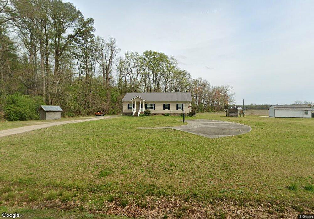
190 Lambs Rd Camden, NC 27921
Estimated Value: $288,000 - $340,000
--
Bed
2
Baths
1,585
Sq Ft
$197/Sq Ft
Est. Value
About This Home
This home is located at 190 Lambs Rd, Camden, NC 27921 and is currently estimated at $311,941, approximately $196 per square foot. 190 Lambs Rd is a home located in Camden County with nearby schools including Grandy Primary School, Camden Intermediate School, and Camden Middle School.
Ownership History
Date
Name
Owned For
Owner Type
Purchase Details
Closed on
Sep 27, 2007
Sold by
Burgess David S and Burgess Wanda D
Bought by
Norfleet William A and Norfleet Sally E
Current Estimated Value
Home Financials for this Owner
Home Financials are based on the most recent Mortgage that was taken out on this home.
Original Mortgage
$49,500
Outstanding Balance
$31,225
Interest Rate
6.41%
Mortgage Type
Future Advance Clause Open End Mortgage
Estimated Equity
$280,716
Create a Home Valuation Report for This Property
The Home Valuation Report is an in-depth analysis detailing your home's value as well as a comparison with similar homes in the area
Home Values in the Area
Average Home Value in this Area
Purchase History
| Date | Buyer | Sale Price | Title Company |
|---|---|---|---|
| Norfleet William A | $555,000 | -- |
Source: Public Records
Mortgage History
| Date | Status | Borrower | Loan Amount |
|---|---|---|---|
| Open | Norfleet William A | $49,500 |
Source: Public Records
Tax History Compared to Growth
Tax History
| Year | Tax Paid | Tax Assessment Tax Assessment Total Assessment is a certain percentage of the fair market value that is determined by local assessors to be the total taxable value of land and additions on the property. | Land | Improvement |
|---|---|---|---|---|
| 2024 | $1,716 | $217,643 | $34,399 | $183,244 |
| 2023 | $1,373 | $217,643 | $34,399 | $183,244 |
| 2022 | $1,373 | $156,055 | $23,085 | $132,970 |
| 2021 | $1,373 | $156,055 | $23,085 | $132,970 |
| 2020 | $1,170 | $156,055 | $23,085 | $132,970 |
| 2019 | $1,155 | $156,055 | $23,085 | $132,970 |
| 2018 | $1,129 | $156,855 | $23,085 | $133,770 |
| 2017 | $1,129 | $156,855 | $23,085 | $133,770 |
| 2016 | $1,093 | $156,855 | $23,085 | $133,770 |
| 2015 | -- | $156,855 | $23,085 | $133,770 |
| 2014 | $992 | $165,259 | $23,085 | $142,174 |
Source: Public Records
Map
Nearby Homes
- 107 Juniper Dr
- 106 Juniper Dr
- 203 Juniper Dr
- 205 Juniper
- 4 Rosabelle Ct
- 3 Rosabelle Ct
- 107 Boxcar Way
- 105 Boxcar Way
- 110 Boxcar Way
- 108 Boxcar Way
- 106 Boxcar Way
- 192 U S 158
- 165 U S 158
- 203 Herman Arnold Rd
- 437 U S 158
- 243 Pinch Gut Rd
- 617 Highway S
- 113 Pinch Gut Rd
- 144 U S Highway 158 W
- 112 Mitchell Dr Unit Lot 114
- 191 Lambs Rd
- 183 Lambs Rd
- 118 Run Swamp Rd
- 114 Run Swamp Rd
- 188 Lambs Rd
- 111 Run Swamp Rd
- 0 Lambs
- 105 Run Swamp Rd
- 106 Run Swamp Rd
- 102 Run Swamp Rd
- 110 Run Swamp Rd
- 264 E 158 Hwy
- 101 Perquimans Dr
- 187A Thomas Point Rd
- 405 Main St
- 105 Cape Fear Dr
- 103 Cape Fear Dr
- 107 Cape Fear Dr
- 110 Cape Fear Dr
- 60 acs Mercer Dr