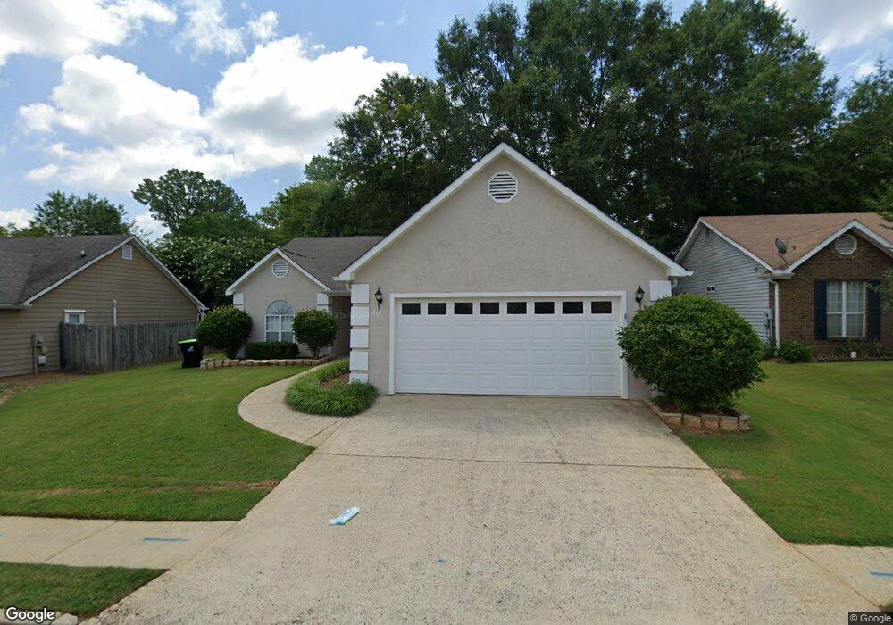
190 Landing Dr Fayetteville, GA 30214
Estimated Value: $267,000 - $331,000
3
Beds
2
Baths
1,544
Sq Ft
$193/Sq Ft
Est. Value
About This Home
This home is located at 190 Landing Dr, Fayetteville, GA 30214 and is currently estimated at $297,547, approximately $192 per square foot. 190 Landing Dr is a home located in Fayette County with nearby schools including Bennett's Mill Middle School, Fayette County High School, and Rising Star Montessori School.
Ownership History
Date
Name
Owned For
Owner Type
Purchase Details
Closed on
Apr 24, 2019
Sold by
Martin T Michael Estate
Bought by
Elohee Svc Grp Llc
Current Estimated Value
Purchase Details
Closed on
Dec 20, 2002
Sold by
Leslie Wayne
Bought by
Martin T Michael
Home Financials for this Owner
Home Financials are based on the most recent Mortgage that was taken out on this home.
Original Mortgage
$127,006
Interest Rate
5.92%
Mortgage Type
FHA
Purchase Details
Closed on
Nov 29, 1999
Sold by
Winkle Mary J
Bought by
Leslie Wayne
Home Financials for this Owner
Home Financials are based on the most recent Mortgage that was taken out on this home.
Original Mortgage
$92,800
Interest Rate
7.89%
Mortgage Type
New Conventional
Purchase Details
Closed on
Oct 31, 1996
Sold by
Reynolds Billy Annette
Bought by
Winkle Mary
Create a Home Valuation Report for This Property
The Home Valuation Report is an in-depth analysis detailing your home's value as well as a comparison with similar homes in the area
Home Values in the Area
Average Home Value in this Area
Purchase History
| Date | Buyer | Sale Price | Title Company |
|---|---|---|---|
| Elohee Svc Grp Llc | $150,100 | -- | |
| Martin T Michael | $129,000 | -- | |
| Leslie Wayne | $116,000 | -- | |
| Winkle Mary | $90,000 | -- |
Source: Public Records
Mortgage History
| Date | Status | Borrower | Loan Amount |
|---|---|---|---|
| Previous Owner | Martin T Michael | $127,006 | |
| Previous Owner | Leslie Wayne | $92,800 | |
| Closed | Winkle Mary | $0 |
Source: Public Records
Tax History Compared to Growth
Tax History
| Year | Tax Paid | Tax Assessment Tax Assessment Total Assessment is a certain percentage of the fair market value that is determined by local assessors to be the total taxable value of land and additions on the property. | Land | Improvement |
|---|---|---|---|---|
| 2024 | $3,666 | $123,344 | $22,320 | $101,024 |
| 2023 | $3,605 | $118,440 | $22,320 | $96,120 |
| 2022 | $2,846 | $93,640 | $14,000 | $79,640 |
| 2021 | $2,098 | $68,160 | $14,000 | $54,160 |
| 2020 | $1,856 | $60,040 | $10,840 | $49,200 |
| 2019 | $2,173 | $69,600 | $11,200 | $58,400 |
| 2018 | $1,802 | $57,120 | $11,200 | $45,920 |
| 2017 | $1,646 | $55,040 | $11,200 | $43,840 |
| 2016 | $1,395 | $45,640 | $11,200 | $34,440 |
| 2015 | $1,325 | $42,600 | $11,200 | $31,400 |
| 2014 | $1,249 | $39,400 | $11,200 | $28,200 |
| 2013 | -- | $39,720 | $0 | $0 |
Source: Public Records
Map
Nearby Homes
- 405 415 Chase Dr
- 1305 & 1307 Highway 54
- 210 Colonial Ct
- 105 Deep Forest Ln
- 120 Deep Forest Ln Unit 1
- 175 Honey Ln
- 550 Thatch Terrace
- 115 Climbing Ivy Cir
- 125 Climbing Ivy Cir
- 165 Honey Ln
- 325 Enchanted Ct
- Thornewood Plan at Village Towns
- 210 Marilyn Dr E
- 160 Winona Dr
- 105 Rehobeth Way
- 220 Rehobeth Way
- 350 Forrest Ave
- 275 Rehobeth Way
- 265 Rehobeth Way
- 0 Hwy 54 West of Yorktown Dr Unit 10463188
- 190 Landing Dr Unit 48
- 180 Landing Dr Unit 49
- 180 Landing Dr
- 210 Landing Dr
- 170 Landing Dr
- 165 Landing Dr
- 175 Landing Dr
- 155 Landing Dr
- 130 Pye Lake Dr
- 185 Landing Dr
- 160 Landing Dr
- 220 Landing Dr
- 0 Landing Dr Unit 8642521
- 0 Landing Dr Unit 8517944
- 0 Landing Dr Unit 8312127
- 0 Landing Dr Unit 8861159
- 0 Landing Dr Unit 8413310
- 0 Landing Dr Unit 7074140
- 0 Landing Dr Unit 9049853
- 0 Landing Dr Unit 8222619