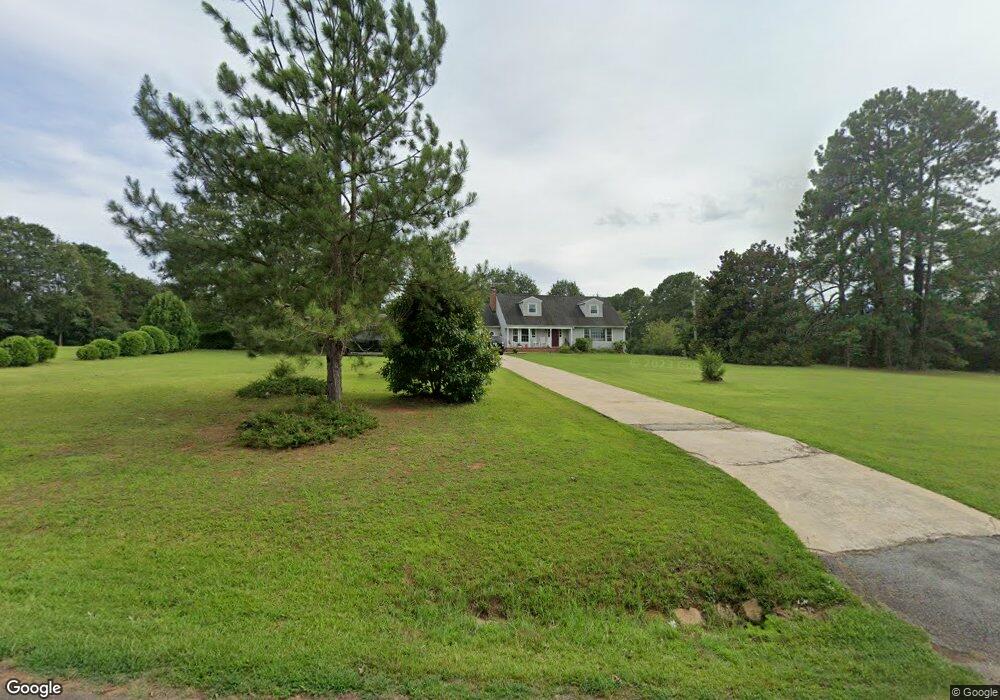
190 Link Rd Pendleton, SC 29670
Estimated Value: $405,000 - $527,000
3
Beds
--
Bath
2,088
Sq Ft
$220/Sq Ft
Est. Value
About This Home
This home is located at 190 Link Rd, Pendleton, SC 29670 and is currently estimated at $459,066, approximately $219 per square foot. 190 Link Rd is a home with nearby schools including Pendleton High School.
Ownership History
Date
Name
Owned For
Owner Type
Purchase Details
Closed on
May 19, 2020
Sold by
Smith Vadrew H
Bought by
Finger David A and Finger Connie
Current Estimated Value
Home Financials for this Owner
Home Financials are based on the most recent Mortgage that was taken out on this home.
Original Mortgage
$355,098
Outstanding Balance
$316,959
Interest Rate
3.37%
Mortgage Type
Construction
Estimated Equity
$142,107
Create a Home Valuation Report for This Property
The Home Valuation Report is an in-depth analysis detailing your home's value as well as a comparison with similar homes in the area
Home Values in the Area
Average Home Value in this Area
Purchase History
| Date | Buyer | Sale Price | Title Company |
|---|---|---|---|
| Finger David A | $69,500 | None Available |
Source: Public Records
Mortgage History
| Date | Status | Borrower | Loan Amount |
|---|---|---|---|
| Open | Finger David A | $355,098 |
Source: Public Records
Tax History
| Year | Tax Paid | Tax Assessment Tax Assessment Total Assessment is a certain percentage of the fair market value that is determined by local assessors to be the total taxable value of land and additions on the property. | Land | Improvement |
|---|---|---|---|---|
| 2024 | $1,574 | $14,180 | $2,820 | $11,360 |
| 2023 | $1,578 | $14,180 | $2,820 | $11,360 |
| 2022 | $1,412 | $14,180 | $2,820 | $11,360 |
| 2021 | $1,192 | $12,010 | $2,760 | $9,250 |
| 2020 | $683 | $2,600 | $2,540 | $60 |
| 2019 | $683 | $2,600 | $2,540 | $60 |
| 2018 | $673 | $2,600 | $2,540 | $60 |
| 2017 | -- | $2,600 | $2,540 | $60 |
| 2016 | $573 | $2,280 | $2,220 | $60 |
| 2015 | $575 | $2,280 | $2,220 | $60 |
| 2014 | $576 | $2,280 | $2,220 | $60 |
Source: Public Records
Map
Nearby Homes
- 00 Liberty Hwy
- 354 Harper Rd
- 616 Anderson Rd
- 540 Seaborn Cir
- 538 Seaborn Cir
- 6620 Liberty Hwy
- 139 Louise Dr
- 145 Old Sanders Rd
- 0 Cherry Street Extension
- 150 Queens Mill Ct
- 00 Danenhower Rd
- 102 Rogers Rd
- 156 Queens Mill Ct
- 2921 Old Greenville Hwy
- 2923 Old Greenville Hwy
- 2925 Old Greenville Hwy
- 168 Queens Mill Ct
- 1000 Hopkins Ave
- 1409 Autun Rd
- 213 Bostic Ct
Your Personal Tour Guide
Ask me questions while you tour the home.