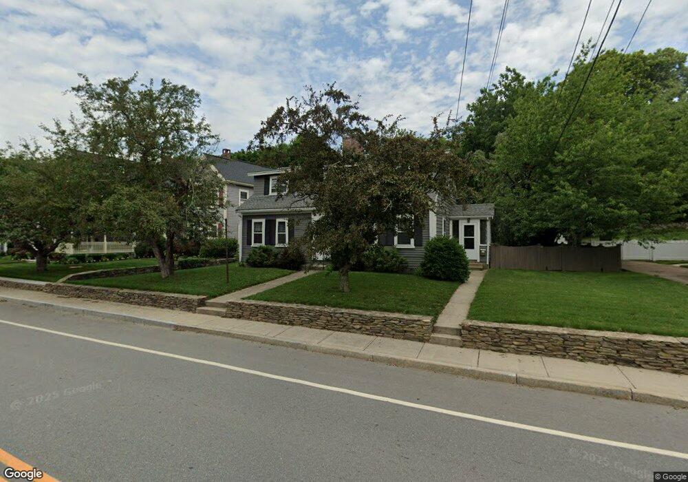
190 Main St North Easton, MA 02356
Estimated Value: $673,000 - $797,000
4
Beds
2
Baths
2,419
Sq Ft
$306/Sq Ft
Est. Value
About This Home
This home is located at 190 Main St, North Easton, MA 02356 and is currently estimated at $741,215, approximately $306 per square foot. 190 Main St is a home located in Bristol County with nearby schools including Easton Middle School and Dovecrest Montessori Academy.
Ownership History
Date
Name
Owned For
Owner Type
Purchase Details
Closed on
Dec 23, 2009
Sold by
Yochim Peter B and Yochim Elaine M
Bought by
Yochim Elaine M
Current Estimated Value
Home Financials for this Owner
Home Financials are based on the most recent Mortgage that was taken out on this home.
Original Mortgage
$282,865
Outstanding Balance
$183,943
Interest Rate
4.92%
Mortgage Type
FHA
Estimated Equity
$557,272
Purchase Details
Closed on
Mar 28, 1997
Sold by
Maliff Robert F
Bought by
Yochim Peter B and Yochim Elaine M
Purchase Details
Closed on
Nov 7, 1989
Sold by
Maliff 80 T Mary L
Bought by
Maliff Robert F
Create a Home Valuation Report for This Property
The Home Valuation Report is an in-depth analysis detailing your home's value as well as a comparison with similar homes in the area
Home Values in the Area
Average Home Value in this Area
Purchase History
| Date | Buyer | Sale Price | Title Company |
|---|---|---|---|
| Yochim Elaine M | -- | -- | |
| Yochim Elaine M | -- | -- | |
| Yochim Elaine M | -- | -- | |
| Yochim Peter B | $175,000 | -- | |
| Yochim Peter B | $175,000 | -- | |
| Maliff Robert F | $100,000 | -- |
Source: Public Records
Mortgage History
| Date | Status | Borrower | Loan Amount |
|---|---|---|---|
| Open | Yochim Elaine M | $282,865 | |
| Closed | Maliff Robert F | $282,865 |
Source: Public Records
Tax History Compared to Growth
Tax History
| Year | Tax Paid | Tax Assessment Tax Assessment Total Assessment is a certain percentage of the fair market value that is determined by local assessors to be the total taxable value of land and additions on the property. | Land | Improvement |
|---|---|---|---|---|
| 2025 | $7,401 | $593,000 | $347,700 | $245,300 |
| 2024 | $6,798 | $509,200 | $264,800 | $244,400 |
| 2023 | $6,382 | $437,400 | $264,800 | $172,600 |
| 2022 | $6,245 | $405,800 | $237,300 | $168,500 |
| 2021 | $6,067 | $391,900 | $223,400 | $168,500 |
| 2020 | $6,055 | $393,700 | $214,400 | $179,300 |
| 2019 | $5,085 | $318,600 | $190,500 | $128,100 |
| 2018 | $4,801 | $296,200 | $180,200 | $116,000 |
| 2017 | $4,973 | $306,600 | $180,200 | $126,400 |
| 2016 | $5,089 | $314,300 | $174,100 | $140,200 |
| 2015 | $5,106 | $304,300 | $167,200 | $137,100 |
| 2014 | $4,720 | $283,500 | $146,400 | $137,100 |
Source: Public Records
Map
Nearby Homes
- 224 Main St
- 225 Main St
- 56 Williams St
- 67 Center St
- 11 Olde Stable Ln
- 15 King Ave
- 8 Hobart Way
- 334-336 Main St
- 280 Washington St
- 12 Holmes St
- 32 Spooner St
- Lot 8 Cooper Ln
- 18 Prudence Crandall Ln Unit 18
- 1 Whittier Ln Unit 1
- 221 Center St
- 7 Coolidge Cir
- 24 Eisenhower Dr
- 175 N Main St
- 45 Randall St
- 79 Summer St
- 182 Main St
- 15A Mechanic St
- 15 Mechanic St
- 15 Mechanic St Unit R
- 15R Mechanic St
- 15R Mechanic St
- 194 Main St
- 194 Main St Unit 1
- 194 Main St Unit 196
- 186 Main St
- 186 Main St Unit 2
- 186 Main St Unit B
- 176 Main St
- 202 Main St
- 166 Main St
- 13 Mechanic St
- 11 Mechanic St
- 9 Mechanic St Unit C
- 9 Mechanic St Unit B
- 9 Mechanic St Unit A